
Showers and thunderstorms at times; summery south, cool north
Downpours possible
Go Deeper.
Create an account or log in to save stories.
Like this?
Thanks for liking this story! We have added it to a list of your favorite stories.


This is a day to have a “plan B” for your outdoor activities. Most of Minnesota and western Wisconsin will have some periods of showers and thunderstorms this Sunday and Sunday night.
The NWS Storm Prediction Center shows a marginal risk (shaded dark green) of severe weather Sunday and Sunday night from central and southern Minnesota into portions of western Wisconsin:

Marginal risk means that an isolated severe t-storm is possible. The Storm Prediction Center updates the severe weather outlook every few hours.
Some areas could also see downpours of heavy rain at times.
Turn Up Your Support
MPR News helps you turn down the noise and build shared understanding. Turn up your support for this public resource and keep trusted journalism accessible to all.
You can hear updated weather information for Minnesota and western Wisconsin on the Minnesota Public Radio network, and you can see updated weather info on the MPR News live weather blog.
Summery south, cooler north
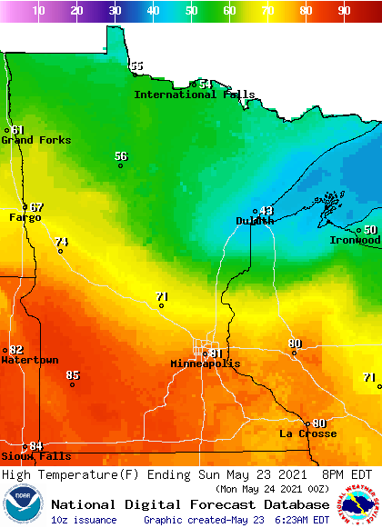
Sunday highs will range from the 40s in northeastern Minnesota to 80s in the south:
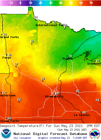
Dew points in the sticky 60s will linger in the south:
This Updraft blog will be updated around 10:20 a.m. with a look at the week ahead.
Programming note
You can hear my live weather updates on MPR News at 7:35 a.m., 9:35 a.m. and 4:39 p.m. each Saturday and Sunday.

