
Cooler weather may bring frost to parts of Minnesota
Temperatures warm again just in time for the holiday weekend
Go Deeper.
Create an account or log in to save stories.
Like this?
Thanks for liking this story! We have added it to a list of your favorite stories.


Following chillier weather, and even frost concerns for northern Minnesota, the holiday weekend turns warmer with a couple chances for rain.
Wednesday’s forecast
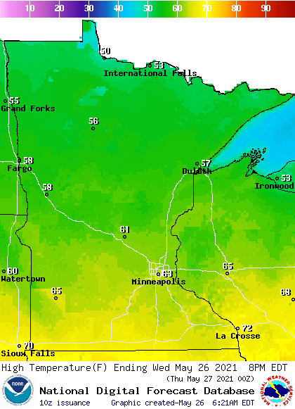
Behind a cold front, all of Minnesota is cooler and drier Wednesday. Morning temperatures ranged from 30s north to 50s south.
Gusty winds from the northwest diminish during the day, but the winds still draw cooler air across the state Wednesday. This brings highs 10 to 20 degrees below average, with 50s north and 60s south.
Dew points are also significantly lower behind the front, from the recent 60s and low 70s that made Minnesota very humid, to dew points only in the 20s and 30s by Wednesday afternoon. This is making the air feel noticeably drier.
Northern Minnesota started the day with some lower clouds that brought drizzle and even a couple snowflakes earlier in the morning.
Turn Up Your Support
MPR News helps you turn down the noise and build shared understanding. Turn up your support for this public resource and keep trusted journalism accessible to all.
Those clouds were clearing quickly as of 9 a.m., and most of the state will see sunny skies during the afternoon.
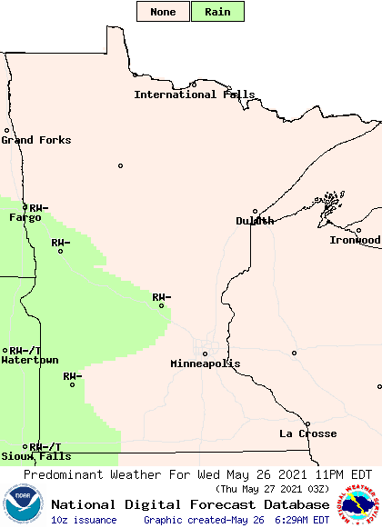
A few more clouds push into western Minnesota Wednesday evening, and that area could see rain showers by late evening.
Cold and rainy Thursday
With temperatures below average already, and dry air that allows temperatures to have more of a day to night swing, Thursday starts chilly.
Morning temperature will be in the 30s north and 40s south, but the northern edge of the state could see a few 20s. That has northern Minnesota under a frost advisory.
Afternoon temperatures do not fair much better with 50s across the state. Northern Minnesota could be the warm spot, with upper 50s under some sunshine, while southern Minnesota struggles to get into the low 50 under widespread rain.
The showers that started moving into Western Minnesota late Wednesday, spread across southern and central Minnesota by Thursday morning. Rain chances diminish as you head north.
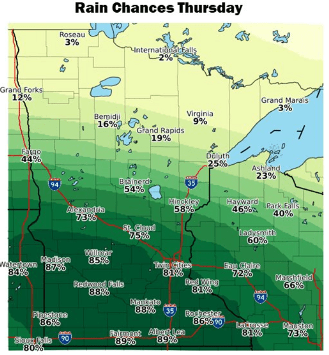
Much of southern Minnesota can expect a half inch to an inch of rain through the day, with higher amounts in thunderstorms.
Holiday weekend forecast
Most of the rain should clear out by Friday morning, but the day starts chilly again, with even more of the state in the 30s and just a couple 40s south. However, under sunshine across the state, most of Minnesota sees highs in the 60s.
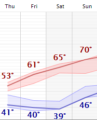
Highs then warm slightly every day through Memorial Day, with more seasonable warmth in the 70s returning by Sunday.
Rain chances do return over the holiday weekend, especially Sunday and Monday, however it currently looks like scattered showers with plenty of dry breaks.
We will keep you posted on that rain potential as the weekend approaches.
Programming note
You can hear my live weather updates on Minnesota Public Radio at 7:49 a.m. Monday through Friday morning.

