
Temperatures climb over the holiday weekend
Thursday stays wet and colder, with falling temperatures in some areas
Go Deeper.
Create an account or log in to save stories.
Like this?
Thanks for liking this story! We have added it to a list of your favorite stories.


After a cool and rainy Thursday, temperatures slowly rise over the holiday weekend, but not before another frosty start for parts of Minnesota on Friday.
A cold and rainy Thursday
A storm moving south of Minnesota was bringing widespread rain to the southern half of the state as of 9 a.m.
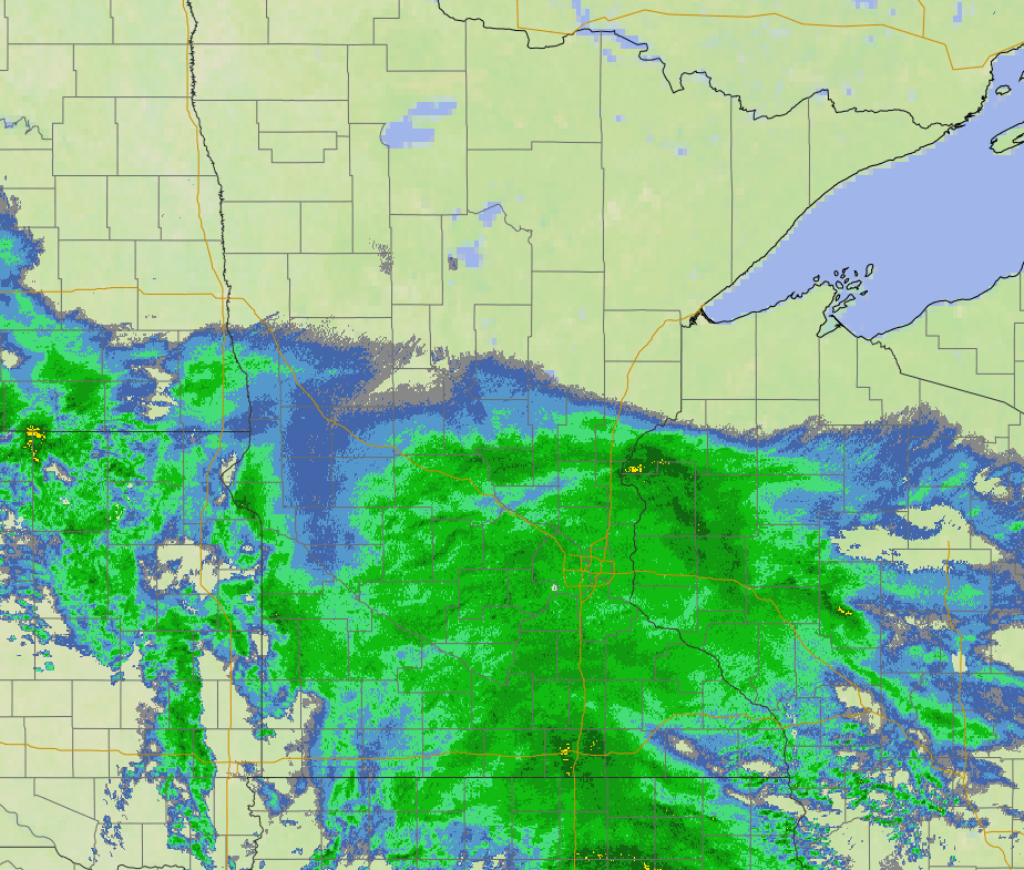
Although there could be a couple isolated thunderstorms during the day, this is primarily a rain event, with showers continuing through the day Thursday then starting to diminish overnight as the storm moves off.
Because of the position of the storm, rain lessens as you head north, with the northern edge of the state likely to remain dry and possibly see a couple breaks of sunshine.
Turn Up Your Support
MPR News helps you turn down the noise and build shared understanding. Turn up your support for this public resource and keep trusted journalism accessible to all.
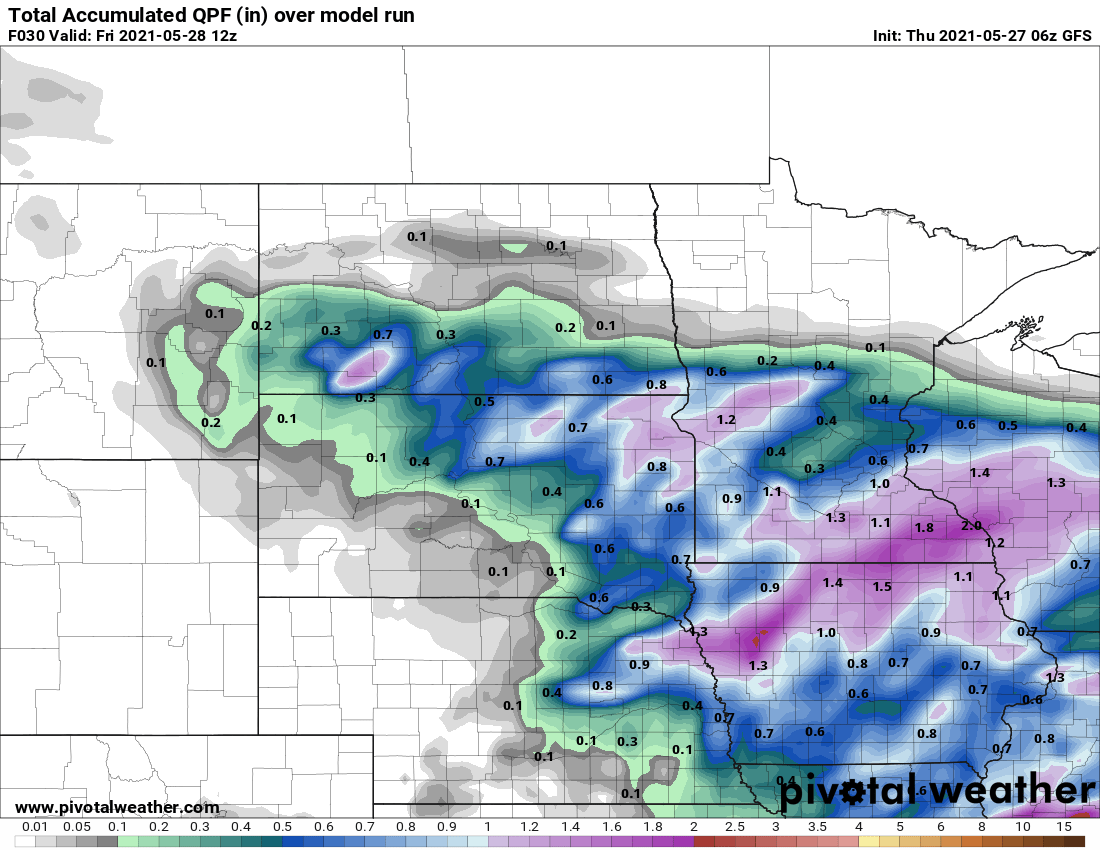
Most of southern Minnesota can expect one-half to 1 inch of rain, with a few higher amounts likely under persistent rain bands and for the southeastern corner of the state.
Meanwhile, the recent cooler air that spread across Minnesota and clear skies overnight allowed temperatures in northern Minnesota to plunge overnight. That region started the day with some 20s and low 30s, causing much of the area to be under either freeze warnings or frost advisories.
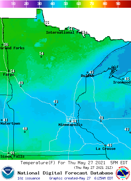
In contrast, central and southern Minnesota stayed milder overnight thanks to the clouds and rain, beginning the day in the 40s and 50s. However, the rain keeps that area from warming, and some places could see temperatures fall slightly during the day.
For example, the Twin Cities was at 56 degrees at midnight, 49 at 7 a.m., and may only be in the mid 40s by the afternoon. By contrast, with drier weather in northern Minnesota, temperatures rise into the 50s.
Here are the forecast Thursday afternoon temperatures:
Frosty start Friday
Most of the rain should clear out by Friday morning, with a couple lingering showers possible in southeastern Minnesota through midday. Despite more cloud cover south, most of Minnesota will drop into the 30s by Friday morning, which is well below average for late May.
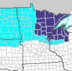
In northern Minnesota, where skies are forecast to be clear overnight Thursday into Friday, some temperatures will drop into the low 30s and upper 20s, allowing for more frost and possibly freeze conditions.
Frost advisories (blue) and freeze warnings (purple) have already been issued from overnight Thursday into Friday morning for much of northern Minnesota.
Under plenty of sunshine, northern Minnesota warms quickly, into the mid 60s for highs, while southern Minnesota does not get more sunshine until the afternoon, keeping highs near 60.
Holiday weekend forecast
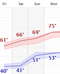
Highs continues to warm slightly each day through Memorial Day, with more seasonable warmth in the 70s returning to most of the state Sunday, and the entire state Monday.
There will also be some scattered rain chances over the weekend, but with plenty of dry breaks to get outdoor activities in.
It currently looks like spotty showers are most likely in western Minnesota Saturday, then statewide Sunday, and maybe in southern or eastern Minnesota Monday.
Rain totals are forecast to stay relatively light, with most of the state seeing less than a half inch of rain through the entire three days.
Programming note
You can hear my live weather updates on Minnesota Public Radio at 7:49 a.m. Monday through Friday morning.

