
Warmer weather returns for the holiday weekend, but so do a few showers
Parts of Minnesota set record cold temperatures Friday morning
Go Deeper.
Create an account or log in to save stories.
Like this?
Thanks for liking this story! We have added it to a list of your favorite stories.


Following a cold morning Friday that set record low temperatures, a warmup begins Friday afternoon that brings seasonable weather to the state by the end of the holiday weekend.
Rain chances also return over the weekend, but it definitely will not be a wash-out.
Friday’s forecast
The storm that brought southern and central Minnesota persistent rain and cold weather Thursday has slid off to the east. Only the southeastern edge of Minnesota has a few lingering showers Friday morning, and those diminish through the morning.
As that weather system exited, skies cleared for most of the state overnight, allowing temperatures to plunge. Much of Minnesota started Friday in the 30s, with 20s for most of the Arrowhead and parts of central Minnesota.
This brought freeze conditions to portions of the state and set numerous record lows, including for Duluth and International Falls. Hibbing shattered the previous May 28 record of 27 by dropping to 21 Friday morning.
However, under clear skies and dry air, temperatures rise quickly, putting the majority of the state in the 60s by the afternoon.
Turn Up Your Support
MPR News helps you turn down the noise and build shared understanding. Turn up your support for this public resource and keep trusted journalism accessible to all.
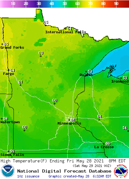
Portions of southern Minnesota may not make it out of the 50s as more sunshine does not return to that area until the afternoon.
Holiday weekend forecast
Although not quite as cold as Friday morning, Saturday will also start off chilly for late May, with 30s and low 40s. A few spots in the Arrowhead could dip below freezing again.
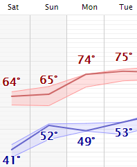
Highs and lows then warm throughout the holiday weekend, with most of Minnesota seeing highs back in the 70s by Monday.
Following the holiday weekend, temperatures continue to rise, with a few 80s possible by the end of the week.
The long weekend also brings scattered rain chances and a few isolated storms, but with plenty of dry and sunny breaks for any outdoor plans.
It currently looks like spotty showers are most likely in western Minnesota Saturday, then statewide Sunday, and possibly southern and eastern Minnesota Monday.
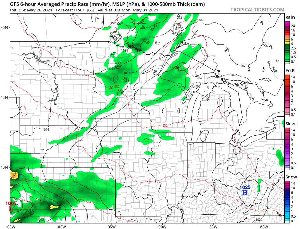
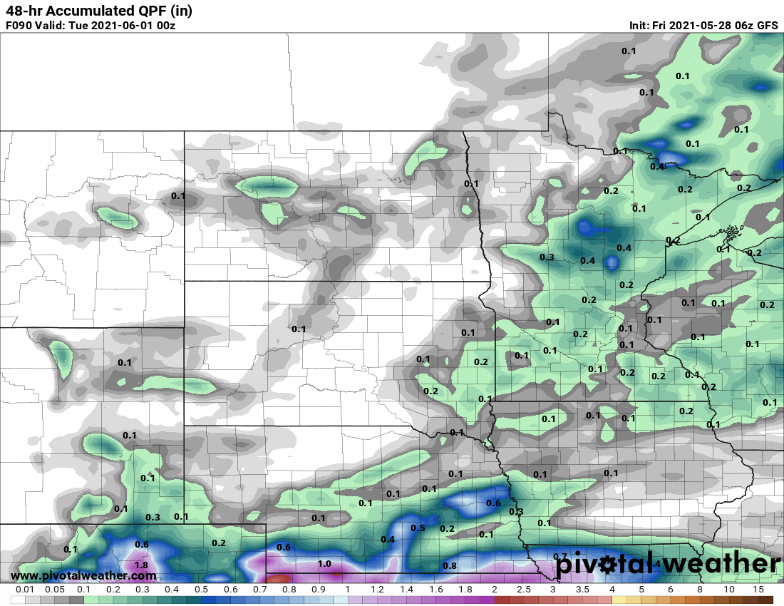
Rain totals are forecast to stay relatively light, with most of the state expecting under a quarter inch of rain through the entire three days.
Programming note
You can hear my live weather updates on Minnesota Public Radio at 7:49 a.m. Monday through Friday morning.

