
Scattered Sunday showers; warmer on Memorial Day
Thunder chance in some areas late Monday
Go Deeper.
Create an account or log in to save stories.
Like this?
Thanks for liking this story! We have added it to a list of your favorite stories.


Wasn’t Saturday nice? Eastern Minnesota and western Wisconsin had plenty of sunshine. Much of western Minnesota saw increasing cloudiness and scattered late-day showers, but it was still a good day for outdoor activities.
Our Saturday afternoon high temp at Minneapolis-St. Paul International Airport was 65 degrees. That was well shy of our average May 29 high of 74, but it felt great with all the sunshine!
It was very chilly in some spots Saturday, including New England:
Sunday shower chances
Turn Up Your Support
MPR News helps you turn down the noise and build shared understanding. Turn up your support for this public resource and keep trusted journalism accessible to all.
Areas of showers in western Minnesota will continue to spread eastward Saturday evening and overnight Saturday night. it looks like some showers could arrive in parts of the Twin Cities metro area anytime after about 10 or 11 p.m.
Minnesota and western Wisconsin will see scattered showers at times on Sunday, especially during the morning. Most areas could be dry during the early afternoon hours, then a chance of additional scattered showers and an isolated t-storm will be with us later Sunday afternoon and Sunday evening.
The National Oceanic and Atmospheric Administration’s North American Mesoscale (NAM) forecast model shows the potential rain pattern for Sunday and Sunday evening:
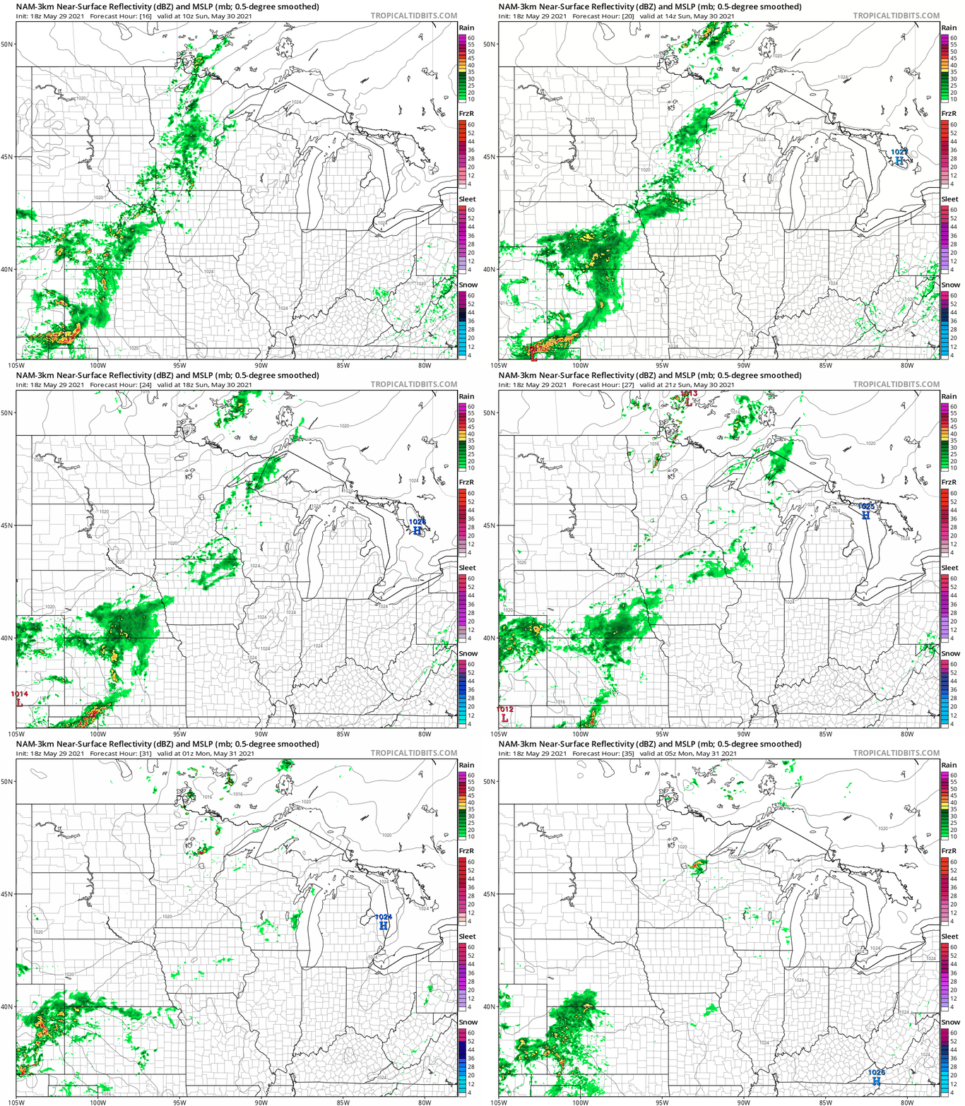
On Memorial Day, there’s a chance of a shower or isolated thunderstorm in the afternoon or evening.
You can hear updated weather information for Minnesota and western Wisconsin on the Minnesota Public Radio network, and you can see updated weather info on the MPR News live weather blog.
Temperature trends and wind gusts
Sunday highs will be slightly above 70 degrees in roughly the northwestern half of Minnesota, with mainly 60s elsewhere:

There will be some 50s near Lake Superior.
Sunday afternoon wind gusts will be mainly in the 15-20 mph range:

Plotted gusts are in knots, with 14 knots equal to 16.1 mph.
Monday highs will be in the 70s in most areas:

There’ll be some 60s near Lake Superior.
Monday wind gusts will be in the 14-18 mph range in most areas:

Back to high temps, Twin Cities metro area highs are projected to reach the upper 70s Tuesday and Wednesday, followed by mid 80s Thursday and upper 80s on Friday. We could be around 90 next weekend!
Programming note
You can hear my live weather updates on MPR News at 7:35 a.m., 9:35 a.m. and 4:39 p.m. each Saturday and Sunday.

