
Lower humidity heading into the weekend
Hot weather may return across Minnesota by Independence Day
Go Deeper.
Create an account or log in to save stories.
Like this?
Thanks for liking this story! We have added it to a list of your favorite stories.


The weekend brings some chances for needed rain, although amounts are likely to stay low for most. The forecast indicates a return to hot and dry by the Fourth of July holiday weekend.
Friday’s forecast
Behind the cold front that finally cleared through southern Minnesota late Thursday, the cooler, drier air that was already in northern Minnesota Thursday is now influencing the entire state. Minnesota started Friday off predominantly in the 50s, with 60s south.
Under plentiful sunshine, highs will still be slightly above average with a couple 70s north and 80s for most of the state.

However, drier air is already across Minnesota behind the front, and by the afternoon, dew points will only be in the 40s and 50s, meaning lower humidity.
Turn Up Your Support
MPR News helps you turn down the noise and build shared understanding. Turn up your support for this public resource and keep trusted journalism accessible to all.
This is a big contrast from Thursday, when southeastern Minnesota especially had very muggy weather with some dew points in the 70s. The Twin Cities hit a dew point of 72 Thursday, making it the highest dew point so far this year.
Skies stay predominantly dry Friday, although the southern edge of Minnesota could see a couple stray showers due to weather south of the state.
Northern Minnesota is likely to see a few showers and possible storms by late afternoon and evening.
Weekend outlook
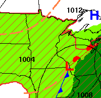
Over the weekend, there will both be a storm system that slides south of Minnesota, and disturbances that move across the state.
This combination keeps enough instability around over the weekend for occasional showers and storms. There will also be plenty of dry breaks, and it currently appears like most of the storms should stay non-severe.
The humidity should stay comfortable, with dew points mostly in the 50s outside of any rainy periods.
Because much of the precipitation will be spotty, most of Minnesota will see under a quarter inch of rain through the weekend.
Higher amounts will be localized with some thunderstorms, and southeastern Minnesota could see more activity particularly on Saturday with the system sliding south.
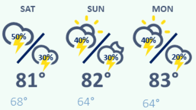
With a bit more cloud cover over the weekend, plus the occasional rain, temperatures stay seasonable for late June, with highs mostly in the 70s, and a few lower 80s south.
Here is that forecast for the Twin Cities through Monday:
Extended forecast
It currently looks like the pattern of seasonable temperatures, instability, and chances for a few showers and storms could last through at least the middle of next week.
By the Fourth of July weekend however, many of the weather models are indicating the hot and dry weather may make a comeback.
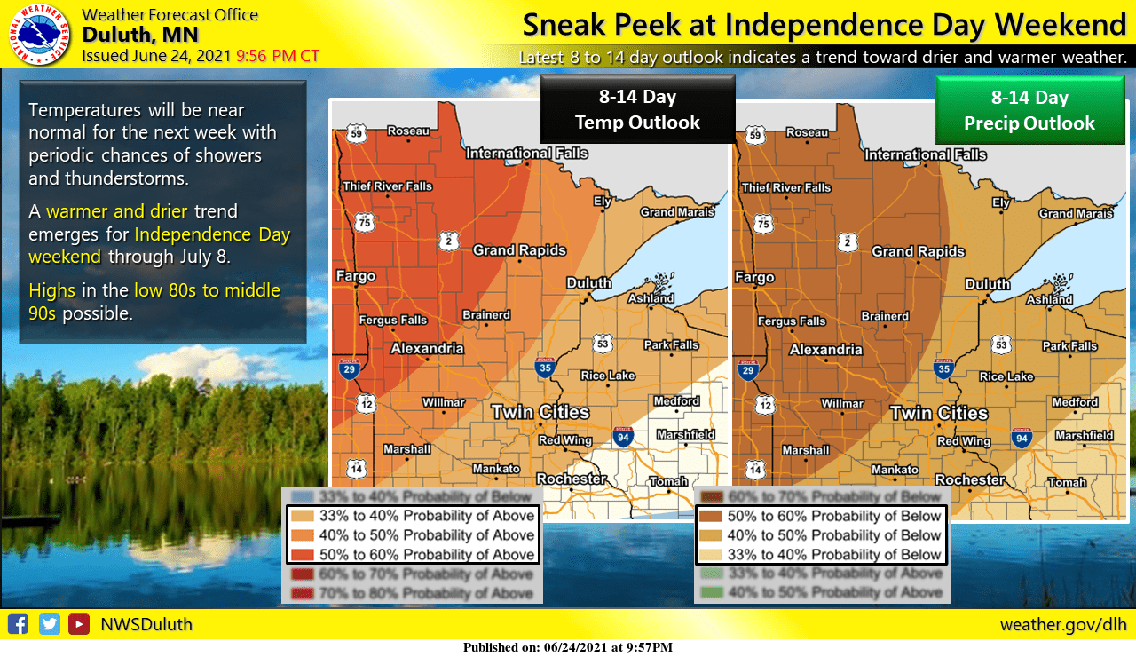
We will keep you posted on potential temperatures as the holiday approaches!
Programming note
You can hear my live weather updates on Minnesota Public Radio at 7:49 a.m. Monday through Friday morning.

