
Scattered Sunday showers at times, with a t-storm possible
A bit cool
Go Deeper.
Create an account or log in to save stories.
Like this?
Thanks for liking this story! We have added it to a list of your favorite stories.


Saturday’s rainfall was helpful, but it wasn’t a drought buster for most of us. The official total at MSP airport was just .14 of an inch. Chanhassen reported .55”. There were torrential rains for a while Saturday in some areas. Radar estimates show between 4 and 5 inches of rainfall Saturday near Nerstrand, in Rice County and between Janesville (Waseca County) and Waterville (Le Sueur County).
Minnesota and western Wisconsin will have a chance of scattered showers and a few thunderstorms this Sunday and Sunday evening.
Temps
Sunday highs will be in the upper 70s to around 80 in most areas:
Turn Up Your Support
MPR News helps you turn down the noise and build shared understanding. Turn up your support for this public resource and keep trusted journalism accessible to all.
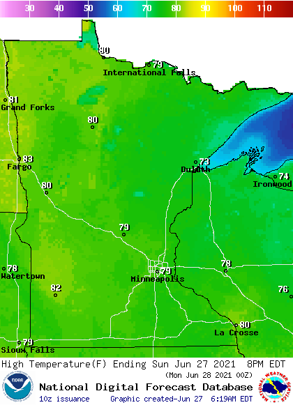
There will be some lower 70s in northeastern Minnesota.
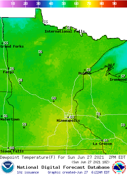
Sunday dew points will be in the sticky 60s in a few locations, with 50s elsewhere:
This Updraft blog will be updated around 10:30 a.m. with a look at the coming week.
Programming note
You can hear my live weather updates on MPR News at 7:35 a.m., 9:35 a.m. and 4:39 p.m. each Saturday and Sunday.

