
As the rain moves out, hot and dry weather return
Most of Minnesota will be in the 90s for Independence Day
Go Deeper.
Create an account or log in to save stories.
Like this?
Thanks for liking this story! We have added it to a list of your favorite stories.


Minnesota’s recent rainier pattern comes to an end, replaced by drier weather that also turns hot by the holiday weekend.
Tuesday’s forecast
Minnesota has been under the influence of an upper-level trough of lower pressure since Saturday. This kept instability in place, which helped fuel the wetter pattern the state has been under. That trough is finally sliding off to the east, taking the wet weather along with it.
Skies are already noticeably drier Tuesday morning, with just a few spotty showers left as of 9 a.m.
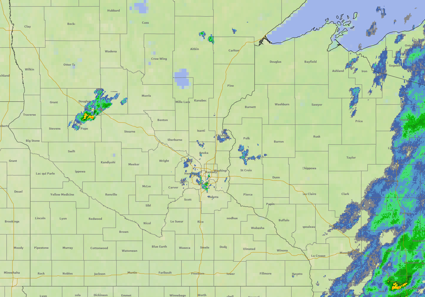
Precipitation chances continue to diminish during the day, with mostly just the eastern edge of Minnesota seeing a chance for isolated showers and a possible storm into the afternoon.
Turn Up Your Support
MPR News helps you turn down the noise and build shared understanding. Turn up your support for this public resource and keep trusted journalism accessible to all.
Dew points are also already lowering from northwest to southeast, dropping the humidity to more comfortable levels. All but the southeastern corner of the state, where dew points linger in the 60s until Wednesday, will see dew points in the 50s by Tuesday afternoon.
Morning temperatures started in the 50s and 60s, and highs for most of the state will be in the 80s.
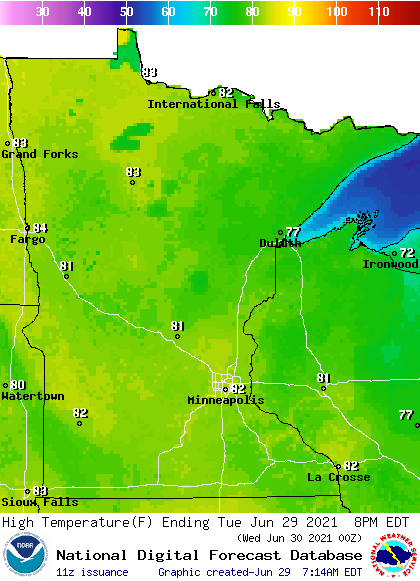
This is near to slightly above average for the end of June.
Hot by the holiday
The return of drier weather keeps Minnesota under mostly sunny skies from Wednesday through the weekend.
Wednesday will be a little hotter, with most of the state in the mid- and upper 80s. An easterly flow cools the Arrowhead into the 70s Thursday and Friday and cools the rest of eastern Minnesota by a couple degrees, while the western edge of the state continues in the upper 80s.
By Saturday, a ridge of higher pressure starts building over the northern plains that will return the hotter weather to all of Minnesota.
This is the forecast pattern at 500 mb (approximately 18,000 feet above sea level) by early Saturday, with the ridge of higher pressure highlighted:

That puts most of the state back into the upper 80s and 90s through Monday.
Here is that forecast for the Twin Cities:
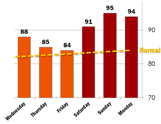
It looks likely that Minnesota will see above average temperatures most of next week also.
Meanwhile, predominantly dry weather prevails, with only a couple spotty chances. For example, northern Minnesota may see a few stray showers or storms Wednesday afternoon or evening.
That drier trend lasts through at least early next week, meaning the combination of hot and dry weather will cause problems for Minnesota’s deepening drought conditions.
Programming note
You can hear my live weather updates on Minnesota Public Radio at 7:49 a.m. Monday through Friday morning.

