
Friday stays sunny for most, with showers south
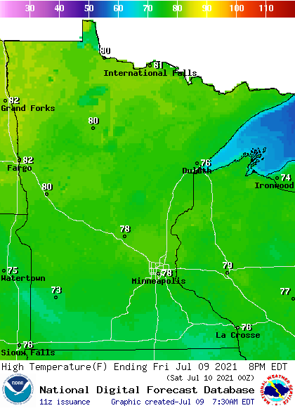
Afternoon temperatures get higher as you head north
Go Deeper.
Create an account or log in to save stories.
Like this?
Thanks for liking this story! We have added it to a list of your favorite stories.


The northern edge of a storm that stays south of Minnesota will bring more clouds and some rain into the state.
Friday’s forecast
Minnesota is off to a milder start than Thursday, with 40s and 50s for most of the state, and 60s south.
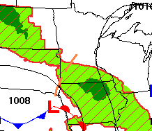
Skies are predominantly clear, except for western and southern Minnesota, where a storm system sliding south of the state is bringing in more clouds and isolated showers right along the Iowa border as of Friday morning.
That unsettled weather south will cause a few showers and maybe a couple isolated storms in southern Minnesota during the day, but severe weather looks unlikely.
Turn Up Your Support
MPR News helps you turn down the noise and build shared understanding. Turn up your support for this public resource and keep trusted journalism accessible to all.
Precipitation will stay under a quarter-inch in most places, with a couple isolated higher amounts with any storms.
Because of the sunnier skies north, northern Minnesota will be the warm spot Friday, with 80s, while the rest of the state stays in the 70s.
Spotty showers linger Saturday for southern Minnesota, but overall, the pattern turns drier and warmer again into next week.
That extended forecast will be updated around 9 a.m.
Programming note
You can hear my live weather updates on Minnesota Public Radio at 7:49 a.m. Monday through Friday morning.

