
Heavy rain and a severe weather risk midweek
Minnesota sees another day of hazy sunshine Monday
Go Deeper.
Create an account or log in to save stories.
Like this?
Thanks for liking this story! We have added it to a list of your favorite stories.


The quiet weather pattern of the past couple days changes mid-week when a strong storm brings both a heavy rain potential and the risk for severe weather.
Monday’s forecast
Like Sunday, most of Minnesota sees very seasonable temperatures for July on Monday, starting with morning lows in the 50s and 60s. Afternoon highs will be in the low and mid-80s south, which is right about average; the upper 80s expected north are 5 to 10 degrees above average.

The warm conditions are aided again by widespread sunshine, although also like Sunday, smoke in the atmosphere due to wildfires in Canada will make it a hazy sunshine.
Winds across the state become southerly Monday, which cuts off the flow of new smoke into Minnesota and helps slowly move out and dissipate the haze during the day.
Turn Up Your Support
MPR News helps you turn down the noise and build shared understanding. Turn up your support for this public resource and keep trusted journalism accessible to all.

Skies stay dry and humidity remains low, with much of the state seeing afternoon relative humidity only in the 30 percent range, and that could dip into the 20 percent range at times.
The one possibility for precipitation is northern Minnesota, where a disturbance is likely to bring a couple spotty showers and nonsevere storms west to east overnight. Rain chances with that area are very limited, with totals expected to stay predominantly under a tenth of an inch for any spots that do see rain.
Heavy rain for some
Tuesday will also stay mostly sunny and warm, with highs back in the 80s. There could be a couple spotty showers or storms in northern or central Minnesota during the day, but overall, the state stays predominantly dry.
That drier trend changes overnight Tuesday as a storm that is expected to slide south of Minnesota starts moving a few showers and storms into the state. The wet weather increases Wednesday, especially in the afternoon and evening, when thunderstorms are forecast to bring downpours at times.
Because of the position of the storm system, the heaviest rain is likely to fall in southern, particularly southeastern, Minnesota, with less rain as you head south.
Parts of southeastern Minnesota could easily see over 2 inches of rain, and although north of the heaviest rain, much of the Twin Cities may see an inch or more.
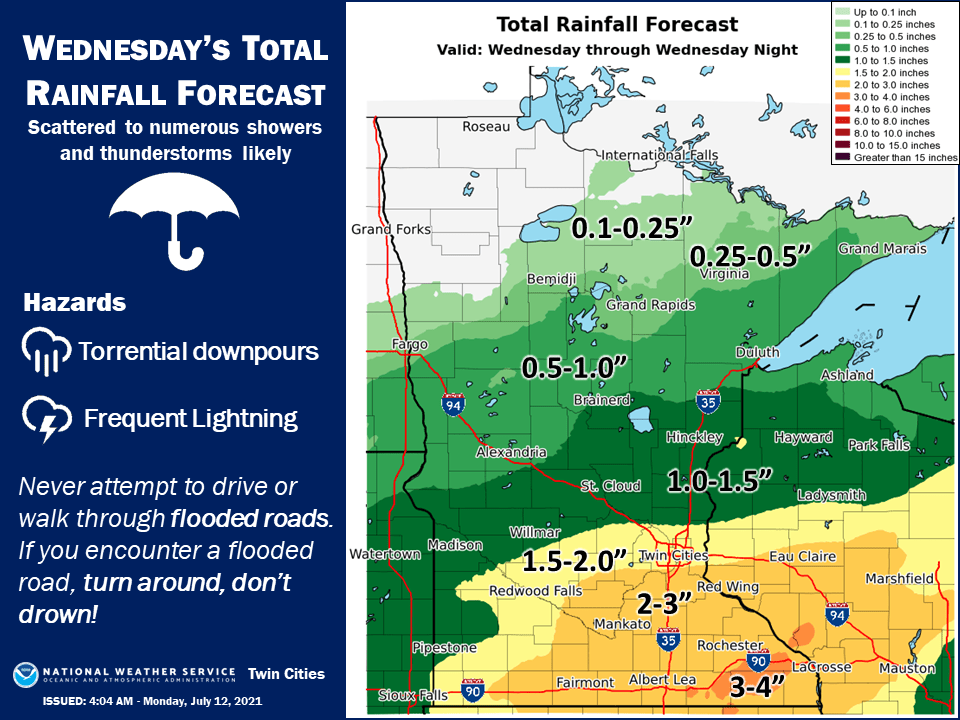
Unfortunately, the northern edge of Minnesota may miss most of the rain, which also happened during last Tuesday’s rain event. Given the drought conditions across Minnesota, this rain is needed everywhere.
While the anticipated precipitation is beneficial, the storm also carries a risk for severe weather.
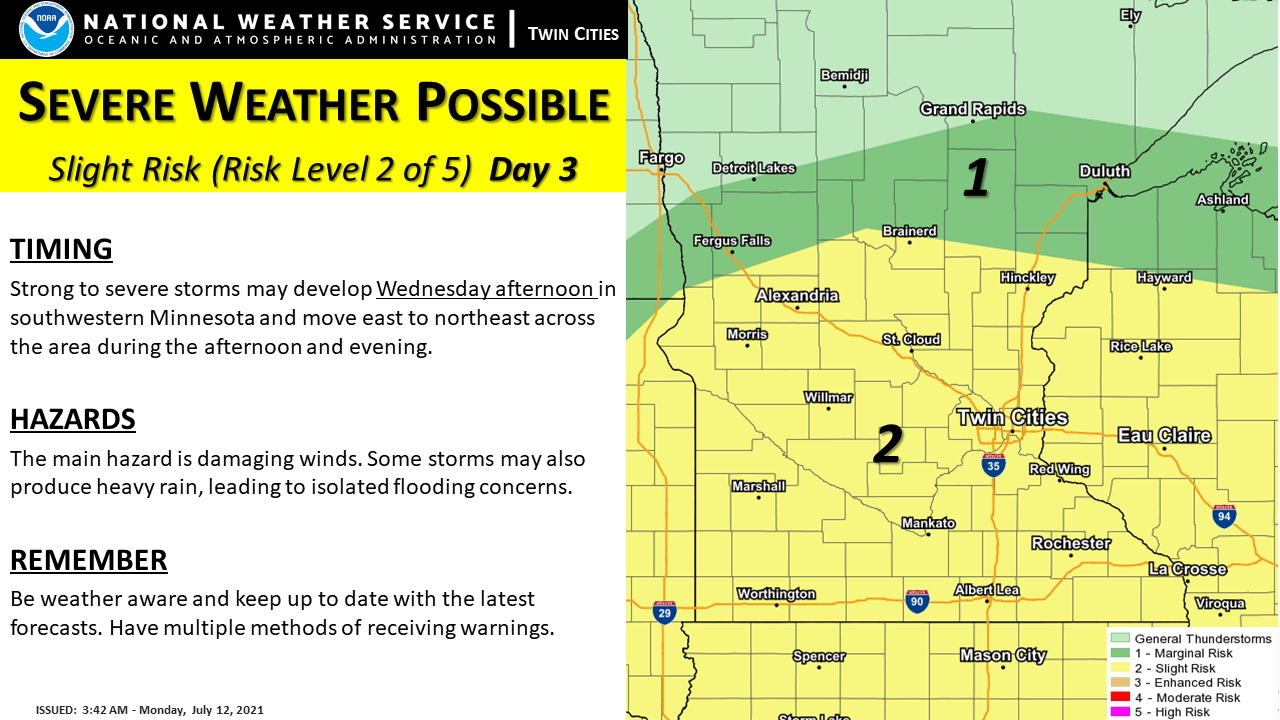
Localized flooding and damaging winds are the primary concerns, but we will also monitor for any tornado or large hail potential.
Although the brunt of the storm hits Wednesday, with some sunshine returning already Thursday, there could still be a couple lingering showers or isolated storms on Thursday.
By Friday, drier, sunnier skies return across the state and it currently looks like most of the weekend should also stay dry.
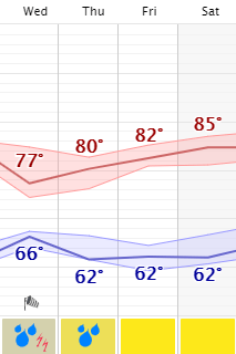
Highs remain in the 80s most of the week. However on Wednesday, depending on how many breaks of sun there are or aren’t during the morning before the rain really gets going, some of southern Minnesota may stay stuck in the 70s due to the precipitation.
Next week has the potential to turn hotter again, with 90s possible. In fact, northern and western Minnesota may get a couple isolated 90s by Friday or Saturday.
Programming note
You can hear my live weather updates on Minnesota Public Radio at 7:49 a.m. Monday through Friday morning.

