
Temperatures increase this week and so does the fire risk
Minnesota sees 90s and possibly a few 100s into the weekend
Go Deeper.
Create an account or log in to save stories.
Like this?
Thanks for liking this story! We have added it to a list of your favorite stories.


As Minnesota heads into another prolonged hot stretch, the drier weather also continues, exacerbating drought conditions and elevating the fire risk.
Sunday night and Monday
Following the warm weather Sunday, when almost all of Minnesota made it into the 80s and many spots near the northern border hit 90, temperatures remain mild overnight. Most of the state will drop only into the 60s, and haze from smoke in the atmosphere also persists.
Monday turns even warmer with almost all of Minnesota back in the 90s.
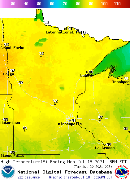
The hotter weather is fueled in part by lots of sunshine and a wind flow from the south and west. That wind direction should minimize the amount of new smoke moving into Minnesota, so it is likely there will be less haze. However, the winds cause a different problem Monday, as gusty conditions north could spread any fires that develop.
Given the drought conditions and the very dry vegetation, the fire risk is already much higher than normal for this time of year, particularly in northern Minnesota.
Turn Up Your Support
MPR News helps you turn down the noise and build shared understanding. Turn up your support for this public resource and keep trusted journalism accessible to all.
Extended outlook
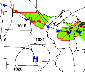
Thanks to a large ridge of higher pressure that is building over the northern plains, Minnesota is heading back into a hotter and drier pattern this week and probably much of next week, too.
For the remainder of the week, highs for most of the state stay in the 90s, and there could be a few spots in western Minnesota that see 100.
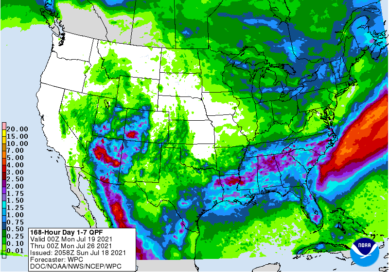
Rain chances look predominantly spotty, with no widespread, soaking rain expected.
There will be a boundary that sits over northern Minnesota the first half of the week, bringing spotty showers and storms mostly to northern Minnesota, although a stray shower or storm could make it as far south as the Twin Cities on Tuesday or Wednesday.
Another opportunity for isolated precipitation moves through the state late in the week, but again, rainfall totals are likely to be sparse.
Most of Minnesota will see less than a quarter inch of rain through the entire week, with most of the state seeing even less.
Programming note
You can hear my live weather updates on Minnesota Public Radio at 7:48 a.m. Monday through Friday morning.

