
The heat returns and lingers into next week
Northern Minnesota sees a few storms Monday but also a fire risk
Go Deeper.
Create an account or log in to save stories.
Like this?
Thanks for liking this story! We have added it to a list of your favorite stories.


Temperatures turn hotter, with most of Minnesota seeing highs in the 90s into next week. A few showers and storms move across the state early in the week, but precipitation remains too sparse to improve drought conditions.
Monday’s forecast
Thanks to a southerly flow, Minnesota started off warm, with a few 50s, but most of the state in the 60s.
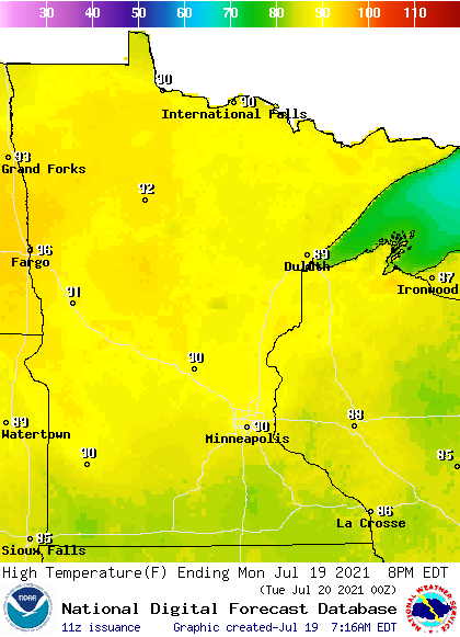
That pattern, along with mostly sunny skies, pushes almost the entire state back into the 90s for highs Monday.
The southerly flow also helps cut off some of the smoke coming in from the Canadian fires, so there should be less haze on Monday.
Turn Up Your Support
MPR News helps you turn down the noise and build shared understanding. Turn up your support for this public resource and keep trusted journalism accessible to all.
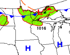
A weak cold front is starting to dip into northern Minnesota and is already brining a few storms along the Canadian border as of 9 a.m. This activity spreads across northern Minnesota into the afternoon.
Rain totals stay light for most areas, under a quarter inch except for any spots right under a strong storm. Isolated severe weather is possible, with damaging winds and large hail as the threat.
That front also turns winds in northern Minnesota westerly by the afternoon and gustier.

The gusty winds, plus any winds with thunderstorms, elevate fire concerns, because with our already dry conditions across Minnesota, that wind could easily spread any fires that develop.
Extended outlook
That front slowly slides south over the next couple days, and although the spotty activity is still most likely north, a few showers and storms will make it into southern Minnesota by Tuesday and Wednesday.
Another opportunity for isolated precipitation moves through the state late week, but again, rainfall totals are likely to be sparse.
Here is the forecast rainfall through Saturday, showing most of Minnesota will see under a quarter inch of total rain.
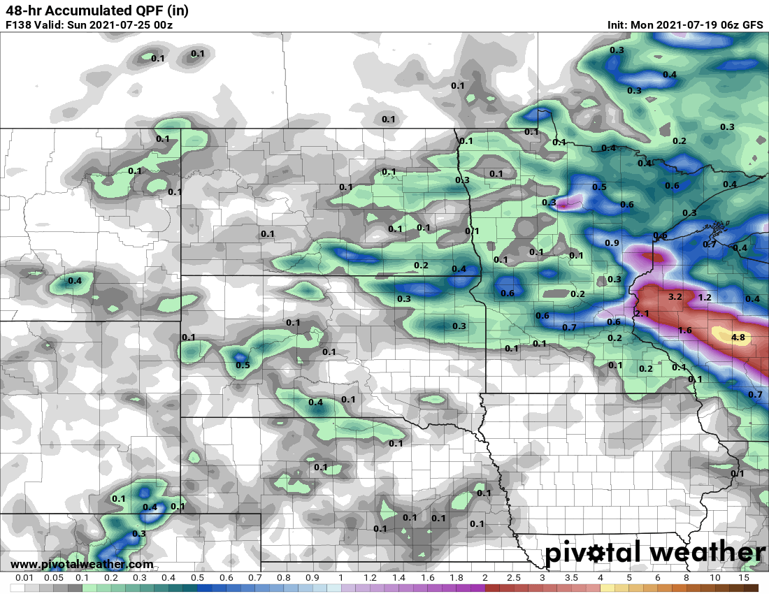
Eastern Minnesota may see slightly more depending on how the late-week system develops, although it currently appears more of the rain with that storm may target Wisconsin.
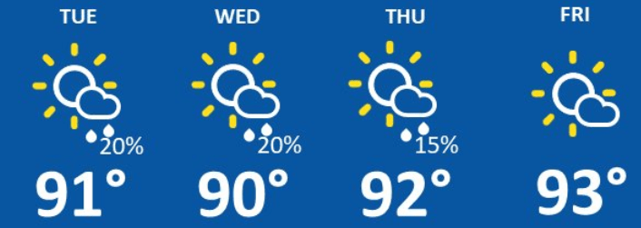
Meanwhile, the heat persists, with most of Minnesota staying in the 90s through the end of the week. A few 100s are even possible in western Minnesota late in the week.
Here is that forecast for the Twin Cities:
The extended outlook through the end of the month also keeps the state hotter and drier than average, which means there is no relief in sight for the drought conditions.
Programming note
You can hear my live weather updates on Minnesota Public Radio at 7:48 a.m. Monday through Friday morning.

