
Spotty thunder Thursday night; more widespread rains likely this weekend
Parts of Minnesota may pick up rainfall totals over an inch this weekend.
Go Deeper.
Create an account or log in to save stories.
Like this?
Thanks for liking this story! We have added it to a list of your favorite stories.


We’re finally tracking some much-needed rainfall on Doppler in the next few days.
Spotty showers and thunderstorms ride a weak frontal zone traveling through Minnesota Thursday night. Forecast models show a thin line of cells sliding southeast across Minnesota Thursday evening, generally fading after dark.
There is a marginal (low) risk that a couple of storms could reach severe limits with 1-inch diameter hail and 60 mph wind gusts.
More widespread weekend rains
We’re still tracking a low-pressure system moving through Minnesota this weekend. NOAA’s GFS model paints scattered rain and thunder cells tracking randomly across the Upper Midwest this weekend.
Turn Up Your Support
MPR News helps you turn down the noise and build shared understanding. Turn up your support for this public resource and keep trusted journalism accessible to all.
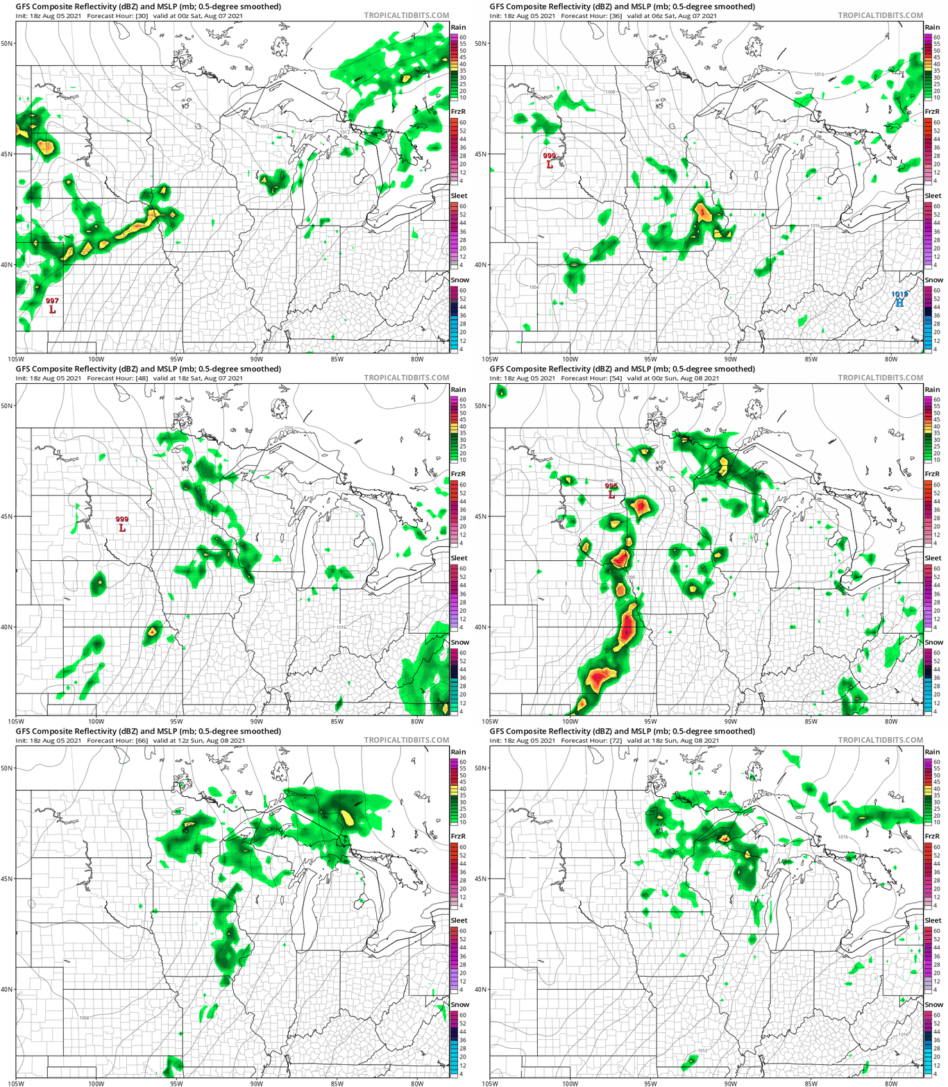
Keep in mind these animations are best used as just a general idea of precipitation coverage. Specific timing and coverage is often an hour-by-hour process in the rapid life-cycle of summer convective systems. The best approach to this weekend is to expect occasional rain and thunder, and plan hour-by-hour as the weekend unfolds.
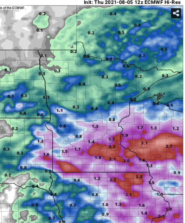
Speaking of random, it’s interesting to watch the forecast models try and wrangle rainfall totals this weekend. The European model favors a broad zone of 1 to more than 2 inches of rainfall by Monday across the southern half of Minnesota.
NOAA’s GFS favors less rain, while the Canadian model cranks out as much as 3 to 5 inches of rain for some areas.
Stay tuned.

