
Northern Minnesota starts Wednesday off with needed rain
Lower humidity levels again by the afternoon
Go Deeper.
Create an account or log in to save stories.
Like this?
Thanks for liking this story! We have added it to a list of your favorite stories.


An area of morning showers and storms Wednesday gives way to sunshine and drier air by the afternoon.
Wednesday’s weather
A weak cold front that brought rain across northern Minnesota during the overnight now has light showers and a few isolated storms over the Arrowhead Wednesday morning.
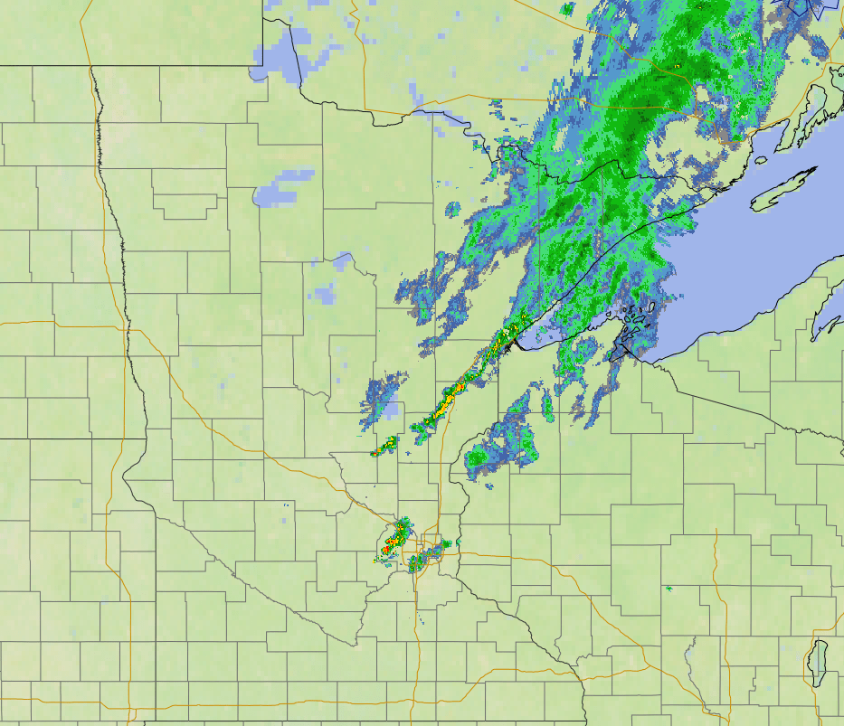
The trailing edge of that disturbance is bringing a couple very spotty showers and storms as far south as the Twin Cities as of 7 a.m.
The rain should completely clear east by late morning, and rain totals will be predominantly under a tenth of an inch.
Ahead of that front, dew points elevated again, with a couple dew points in southern Minnesota making it back into the low 70s after slightly drier air moved in with Tuesday’s cold front.
Turn Up Your Support
MPR News helps you turn down the noise and build shared understanding. Turn up your support for this public resource and keep trusted journalism accessible to all.
When Wednesday’s front clears, dew points lower again. By the afternoon, most of the state will have dew points back down in the 50s and comfortable relative humidity levels in the 30 to 40 percent range.
Wednesday morning temperatures vary from 50s north to 70s south.
Highs will be in the upper 70s north to mid-80s south, which is seasonable for mid-August.
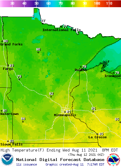
Another weak disturbance bring northern Minnesota an additional rain chance overnight Wednesday, but overall conditions will be predominantly dry in the coming week.
That extended forecast will be updated around 9 a.m.
Programming note
You can hear my live weather updates on Minnesota Public Radio at 7:48 a.m. Monday through Friday morning.

