
Warmer weather returns over the weekend
Beneficial rain looks promising by the middle of next week
Go Deeper.
Create an account or log in to save stories.
Like this?
Thanks for liking this story! We have added it to a list of your favorite stories.


Highs in the 70s Friday give way to 80s and 90s by the end of the weekend. Meanwhile, the current dry trend breaks the second half of next week, with widespread chances for needed rain.
Friday’s weather
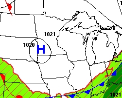
An area of high pressure is sitting directly over Minnesota as of Friday morning, bringing clear skies and predominantly light winds.
Under those conditions, temperatures dropped overnight, and Friday started cool for mid-August. Northern Minnesota was mostly in the 40s, with a few 30s in the Arrowhead, and southern Minnesota had lows predominantly in the 50s.
Those low temperatures are about 5 to 10 degrees below average for this time of year.
Turn Up Your Support
MPR News helps you turn down the noise and build shared understanding. Turn up your support for this public resource and keep trusted journalism accessible to all.
Highs also run slightly cooler than normal, with most of Minnesota seeing highs in the 70s, and a few 60s north.
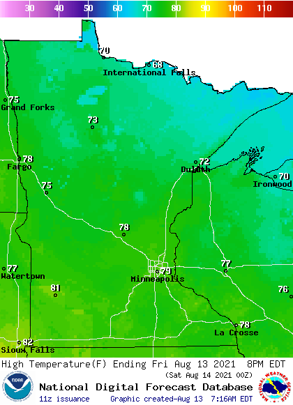
Humidity stays very low through the day and a breeze picks up in the afternoon. Under sunny skies, it is looking like a comfortable day.
Weekend weather
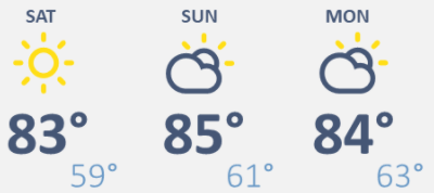
Saturday will be much like Friday, with a brisk morning in the 40s and 50s, plentiful sunshine and low humidity. The major difference is that a southerly flow returns by the afternoon, putting most of the state back into the 80s for highs.
That wind flow form the south also means Sunday starts milder, with more 50s and 60s. Humidity levels nudge higher, as do the highs, with most of Minnesota in the upper 80s and a few 90s north.
Here is that forecast for the Twin Cities:
Rain returns
The warm and dry weather continues Monday.
By Tuesday, the pattern starts to change, and a few showers and storms are likely to move back into the state, with much more active weather expected at Wednesday through Friday. While this is almost a week away, and there is still some uncertainty in totals and exact storm tracks, it does look like the state may see a couple rounds of showers and storms push through late week.
The current rainfall forecast through next Friday morning brings most of Minnesota at least a half an inch of rain, with higher amounts possible north.
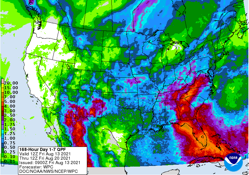
As northern Minnesota is seeing the most extreme areas of drought, and missed most of the rainfall last weekend, this will be tremendously beneficial precipitation.
Programming note
You can hear my live weather updates on Minnesota Public Radio at 7:48 a.m. Monday through Friday morning.

