
A dry Saturday, with comfortable dew points
Update on fire weather conditions
Go Deeper.
Create an account or log in to save stories.
Like this?
Thanks for liking this story! We have added it to a list of your favorite stories.


We’re still in drought, and no rain is in the forecast today. Instead, we’ll have a lot of sunshine and very low dew points.
A sprawling high pressure system will drift slowly eastward today. The National Oceanic and Atmospheric Administration’s High-Resolution Rapid-Refresh model isn’t showing any rain in Minnesota or western Wisconsin this Saturday or Saturday evening:
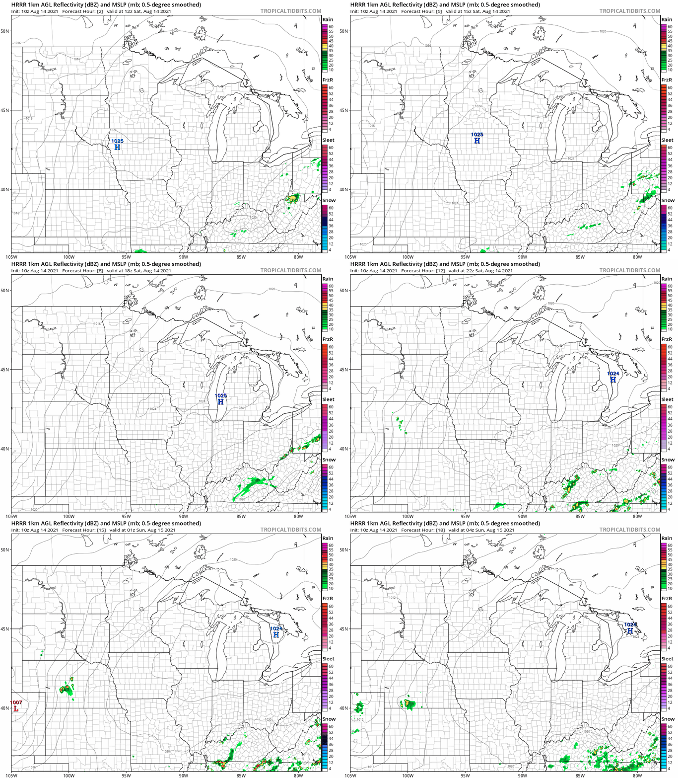
Breezes will pick up as the high drifts eastward.
Highs and dew points
Turn Up Your Support
MPR News helps you turn down the noise and build shared understanding. Turn up your support for this public resource and keep trusted journalism accessible to all.
Saturday highs reach the 80s in most areas:

A few spots in northwestern Minnesota could top 90. Parts of northeastern Minnesota might only reach the upper 70s.
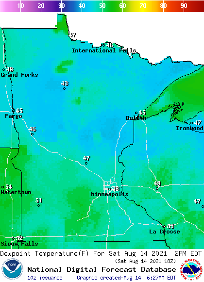
Saturday dew points will be in the very comfortable 40s to lower 50s:
Fire weather conditions
The NWS cautions that the risk of wildfire spread will increase in northern Minnesota Saturday afternoon and evening:
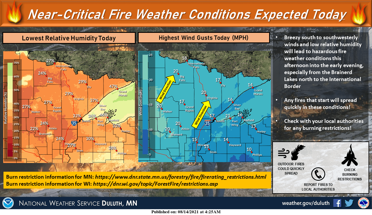
Here are details, from the Duluth office of the NWS:
Special Weather Statement National Weather Service Duluth MN 425 AM CDT Sat Aug 14 2021 MNZ010>012-018>021-025-026-033>038-141800- Koochiching-North St. Louis-Northern Cook and Lake-North Itasca- Central St. Louis-Southern Lake-Southern Cook-North Cass- South Itasca-South Cass-Crow Wing-Northern Aitkin-South Aitkin- Carlton and South St. Louis-Pine- Including the cities of International Falls, Ely, Isabella, Bigfork, Hibbing, Two Harbors, Silver Bay, Grand Marais, Walker, Grand Rapids, Pine River, Brainerd, Hill City, Aitkin, Duluth, Pine City, and Hinckley 425 AM CDT Sat Aug 14 2021 ...NEAR-CRITICAL FIRE WEATHER CONDITIONS THIS AFTERNOON AND EARLY EVENING FOR PORTIONS OF CENTRAL AND NORTHEAST MINNESOTA DUE TO LOW RELATIVE HUMIDITY AND GUSTY WINDS... Dry conditions and gusty winds will lead to near-critical fire weather conditions today. South and southwest winds of 5 to 15 mph with gusts of 10 to 20 mph are forecast for this afternoon and early evening. Minimum relative humidity values of 20 to 35 percent are also expected. Together, these conditions could lead to the rapid spread of fires. Please check burning restrictions and fire danger before burning. For more information on burning restrictions for Minnesota, see www.dnr.state.mn.us/forestry/fire/firerating_restrictions.html.
You can hear updated weather information for Minnesota and western Wisconsin on the Minnesota Public Radio network, and you can see updated weather info on the MPR News live weather blog.
Programming note
You can hear my live weather updates on MPR News at 7:35 a.m., 9:35 a.m. and 4:39 p.m. each Saturday and Sunday.

