
A warm and breezy Sunday
Near-critical fire danger in many areas
Go Deeper.
Create an account or log in to save stories.
Like this?
Thanks for liking this story! We have added it to a list of your favorite stories.


Parts of west-central Minnesota have scattered showers and thunderstorms as of 7 a.m. this Sunday. The rain activity extends northeastward toward Bemidji, and is expected to continue for a while before falling apart later this morning.
You can hear updated weather information for Minnesota and western Wisconsin on the Minnesota Public Radio network, and you can see updated weather info on the MPR News live weather blog.
Sunday warmth
Sunday highs reach the 80s in most areas, with 90s in northwestern Minnesota and parts of north-central Minnesota:
Turn Up Your Support
MPR News helps you turn down the noise and build shared understanding. Turn up your support for this public resource and keep trusted journalism accessible to all.
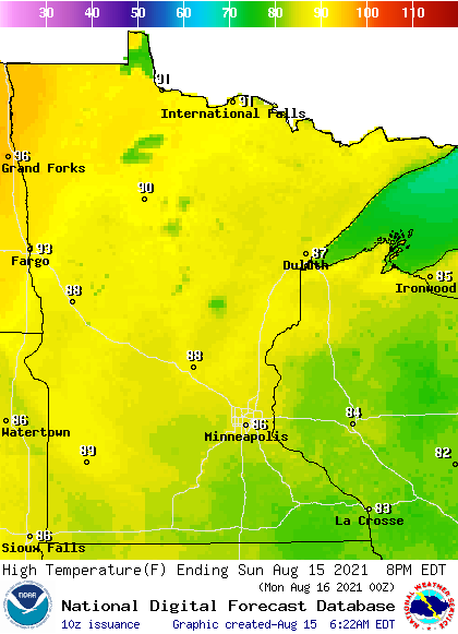
Some spots in the Twin Cities metro area are expected to top out in the upper 80s…well above our average August 15 high of 81.
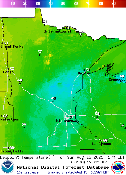
Sunday afternoon dew points will be in the fairly comfortable 40s to lower 50s much of Minnesota, with stickier upper 50s to lower 60s in parts of the northwest:
Near critical fire weather conditions
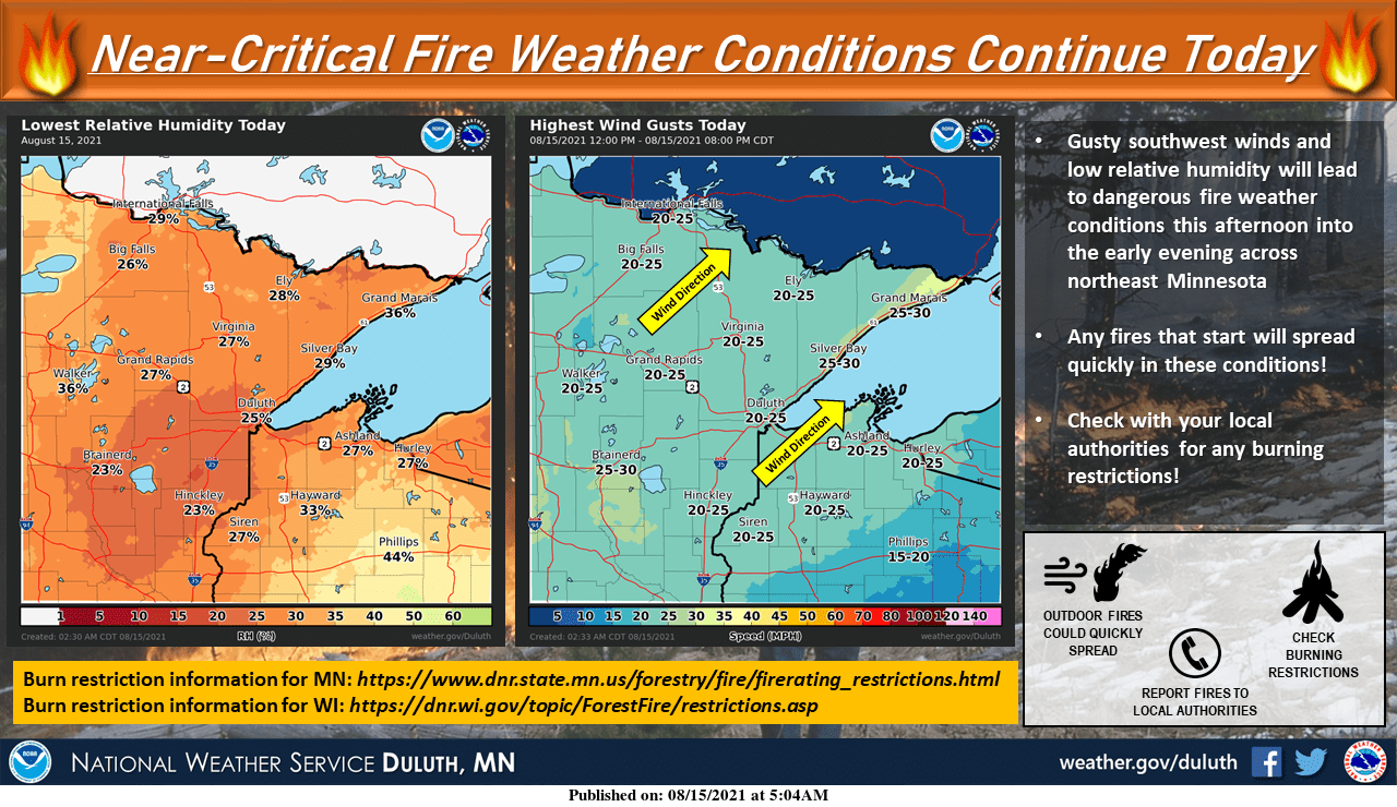
Fire weather conditions are near-critical in much of Minnesota today, due to low relative humidity and dry conditions plus gusty winds:
The near-critical fire conditions extend southward to Mankato and portions of the Twin Cities metro area:
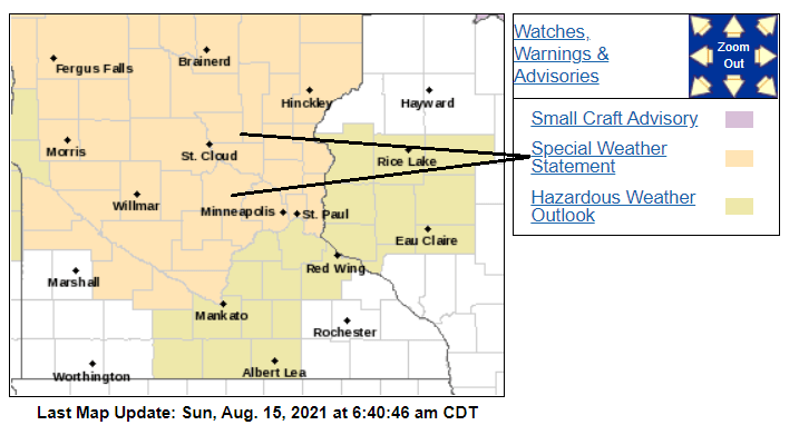
Here’s the NWS discussion of fire weather conditions:
Special Weather Statement National Weather Service Twin Cities/Chanhassen MN 346 AM CDT Sun Aug 15 2021 MNZ041>045-047>068-073>075-160000- Douglas-Todd-Morrison-Mille Lacs-Kanabec-Stevens-Pope-Stearns- Benton-Sherburne-Isanti-Chisago-Lac Qui Parle-Swift-Chippewa- Kandiyohi-Meeker-Wright-Hennepin-Anoka-Ramsey-Washington- Yellow Medicine-Renville-McLeod-Sibley-Carver-Redwood-Brown- Nicollet- Including the cities of Alexandria, Long Prairie, Little Falls, Princeton, Mora, Morris, Glenwood, St Cloud, Sauk Rapids, Elk River, Cambridge, Center City, Madison, Benson, Montevideo, Willmar, Litchfield, Monticello, Minneapolis, Blaine, St Paul, Stillwater, Granite Falls, Olivia, Hutchinson, Gaylord, Chanhassen, Chaska, Victoria, Redwood Falls, New Ulm, and St Peter 346 AM CDT Sun Aug 15 2021 ...NEAR CRITICAL FIRE WEATHER CONDITIONS TODAY FOR MUCH OF CENTRAL INTO SOUTHERN MINNESOTA DUE TO LOW HUMIDITY AND DRY FUELS... Low humidity levels and dry vegetation will lead to near critical fire weather conditions today. Minimum relative humidity values of around 25 percent are expected while fire officials report that grasses and other vegetation are quite dry. In addition, sustained southerly winds of 10 to 15 mph with gusts to 20 mph can be expected this afternoon into early this evening. This combination of dry conditions with breezy winds may contribute to the rapid spread of fires. Outdoor burning is not recommended. Check burning restrictions and heed instructions from fire officials.
This Updraft blog will be updated by around 10:20 a.m. with a look at the week ahead.
Programming note
You can hear my live weather updates on MPR News at 7:35 a.m., 9:35 a.m. and 4:39 p.m. each Saturday and Sunday.

