
Hotter, more humid weather returns
Minnesota sees rain chances return by Thursday
Go Deeper.
Create an account or log in to save stories.
Like this?
Thanks for liking this story! We have added it to a list of your favorite stories.


Heat and humidity are on the rise through Wednesday, then a pattern shift brings needed rain chances to Minnesota late in the week.
Sunday night and Monday
Other than a few isolated showers and storms Sunday morning in an area west of Bemidji toward Fergus Falls and westward, the weekend brought predominantly quiet and comfortable weather across Minnesota.
Highs were mostly in the 80s, with a few 90s northwest by Sunday, and the low humidity and breezy conditions did contribute to an elevated fire risk during the day, with much of Minnesota under a fire weather watch until 8 p.m. Sunday.
Overnight and into Monday morning, most of the state stays mild and in the 60s, with a few 70s lingering northwest.
Northwestern Minnesota will be the hot spot once again Monday, and highs in the 90s expand to even more of the northern and western edges of the state.
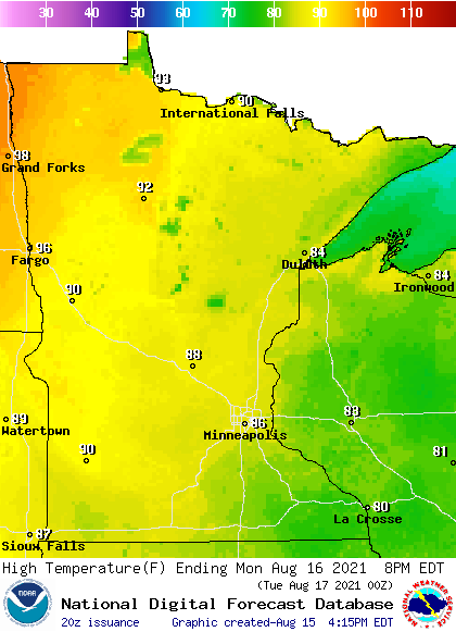
Meanwhile, southeastern Minnesota is forecast to be the “cooler” part of the state again, with mid-80s near the Twin Cities, and 80s near Rochester.
Turn Up Your Support
MPR News helps you turn down the noise and build shared understanding. Turn up your support for this public resource and keep trusted journalism accessible to all.
Breezy winds from the south continue Monday, and the humidity rises in western Minnesota. Eastern Minnesota sees one more day of lower humidity before almost all of the state sees muggier dew points back in the 60s by Tuesday.
Extended forecast
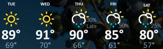
Hotter, more humid weather prevails Tuesday through Thursday, with much of the state seeing highs in the upper 80s and 90s.
Thursday is also our next significant chance for rain, with scattered showers and storms spreading across Minnesota during the day.
Precipitation chances continues through most of the weekend, with almost all of the state currently forecast to see at least a half an inch of needed rain through Sunday. Higher amounts are likely with any stronger storms.
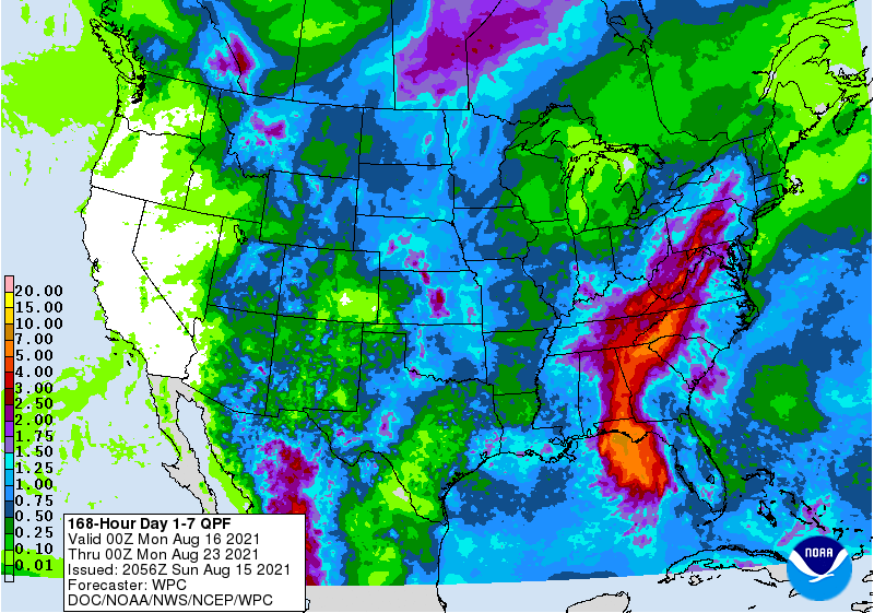
Meanwhile, a cold front moves through with the wet weather, dropping highs for most of Minnesota back into the 70s on Saturday.
Here is that forecast for the Twin Cities:
Programming note
You can hear my live weather updates on Minnesota Public Radio at 7:48 a.m. Monday through Friday morning.

