
Heat and humidity return through Thursday
A late-week storm brings both needed rain and a severe weather risk
Go Deeper.
Create an account or log in to save stories.
Like this?
Thanks for liking this story! We have added it to a list of your favorite stories.


Hot and humid weather grips Minnesota once again, until a late-week storm both lowers temperatures and brings needed rain back into the state.
Tuesday’s forecast
Minnesota had a warm start Tuesday, with most of the state in the 60s, and above-average lows in the 70s for parts of northern and western Minnesota.
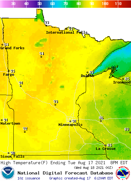
Highs are also on the rise again Tuesday, with almost the entire state making it into the 90s during the afternoon.
Dew points have also been nudging higher thanks to moist air funneling in with a southerly wind flow. By Tuesday afternoon, most of Minnesota will have dew points back in the 60s.
Turn Up Your Support
MPR News helps you turn down the noise and build shared understanding. Turn up your support for this public resource and keep trusted journalism accessible to all.
Despite slightly higher humidity levels, the fire risk is still a concern across much of the state due to the hot and breezy conditions forecast Tuesday, along with already dry vegetation from the state’s drought.
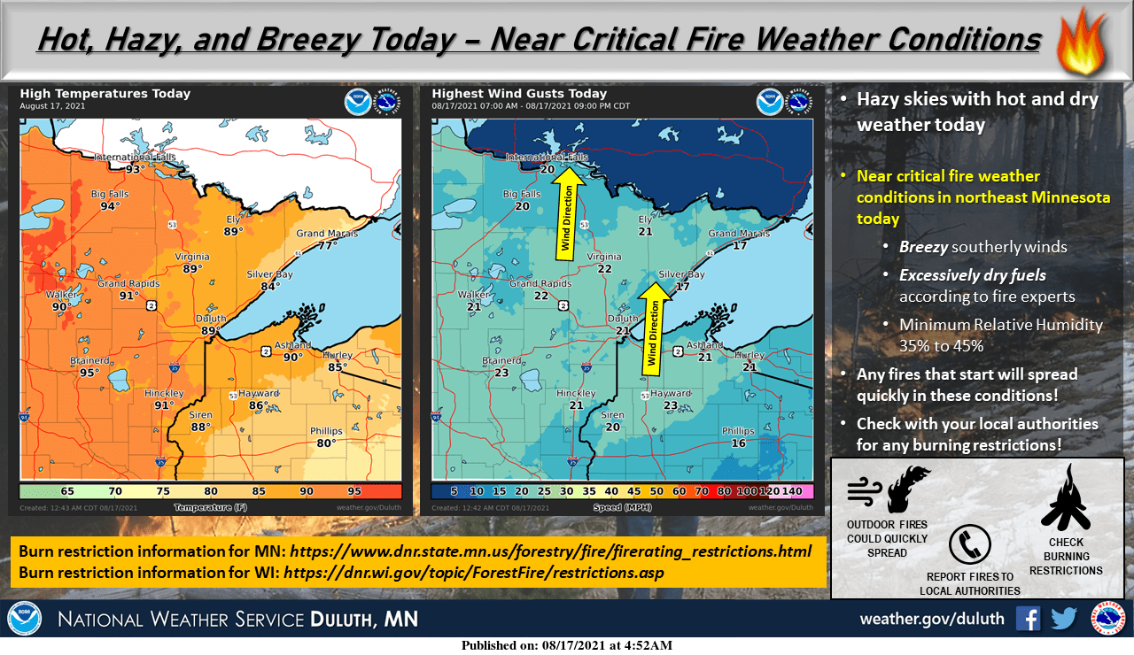
Because of the Greenwood Fire burning in Superior National Forest, surrounding areas are under an air quality alert until at least Tuesday afternoon because of smoke from that fire.
Minnesota also saw hazy skies return Monday due to smoke aloft from fires in the western United States, and that haze is likely to linger through Tuesday under otherwise sunny skies.
Extended forecast
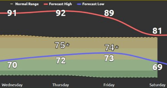
Temperatures remain hot and the humidity stays elevated through Thursday.
Highs stay predominantly in the 90s during that period and morning lows turn warmer too, with more of the state in the 70s. It is actually the morning lows that have the best chance to set some records, for “warmest lows,” especially Thursday and Friday morning.
Temperatures start to dip Friday with more clouds and rain along with a cold front moving in.
Behind Friday’s front, temperatures dive to more seasonable levels for mid-August, with highs in the 70s and low 80s over the weekend.
Here is that temperature forecast for the Twin Cities, with the current record warm minimum temperatures highlighted with asterisks on mornings we will be close to setting a record:
The weather pattern also stays mostly dry through Wednesday. A few showers and storms spread across Minnesota during the day Thursday, with most of the state seeing at least isolated precipitation chances by Thursday night.
More widely scattered thunderstorms and possible severe weather are likely Friday as a cold front moves through the state.
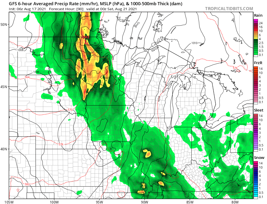
Periods of showers and storms linger through at least early next week, and there may be another heavier round of storms Sunday.
While there is still some uncertainty in exactly how much precipitation the different rounds of rain may bring, it looks like almost all of Minnesota can expect at least a half inch of rain through the weekend, with many totals over an inch.
The most significant rainfall may target northwestern Minnesota, which would be very beneficial as that part of the state is seeing some of the most extreme drought areas.
Programming note
You can hear my live weather updates on Minnesota Public Radio at 7:48 a.m. Monday through Friday morning.

