
Most of Minnesota is back in the 90s Tuesday
Humidity increases and skies remain hazy
Go Deeper.
Create an account or log in to save stories.
Like this?
Thanks for liking this story! We have added it to a list of your favorite stories.


Heat spreads across Minnesota Tuesday and humidity levels continues to rise. The fire risk remains a concern, and portions of the state are dealing with smoke and haze.
Tuesday’s forecast
Minnesota is off to a warm start Tuesday, with most of the state in the 60s, and above-average lows in the 70s for parts of northern and western Minnesota.
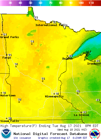
Highs are also on the rise again Tuesday, with almost the entire state making it into the 90s during the afternoon.
Dew points have also been nudging higher thanks to moist air funneling in with a southerly wind flow. By Tuesday afternoon, most of Minnesota will have dew points back in the 60s.
Turn Up Your Support
MPR News helps you turn down the noise and build shared understanding. Turn up your support for this public resource and keep trusted journalism accessible to all.
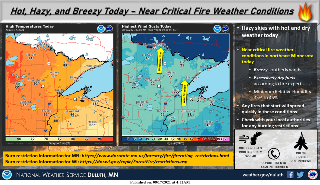
Despite slightly higher humidity levels, the fire risk is still a concern across much of the state due to the hot and breezy conditions forecast Tuesday, along with already dry vegetation from the state’s drought.
Because of the Greenwood Fire burning in Superior National Forest, surrounding areas are under an air quality alert until at least Tuesday afternoon because of smoke from that fire.
Minnesota also saw hazy skies return Monday due to smoke aloft from fires in the western United States, and that haze is likely to linger through Tuesday under otherwise sunny skies.
Heat prevails through Thursday, then rain returns toward the end of the week.
That extended forecast will be updated around 9 a.m.
Programming note
You can hear my live weather updates on Minnesota Public Radio at 7:48 a.m. Monday through Friday morning.

