
Weekend forecast: Friday evening thunder; many dry hours Saturday and Sunday
Severe weather potential Friday p.m.
Go Deeper.
Create an account or log in to save stories.
Like this?
Thanks for liking this story! We have added it to a list of your favorite stories.


I’ll get to our Friday p.m. thunderstorm chances shortly, but I first want to give you a drought update.
The latest U.S. Drought Monitor report shows that 96 percent of Minnesota is in drought right now, with slightly more than 8 percent (shaded dark red) in exceptional drought:
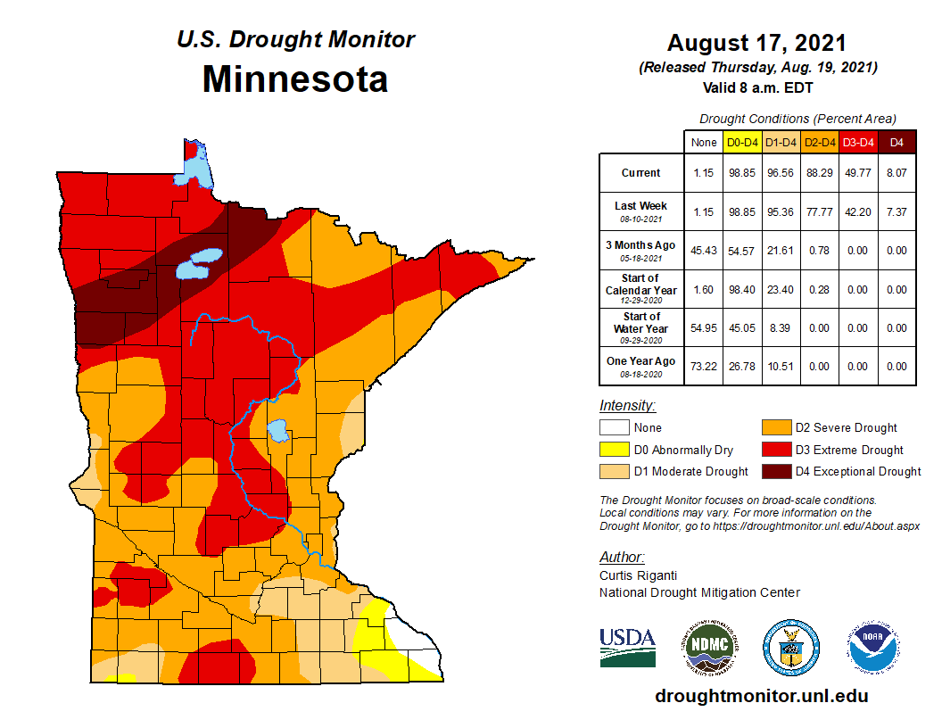
Extreme drought (medium red) covers almost 42 percent of Minnesota. Severe drought (orange) covers 38 percent of Minnesota, including most of the seven-county Twin Cities metro area.
When added together, the severe drought, extreme drought and exceptional drought areas cover 88 percent of Minnesota. That’s up from 78 percent one week ago.
Turn Up Your Support
MPR News helps you turn down the noise and build shared understanding. Turn up your support for this public resource and keep trusted journalism accessible to all.
Almost all of Minnesota could really use some rain.
Friday p.m. rain and thunder opportunities
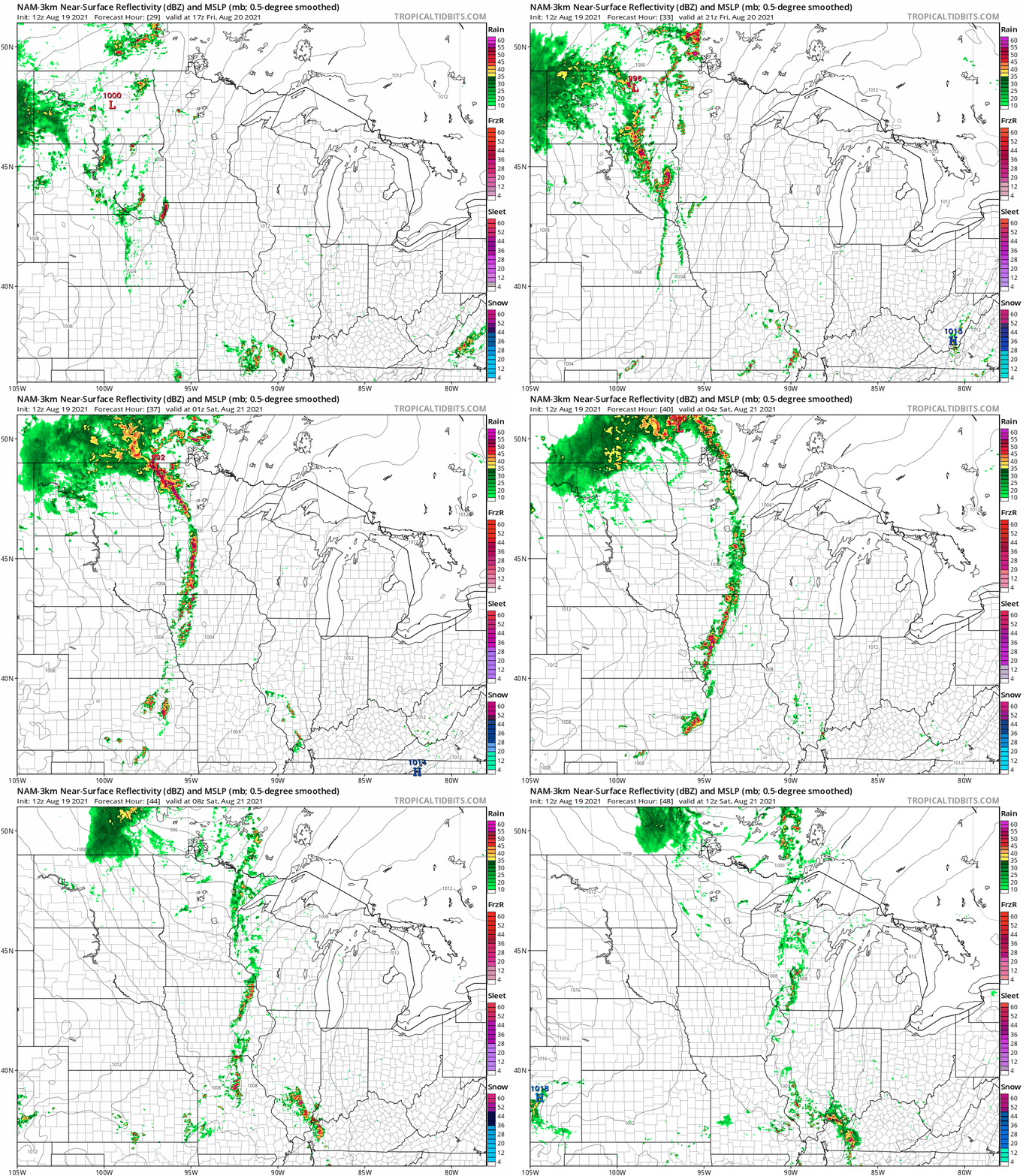
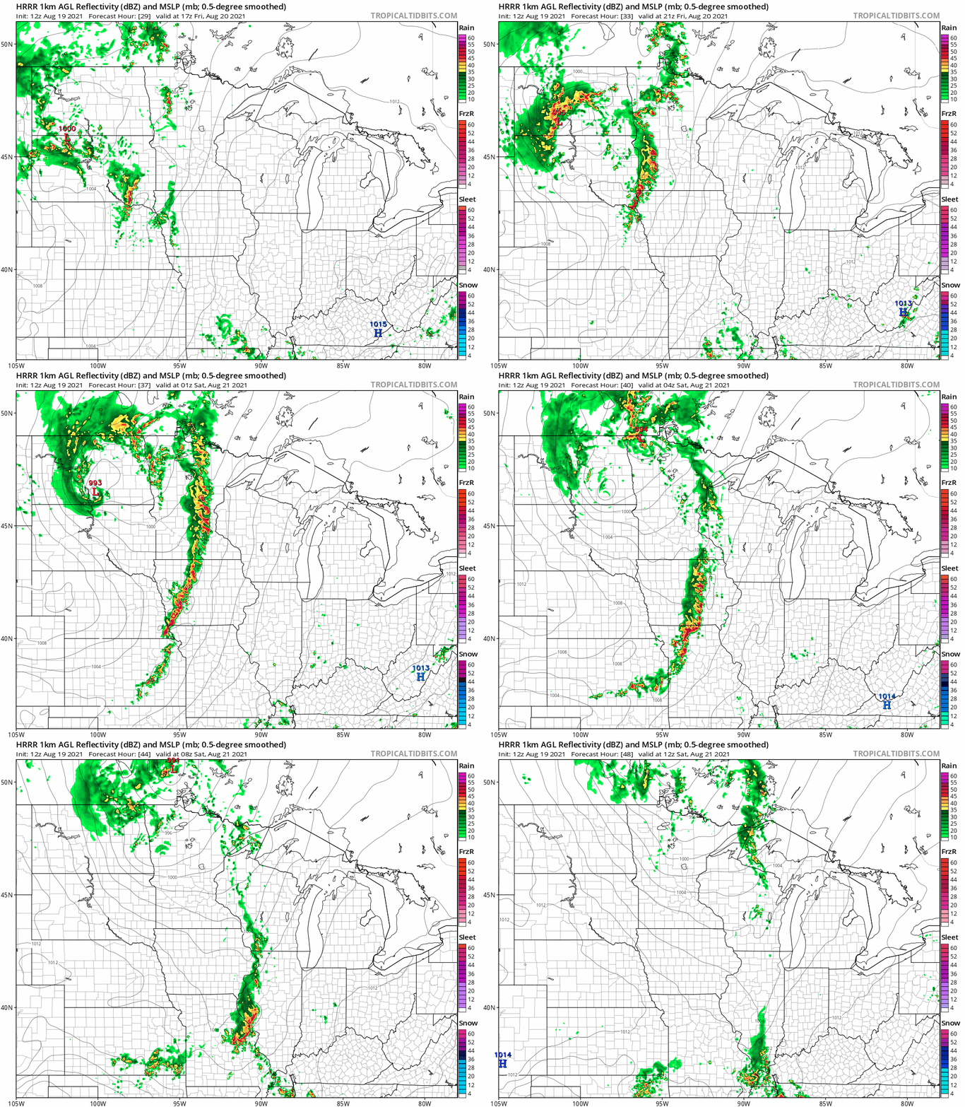
Forecast models are fairly consistent in bringing some showers and thunderstorms into western Minnesota Friday afternoon, then spreading the rain activity eastward Friday evening and overnight Friday night.
The National Oceanic and Atmospheric Administration’s North American Mesoscale (NAM) forecast model shows the potential rain pattern from noon Friday through 7 a.m. Saturday:
NOAA’s High-Resolution Rapid-Refresh model shows a similar rain pattern:
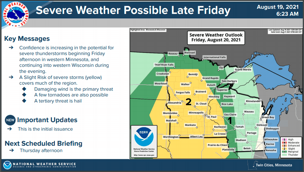
There is the potential for severe weather Friday afternoon and evening. The NWS Storm Prediction Center has much of Minnesota and parts of western Wisconsin in a slight risk of severe weather for that period. Slight risk means that scattered severe thunderstorms are possible. The slight risk area is shaded yellow on the following severe weather discussion from the Twin Cities office of the NWS:
At this point it looks like the daylight hours of Saturday plus much of Sunday will be dry in Minnesota and western Wisconsin. Showers and thunderstorms could return to parts of western Minnesota Sunday afternoon, then spread eastward Sunday evening.
Weekend temps and dew points
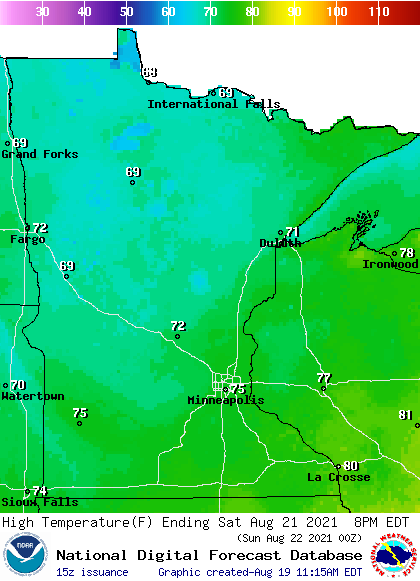
Saturday highs will be in the 70s in most areas, with 60s in northwestern and north-central Minnesota:
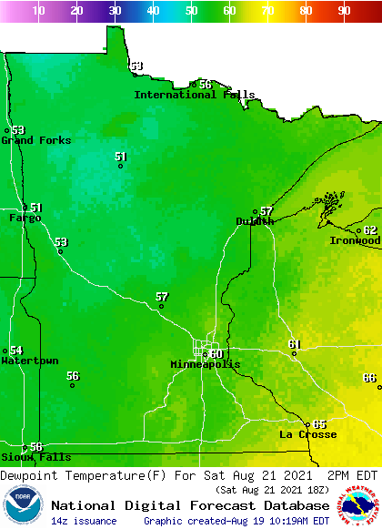
Saturday dew points will be in the comfortable 50s in most areas, with stickier 60s to the southeast:
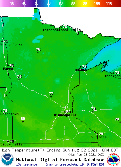
Sunday highs will be mainly in the 70s, with a few spots in southwestern Minnesota touching 80:
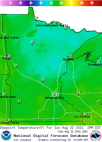
Sunday dew points will be in the comfortable 50s:
Programming note
You can hear my live weather updates on MPR News at 7:35 a.m., 9:35 a.m. and 4:39 p.m. each Saturday and Sunday.

