
Widespread strong thunderstorms Tuesday morning; Wednesday looks pleasant
Multiple weather disturbances are likely to bring significant rain Thursday and Friday
Go Deeper.
Create an account or log in to save stories.
Like this?
Thanks for liking this story! We have added it to a list of your favorite stories.


We have been getting widespread heavy rain Tuesday morning as strong thunderstorms sweep across the state. Numerous rainfall amounts well in excess of 1 inch will be reported once the rain gauges get checked. Lawns and farm fields will be happy.
Most storms so far have not been severe, with maximum wind gusts in the 50 to 55 mph range.
Continued severe storm risk
The chance of severe weather will continue mainly for southern Minnesota and then across Wisconsin.
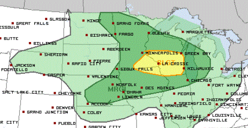
More showers and storms are likely Tuesday afternoon, mainly from west to east across the northern half of Minnesota. Afternoon high temperatures will range from the low 70s in the northwest to near 90 in the south.
Wednesday looks to be pleasant. Expect cooler temperatures and less mugginess.
Soggy pattern later in the week
Multiple weather disturbances are likely to bring us significant rain for Thursday and Friday. Some rainfall could be heavy.
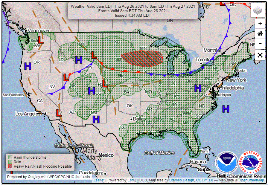
The weekend outlook is for at least a chance of showers and storms at times.
Turn Up Your Support
MPR News helps you turn down the noise and build shared understanding. Turn up your support for this public resource and keep trusted journalism accessible to all.

