
Much less humid Wednesday
Go Deeper.
Create an account or log in to save stories.
Like this?
Thanks for liking this story! We have added it to a list of your favorite stories.


A cold front is sliding slowly southeast across Minnesota to bring us much drier air on Wednesday. It will be a comfortable summer day with high temperatures ranging from the mid 60s in the northwest corner to the low 80s in the Twin Cities and across the south. Most of the state will have highs in the 70s with a light northwest breeze.
More rain ahead
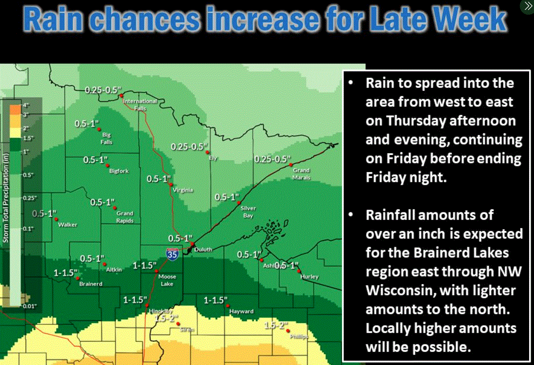
Multiple rounds of showers and thunderstorms will come our way from Wednesday night into the weekend. Parts of southern Minnesota could easily pick up a couple inches of total rain. While northern Minnesota will receive lesser amounts, the prospects are good that the drought- and wildfire-plagued areas of the north will get at least some rain.
Turn Up Your Support
MPR News helps you turn down the noise and build shared understanding. Turn up your support for this public resource and keep trusted journalism accessible to all.

