
Highs in the 70s for most of Minnesota Monday
Sunny skies prevail, although sprinkles are possible north
Go Deeper.
Create an account or log in to save stories.
Like this?
Thanks for liking this story! We have added it to a list of your favorite stories.


Following a foggy start in portions of Minnesota, Monday brings mostly dry weather and seasonably mild temperatures across the state.
Monday’s forecast
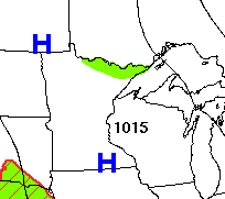
The rain and storms of last week are long gone, and high pressure now dominates the Minnesota forecast.
Under clear skies overnight, most of the state dropped into the 50s, with a couple lingering low 60s south, and a few 40s in northern Minnesota.
Given the recent moisture, light winds overnight and cool morning temperatures, a few areas of fog were able to develop, especially in central and southeastern Minnesota. The fog should lift by midmorning.
Turn Up Your Support
MPR News helps you turn down the noise and build shared understanding. Turn up your support for this public resource and keep trusted journalism accessible to all.
Otherwise, the day remains sunny and mild, with highs in the 70s and a few low 80s south.
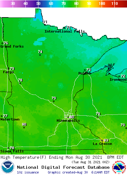
For most of the state this is within a couple degrees of average and very seasonable for late August.
The northeastern border may see a couple light showers or sprinkles in the afternoon due to low pressure in Canada. Parts of the Arrowhead also remain under an air quality alert until at least Monday evening due to smoke from the Greenwood Fire,
A more widespread rain chance returns to the state by Thursday.
That extended forecast will be updated around 9 a.m.
Programming note
You can hear my live weather updates on Minnesota Public Radio at 7:48 a.m. Monday through Friday morning.

