
Near average temperatures and precipitation this week
Rain returns to most of the state by Thursday
Go Deeper.
Create an account or log in to save stories.
Like this?
Thanks for liking this story! We have added it to a list of your favorite stories.


Seasonable weather prevails in the week ahead, with both temperatures and precipitation chances that are very close to average for this time of year.
This follows last week, where most of Minnesota saw significant, heavy rainfall that put much of the state at or above average precipitation for the month of August. That is in large contrast to the much drier-than-average weather most of the state saw in May, June and July.
For the Twin Cities, the recent heavy rains shot the metro area into the top 10 wettest Augusts on record:
Monday’s forecast
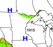
The rain and storms of last week are long gone. High pressure now dominates the Minnesota forecast.
Turn Up Your Support
MPR News helps you turn down the noise and build shared understanding. Turn up your support for this public resource and keep trusted journalism accessible to all.
Under clear skies overnight, most of the state dropped into the 50s, with a couple lingering low 60s south, and a few 40s in northern Minnesota.
Given the recent moisture, light winds overnight and cool morning temperatures, a few areas of fog developed, especially in central and southeastern Minnesota. That fog has lifted.
Otherwise, the day remains sunny and mild, with highs in the 70s and a few low 80s south.
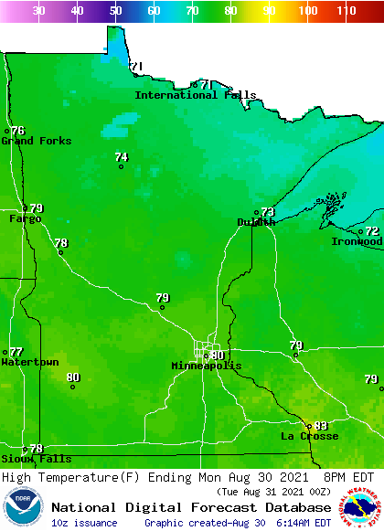
This is within a couple degrees of average for late August for most of the state.
The northeastern border may see a couple of light showers or sprinkles in the afternoon due to low pressure in Canada. Parts of the Arrowhead also remain under an air quality alert until at least Monday evening due to smoke from the Greenwood Fire.
Extended forecast
Near-average temperatures continue through the end of the week, with most of Minnesota in the mid-70s to near 80 until Wednesday. The state also stays mostly sunny and predominantly dry, although a few showers my clip southern Minnesota early Tuesday.
Areas of fog are also likely again Tuesday morning, especially in northeastern Minnesota. The next widespread rain chance returns late Wednesday, through Thursday, then diminishing Friday.
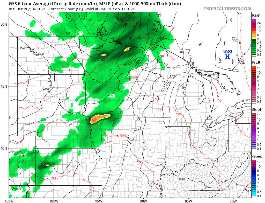
It currently looks like that storm could bring much of the state at least one-half inch to 1 inch of rain, with higher amounts possible north. That means in addition to seasonable temperatures, precipitation should remain near average for the week.
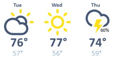
The additional cloud cover and rain late-week decreases temperatures a couple degrees, with more of the state in the mid to lower 70s by Thursday.
Here is the forecast for the Twin Cities showing that slight drop:
Programming note
You can hear my live weather updates on Minnesota Public Radio at 7:48 a.m. Monday through Friday morning.

