
Rain returns Thursday across Minnesota
Cloudy skies and rain drop highs into the 60s and low 70s
Go Deeper.
Create an account or log in to save stories.
Like this?
Thanks for liking this story! We have added it to a list of your favorite stories.


Needed rain that spreads across Minnesota throughout the day Thursday will also be responsible for keeping temperatures cooler.
Thursday’s forecast
A storm that will impact the state through Friday is already bringing showers and a few storms into western Minnesota as of 7 a.m.
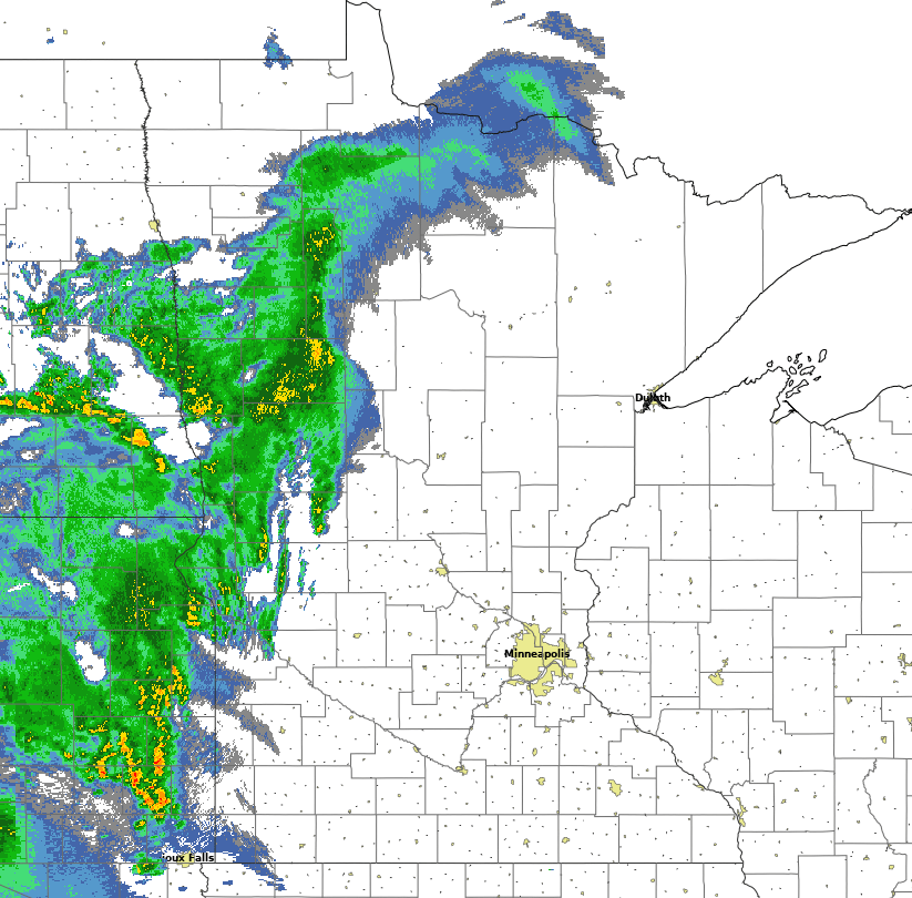
This area of precipitation is moving slowly, with most of eastern Minnesota, including the Twin Cities, not expected to see the precipitation begin until Thursday evening.
Here is that forecast timing of when the rain moves in:
Turn Up Your Support
MPR News helps you turn down the noise and build shared understanding. Turn up your support for this public resource and keep trusted journalism accessible to all.

Although there will be thunderstorms, this is mostly a rain event, and severe weather is not forecast.
Even before the rain moves in, clouds have spread across the state, with mostly cloudy skies expected Thursday.
In western Minnesota, where the clouds moved in earlier, overnight lows stayed in the 60s, while eastern Minnesota kept cleared skies and started Thursday in the 40s north and 50s south.
During the day, with little sunshine providing warmth, eastern Minnesota should only make it into the low 70s.
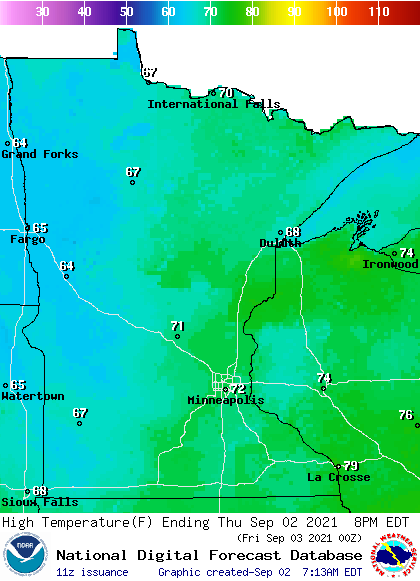
Western Minnesota will be even cooler thanks to the rain during the day, with more highs in the 60s. That puts highs in most places 5 to 10 degrees below average.
The rain moves out Friday, and the weather stays predominantly dry over the holiday weekend.
That extended forecast will be updated around 9:30 a.m.
Programming note
You can hear my live weather updates on Minnesota Public Radio at 7:48 a.m. Monday through Friday morning.

