
Cooler, but less windy for Wednesday
Northeastern Minnesota sees more afternoon showers and storms.
Go Deeper.
Create an account or log in to save stories.
Like this?
Thanks for liking this story! We have added it to a list of your favorite stories.


Winds stay breezy Wednesday, and most of the state sees sunshine, with the exception of wet weather in the Arrowhead.
Wednesday’s forecast
High pressure is moving in, but northeastern Minnesota is still seeing instability from an area of low pressure in Canada (the same storm that brought the cold front through the state early Tuesday and caused gusty winds), so Wednesday’s weather will be fairly similar to what we saw Tuesday.
It will still be breezy Wednesday, with gusts over 20 mph at times, although that is far less than Tuesday’s winds that reached over 50 mph in a couple spots.
Wednesday morning lows are fairly seasonable, with most of the state in the 50s.
Turn Up Your Support
MPR News helps you turn down the noise and build shared understanding. Turn up your support for this public resource and keep trusted journalism accessible to all.
Under a continued chilly wind flow from the northwest, the highs drop a couple degrees cooler again, with most of northern Minnesota in the 60s Wednesday and low to mid-70s west and south.
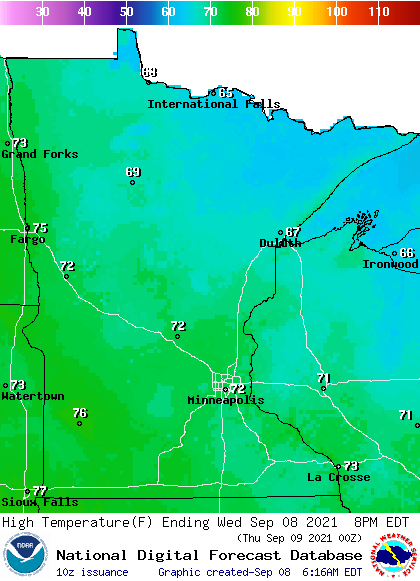
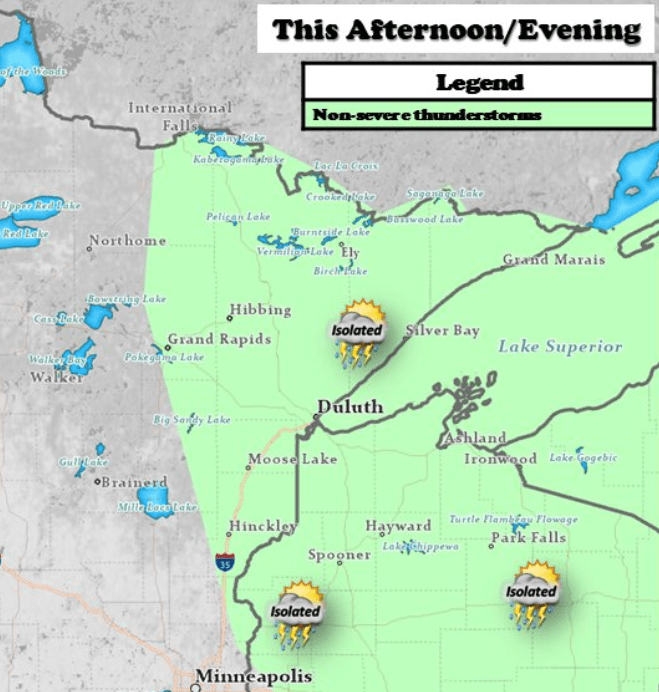
Much like the recent trend, sunshine will be widespread Wednesday except for in northeastern Minnesota.
Because of the instability around the Arrowhead, that area will once again see spotty showers and storms, especially in the afternoon and evening hours with daytime heating.
This wet weather should finally end by Thursday as high pressure builds in, then another rain chance returns by Friday night.
That extended forecast will be updated by 9:30 a.m.
Programming note
You can hear my live weather updates on Minnesota Public Radio at 7:48 a.m. Monday through Friday morning.

