
Southern Minnesota gets spotty showers Thursday
The North Shore is dealing with dense fog once again.
Go Deeper.
Create an account or log in to save stories.
Like this?
Thanks for liking this story! We have added it to a list of your favorite stories.


A change in the weather pattern that has already brought more clouds to eastern Minnesota will now bring a few rain showers into the state.
Thursday’s forecast
Minnesota is starting the day Thursday with areas of fog again. There is some predominantly lighter fog in the southwestern corner of the state, but once more, the thickest fog is found near Lake Superior. A dense fog advisory is in effect along the North Shore until 10 a.m.
Our wind pattern is still from the southeast, which kept the state very mild overnight for October. Most of the state is at least in the 50s, with widespread 60s south. This is 10 to 20 degrees above average for much of Minnesota.
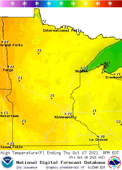
Highs remain warm too, with 70s for all but portions of the Arrowhead.
Turn Up Your Support
MPR News helps you turn down the noise and build shared understanding. Turn up your support for this public resource and keep trusted journalism accessible to all.
The southeast winds drew more moisture across Minnesota Wednesday, increasing clouds across the eastern half of the state.
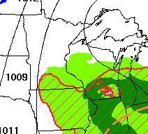
For Thursday, that same flow is forecast to draw in a few light showers from a storm far south of Minnesota.
Because of the location of that storm, showers are most likely to occur in southern Minnesota or along the eastern edge of the state.
Any rain that falls is forecast to have very limited accumulation, mostly under a tenth of an inch.
A more potent storm is expected to bring significant rain to northern Minnesota over the weekend.
That extended forecast will be updated around 9 a.m.
Programming note
You can hear my live weather updates on Minnesota Public Radio at 7:48 a.m. Monday through Friday morning.

