
Severe weather possible in some areas Saturday night; Sunday rain chances highest north
Fall color update for leaf-peepers
Go Deeper.
Create an account or log in to save stories.
Like this?
Thanks for liking this story! We have added it to a list of your favorite stories.


The Saturday high temperature at Minneapolis-St. Paul International Airport was 79 degrees. That’s warm for Oct. 9; our average Twin Cities high is just 62 degrees this time of year.
Along with the warmth, we had sticky dew points here and across most of Minnesota. That moisture will provide fuel for thunderstorms.
Minnesota and western Wisconsin will see areas of showers and thunderstorms Saturday evening and overnight Saturday night.
The NWS Storm Prediction Center has included three west-central Minnesota counties in a severe thunderstorm watch that continues until 10 p.m. this Saturday:
Turn Up Your Support
MPR News helps you turn down the noise and build shared understanding. Turn up your support for this public resource and keep trusted journalism accessible to all.
_______________________________________________________________________________________________
6:35 p.m. Saturday update:
The NWS Storm Prediction Center has included much of central Minnesota and parts of western Minnesota in a severe thunderstorm watch until 2 a.m. Sunday:
_______________________________________________________________________________________________
You can hear updated weather information for Minnesota and western Wisconsin on the Minnesota Public Radio News network, and you can see updated weather info on the MPR News live weather blog.
The overall severe weather outlook for Saturday evening and the overnight hours of Saturday night shows that scattered severe thunderstorms are possible in portions of western and central Minnesota that are shaded yellow in the following graphic:
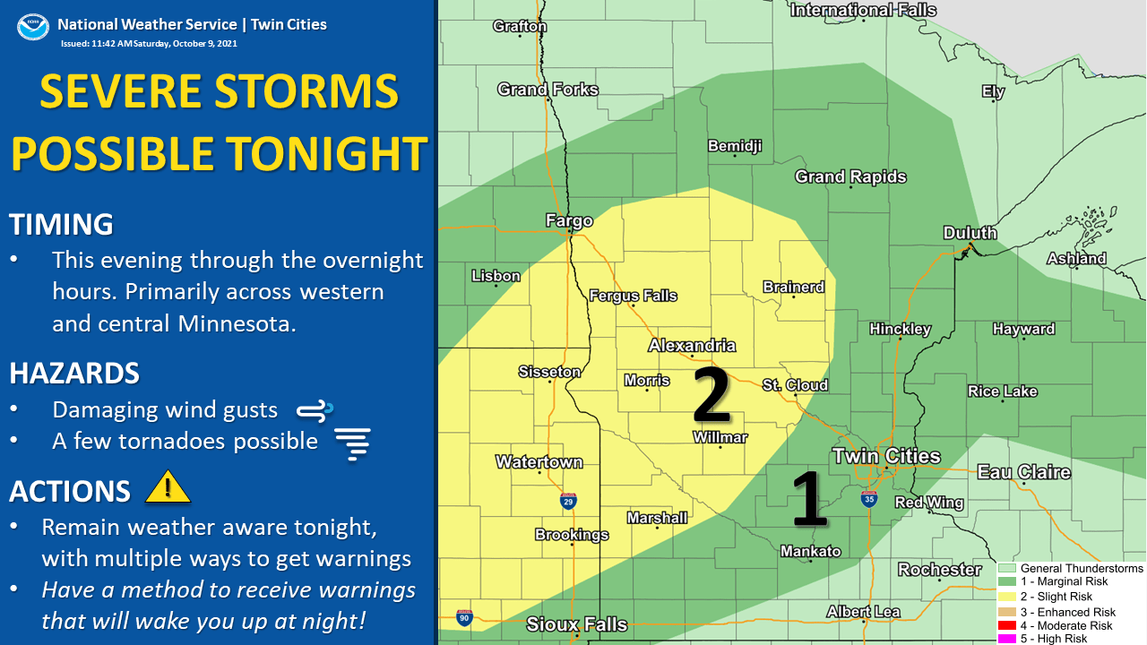
“Tonight” in the NWS graphic refers to Saturday evening and overnight Saturday night. The dark-green shaded area, which includes the Twin Cities, has a marginal risk of severe weather; meaning that an isolated severe thunderstorm is possible.
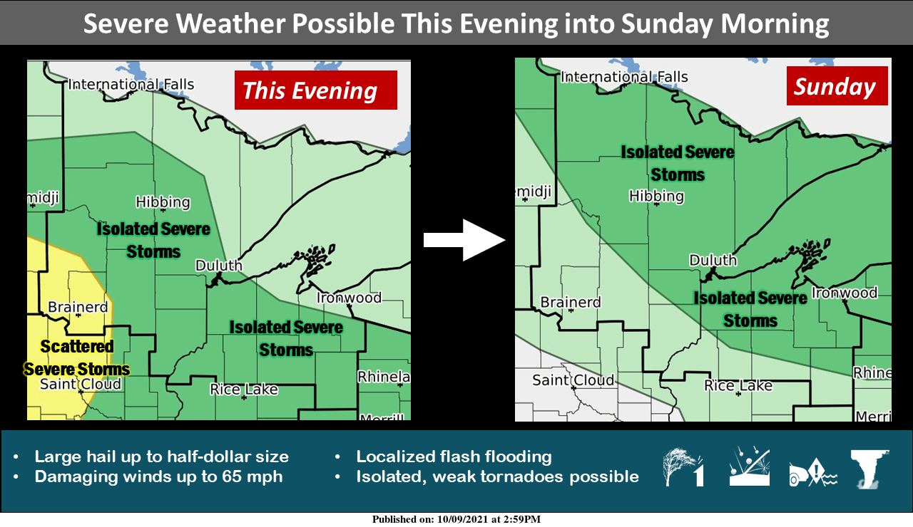
Here’s the severe weather discussion for Saturday night and Sunday in northeastern Minnesota and northern Wisconsin, from the Duluth office of the NWS:
Portions of northeastern Minnesota and northwestern Wisconsin are in a dense fog advisory Saturday evening and overnight, ending at 10 a.m. Sunday:

Sunday rain chances?
The best chance of showers and a few embedded t-storms during the daylight hours of Sunday will be in the northern half of Minnesota plus west-central Minnesota.
NOAA’s North American Mesoscale (NAM) forecast model shows the potential rain pattern on during the daylight hours of Sunday:

A few scattered showers are also possible elsewhere in Minnesota and parts of Wisconsin on Sunday.
Temperature trends
Sunday highs will be in the 60s to the north and west, with some 70s from the Twin Cities through southeastern Minnesota and western Wisconsin:

Afternoon dew points will be in the 50s:

Back to high temperatures, Twin Cities metro area highs are projected to reach the upper 60s Monday and Tuesday, then mid 60s on Wednesday. Cooler temps move in to end the week, with highs in the lower 60s Thursday and upper 50s on Friday. Highs may be in the upper 50s again on Saturday, then rebound on Sunday.
The NWS Climate Prediction Center shows a tendency for above normal temperatures in Minnesota and western Wisconsin next Sunday into the following week:

Fall color report
The percentage of changeover to fall colors is highest in the northern half of Minnesota plus the northeastern part of the Twin Cities metro area right now. Here’s the latest fall color report from the Minnesota Department of Natural Resources:

The dark-red shaded areas in northern Minnesota are past peak. Keep in mind that all deciduous trees are included in the fall color report, not just maples.
Wisconsin fall color info can be found here.
Programming note
You can hear my live weather updates on MPR News at 7:35 a.m., 9:35 a.m. and 4:39 p.m. each Saturday and Sunday.

