
Despite a cooler finish, October was a very warm month
The Twin Cities will see 20s for the first time since April
Go Deeper.
Create an account or log in to save stories.
Like this?
Thanks for liking this story! We have added it to a list of your favorite stories.


Following a warm October, November is beginning slightly below average. The cooler weather does not last long though, with milder temperatures returning by the weekend.
Not only was Sunday Halloween, but it was also the final day of October. Although the final days of the month brought a return to seasonably cool weather, October of 2021 will be remembered as a warm month, especially the first half of the month where much of Minnesota had numerous days with highs in the 70s.
This put the state well above average, with much of the state in the top 10 for warmest Octobers.
For the Twin Cities, October temperatures averaged 6.1 degrees above normal. The warmth was even more impressive farther north. For example, International Falls averaged 8.2 degrees above normal for the month.
Turn Up Your Support
MPR News helps you turn down the noise and build shared understanding. Turn up your support for this public resource and keep trusted journalism accessible to all.
Monday’s forecast
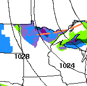
Thanks to a disturbance that kept a few more clouds in overnight Sunday, the first day of November had a relatively mild start, with most morning temperatures in the 30s. Under clear skies, southern Minnesota was the chilly spot Monday morning with a few more 20s.
That same disturbance which provided the clouds keeps the northern half of Minnesota mostly cloudy Monday and brings the northern edge of the state an occasional light wintry mix of precipitation.
No significant accumulation is expected.
Winds stay predominantly out of the west-northwest Monday and remain somewhat breezy.
That continued cooler wind flow will drop highs a couple more degrees from where they were at on Sunday, ranging from the mid-30s north to mid-40s south.
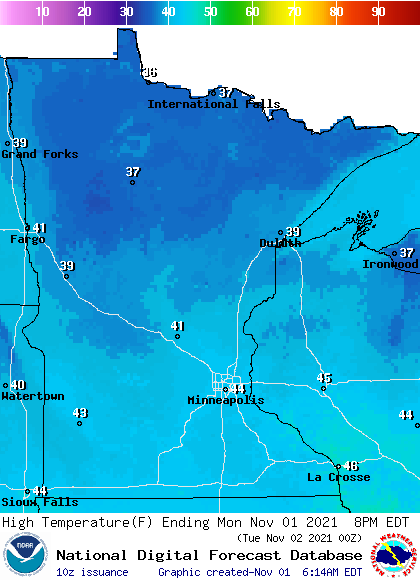
This puts much of the state about 5 degrees below our average highs in early November.
Extended forecast
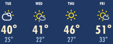
Temperatures nudge even colder the next couple days, with highs in the 30s for most of Minnesota and a few low 40s south on Tuesday and Wednesday.
Under mostly clear skies, there will be sunshine during the days, but temperatures will cool into the 20s overnight across the state. While much of Minnesota has been in the 20s already this autumn, for a few spots, including the Twin Cities, this will be the first time in the 20s this season and the coldest weather since April.
By Thursday, a southerly wind flow returns, and combined with sunshine, it warms temperatures back above average by the end of the week. Most of Minnesota can expect 50s again by Friday.
Here is that forecast for the Twin Cities:
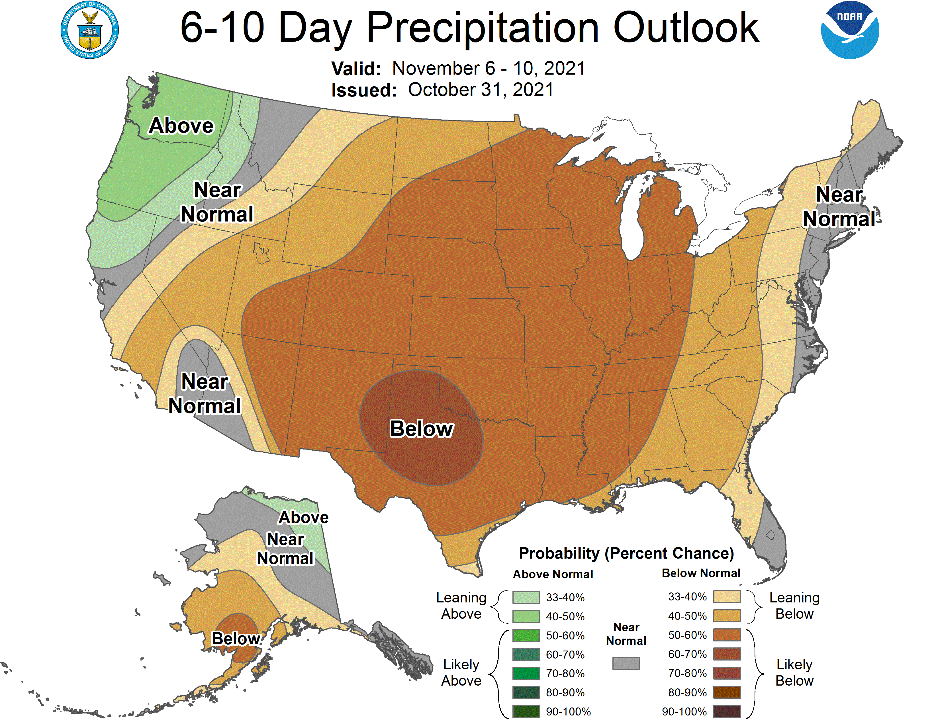
Sunshine prevails most of the week as the state gets into a very dry pattern, with no significant precipitation chances until at least mid to late next week.
Programming note
You can hear my live weather updates on Minnesota Public Radio at 7:49 a.m. Monday through Friday morning.

