
November starts off cool
Northern Minnesota gets a mix of rain and snow Monday.
Go Deeper.
Create an account or log in to save stories.
Like this?
Thanks for liking this story! We have added it to a list of your favorite stories.


Temperatures dip a few more degrees Monday bringing highs below average, which will be chilly enough for northern Minnesota to see a couple snowflakes.
Monday’s forecast
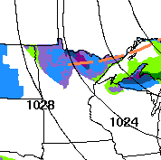
Thanks to a disturbance that kept a few more clouds in overnight Sunday, the first day of November is off to a relatively mild start, with most morning temperatures in the 30s. Under clear skies, it is southern Minnesota that is beginning Monday with a few more 20s.
That same disturbance which provided the clouds keeps the northern half of Minnesota mostly cloudy Monday and brings the northern edge of the state an occasional light wintry mix pf precipitation.
No significant accumulation is expected.
Turn Up Your Support
MPR News helps you turn down the noise and build shared understanding. Turn up your support for this public resource and keep trusted journalism accessible to all.
Winds stay predominantly out of the west-northwest Monday and remain somewhat breezy.
That continued cooler wind flow will drop highs a couple more degrees from where they were at on Sunday, ranging from the mid-30s north to mid-40s south.
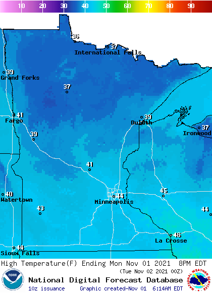
This puts much of the state about 5 degrees below our average highs in early November.
Warmer weather returns by the end of the week.
That extended forecast will be updated around 9 a.m.
Programming note
You can hear my live weather updates on Minnesota Public Radio at 7:49 a.m. Monday through Friday morning.

