
Warming weather pattern will peak this weekend; mild into next week
Go Deeper.
Create an account or log in to save stories.
Like this?
Thanks for liking this story! We have added it to a list of your favorite stories.


Temperatures fell into the 20s Wednesday morning in much of Minnesota as Tuesday’s overcast began exiting the state eastbound. The Twin Cities’ low up to 7 a.m. was 32 beneath lingering cloud cover. The cold spot at 8 a.m. is Bemidji in northwestern Minnesota with 19 degrees under clear skies.
Continued cool for one more day
Wednesday will be an uneventful day, still a bit on the cool side but with some sun and just a light wind. Afternoon high temperatures should range from the upper 30s to the mid-40s, with the exact number depending a bit on how much sunshine you get.
The Twin Cities should have a high around 45 with a light south breeze. The Twin Cities’ record high for this date, Nov. 3, is 75 set just last year.
Warmup gets underway on Thursday
Milder air on Thursday will bring high temperatures from the mid-40s to low 50s. The Twin Cities should reach about 50 degrees.
Turn Up Your Support
MPR News helps you turn down the noise and build shared understanding. Turn up your support for this public resource and keep trusted journalism accessible to all.
Gusty south winds will boost afternoon temperatures to the 50s across most of Minnesota on Friday. The southwest corner could warm to the upper 50s while upper 40s linger in the Arrowhead. I am forecasting a high of about 55 for the Twin Cities.
Precipitation will be sparse or absent this week. An unimpressive weather system might trigger a scattering of light rain showers across parts of mainly northern Minnesota Friday night and maybe into Saturday morning.

Look forward to the weekend
A lovely weekend seems to be a sure bet for Saturday and Sunday with highs from the mid-50s up north to the low 60s in the south. The Twin Cities area should see highs reaching the low 60s both days. The last time the Twin Cities reached 60 degrees was back on Oct. 20.

Mild into next week
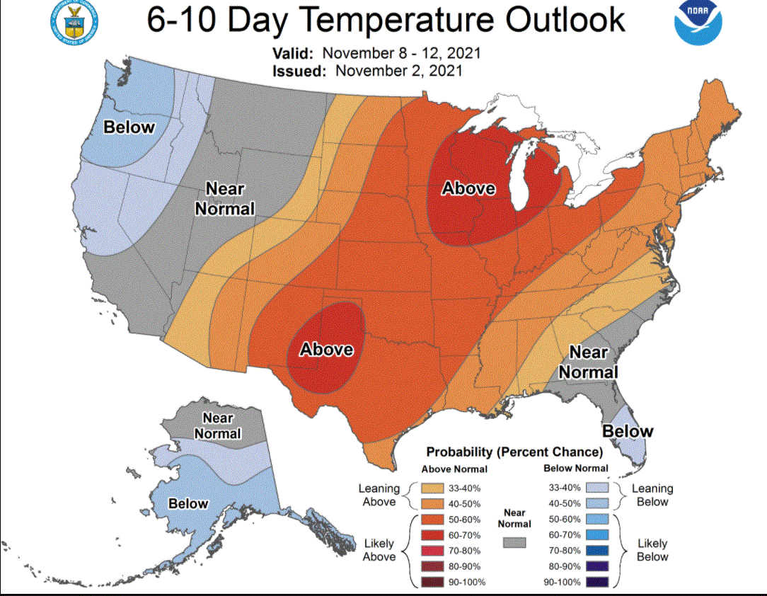
The six-to-10-day temperature outlook is calling for the Minnesota-Wisconsin area to remain warmer than normal Nov. 8-12.
Messy storm possible later next week
Forecast models are suggesting the possibility of a deepening low pressure system coming our way later next week. If it develops as models indicate, it would begin as rain and develop wraparound snow on its backside. Early season storms can be messy with rain followed by snow. Sometimes that wet snow falls on warm ground, partially melts and then freezes into rutty ice as the temperatures cool, as occurred with our 1991 Halloween blizzard.

