Quite a cooldown coming this week; messy storm system Wednesday through Friday
Go Deeper.
Create an account or log in to save stories.
Like this?
Thanks for liking this story! We have added it to a list of your favorite stories.


What a great weekend it has been to be outdoors. Temperatures far above normal were made for bike rides and walks in parks. Even yardwork was pleasant.

The Twin Cities had a high of 62 Sunday afternoon, held back a bit by extensive clouds, when the average high for the day would be 46.
Cooldown coming
Now change is coming. Afternoon high temperatures will be turning cooler as we go through the week. Highs for Monday will be in the 50s statewide, then progressively cooler Tuesday and Wednesday. The Twin Cities should reach about 57 on Monday, mid 50s on Tuesday and probably low 50s on Wednesday. Those will still be mild temperatures for November.
Turn Up Your Support
MPR News helps you turn down the noise and build shared understanding. Turn up your support for this public resource and keep trusted journalism accessible to all.
Messy storm system Wednesday through Friday
Low pressure will develop east of the Rockies on Wednesday and intensify significantly as it comes our way. Deeper low pressure means increasing winds around the counterclockwise circulation
This will be one of those early-season storms where the mix of mild air and some colder air will make it difficult to forecast whether rain, snow or a mix will fall at some locations. Widespread rain is likely to arrive from the west on Wednesday. The rain should become mixed with or possibly change over to snow in northern Minnesota Wednesday night.
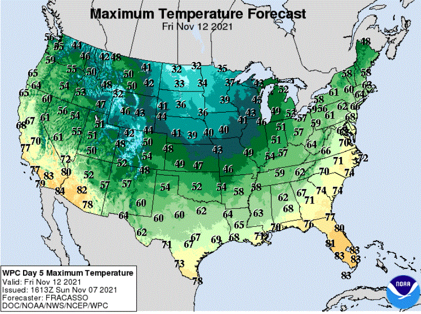
Thursday through Friday will see gusty northwest winds on the backside of the slow-moving storm that should provide enough cold air for a rain/snow mix Thursday night changing to all snow possibly statewide on Friday before ending. Shovelable snow is most likely in northern Minnesota.
I must stress that it is far too early to be forecasting amounts of snowfall when there is such uncertainty in the type of precipitation that will fall.
Turning much colder later in the week
Temperatures are generally easier to forecast than precipitation amounts, especially during these shoulder seasons when precipitation type is so uncertain. Confidence is high that the late-week northwest flow will drive our temperatures below seasonal averages.
Some highs in the upper 30s should arrive on Thursday. Then it looks like the whole state will see chilly high temperatures in the 30s for Friday, Saturday and Sunday.