
3-day punch: Intensifying storm brings rain, snow, wind starting Wednesday
Portions of northern Minnesota may see over 6 inches of snow
Go Deeper.
Create an account or log in to save stories.
Like this?
Thanks for liking this story! We have added it to a list of your favorite stories.


A multifaceted storm moving into Minnesota with rain Wednesday will bring high winds and heavy snow before finally clearing out Friday, leaving colder weather for the weekend.
Wednesday’s forecast
A strong storm that is approaching Minnesota is bringing a trough of low pressure across the Dakotas as of Wednesday morning, and by 9 a.m. was already pushing some rain into western Minnesota.
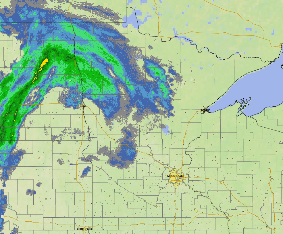
This rain keeps spreading throughout the state throughout the morning, with most of Minnesota seeing rain by the afternoon.
Most of the precipitation stays as rain Wednesday. With the low pressure tracking south then clipping southeastern Minnesota before heading into Wisconsin, the state stays on the warm side of the storm Wednesday.
Turn Up Your Support
MPR News helps you turn down the noise and build shared understanding. Turn up your support for this public resource and keep trusted journalism accessible to all.
Because of this, Minnesota had another mild start Wednesday morning, with most spots in the 30s and 40s, although the Arrowhead saw some cooler teens and 20s.
Winds from the southeast help keep temperatures above average, but the clouds and rain drop temperatures slightly versus Tuesday. Wednesday highs will be mostly in the 40s with a few 50s south.
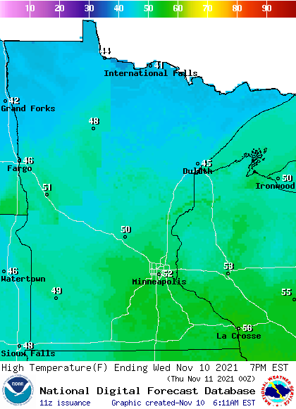
While the precipitation will be mostly rain on Wednesday, it could be cool enough in northern Minnesota for some light snow to mix in.
It will also turn windier as the storm approaches, with most of the state seeing gusty winds over 20 mph by the afternoon.
Intensifying storm
By early Thursday, the low pressure and associated cold front will have passed into Wisconsin, putting Minnesota on the colder side of the storm.
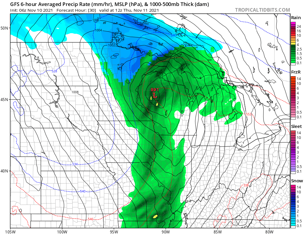
The storm rapidly intensifies Thursday, meaning the low pressure of the storm quickly gets even lower, while moving up toward Lake Superior.
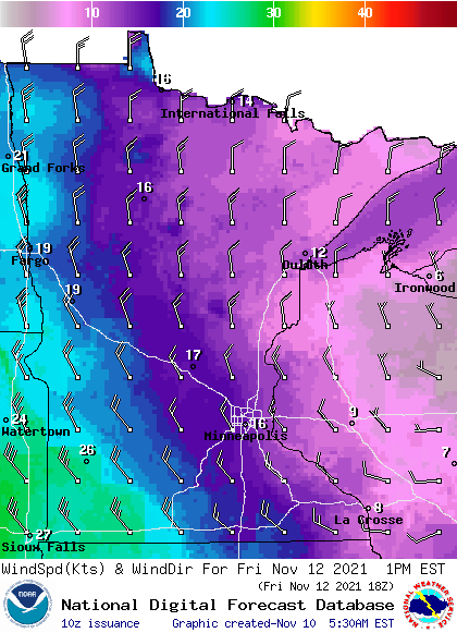
So, unlike many storms where winds and precipitation decrease as the storm moves away, this storm brings even more potent impacts Thursday and Friday. Winds keep increasing, with much of the state seeing gusts over 30 mph by Thursday and 40 mph by Friday.
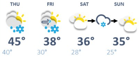
Temperatures keep falling, putting Thursday in the 30s north and 40s south for highs, with all of the state only warming into the 30s by Friday. Because of the high winds, wind chills will be in the frigid teens and 20s Friday.
The biggest impact for many will be the snow. The storm will start wrapping snow back into northern then western Minnesota during the day Thursday. For much of southern Minnesota, including the Twin Cities, Thursday will still be mild enough that the snow is most likely to begin Thursday evening.
Snow then lingers into Friday, before the precipitation finally starts clearing by the evening. During the day Friday, highs in the mid to upper 30s in southern Minnesota may be mild enough for some rain to mix back in.
Because of the temperatures right near freezing and the rain/snow mix, the snow forecast could vary, but the current thinking has much of the state getting at least a wet inch of snow (that may not last long due to the warm ground and rain Friday afternoon).

For northern Minnesota, snowfall will be much more significant, with some areas north of Bemidji possibly seeing more than 6 inches. It will reduce visibility at times due to the gusty winds.
The places seeing less snow pick up more rain, with totals in most places of one-half inch to 1 inch of rain.
That storm clears out by late Friday, but another minor disturbance over the weekend may bring another round of very light snow Saturday into Sunday as temperatures will still be chillier, with highs only in the 30s.
Here is that forecast for the Twin Cities:
Programming note
You can hear my live weather updates on Minnesota Public Radio at 7:49 a.m. Monday through Friday morning.

