
Breezy and chilly Sunday
Winds will taper off this afternoon
Go Deeper.
Create an account or log in to save stories.
Like this?
Thanks for liking this story! We have added it to a list of your favorite stories.


The official Saturday snow total was 1.2 inches at Minneapolis-St. Paul International Airport. Higher snow totals were seen in parts of central and northern Minnesota and western Wisconsin. Many observers will be taking snow measurements this morning. The NWS will plot new snow reports here.
Accumulating snow has moved out of Minnesota for the most part. There could be scattered light snow showers in far southeastern Minnesota this morning, with just a stray flurry possible elsewhere in Minnesota.
You can hear updated weather information for Minnesota and western Wisconsin on the Minnesota Public Radio News network, and you can see updated weather info on the MPR News live weather blog.
Minnesota road conditions can be found here. Wisconsin road conditions can be found here.
Turn Up Your Support
MPR News helps you turn down the noise and build shared understanding. Turn up your support for this public resource and keep trusted journalism accessible to all.
Temps and winds
The low pressure system that moved through Minnesota yesterday is sitting over southeastern Wisconsin this morning, with gusty winds extending back over Minnesota. The winds will gradually taper off as the low moves slowly away.
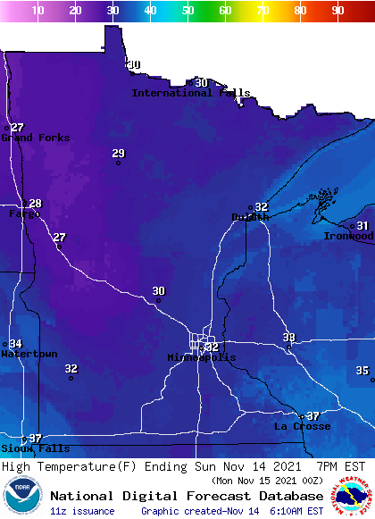
Sunday highs will be mainly in the 30s, with some 20s in northwestern Minnesota:
Sunday morning wind gusts will be over 20 mph in eastern Minnesota and western Wisconsin:
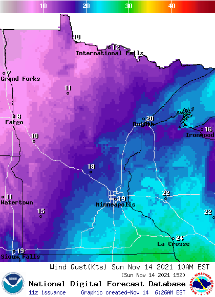
Forecast wind gusts are in knots, with 18 knots equal to 20.7 mph.
Sunday morning wind chills will be in the teens:
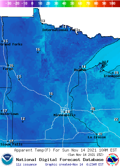
Wind chill temps will not be as low this afternoon, due to a gradual decrease in wind speeds.
Update
The Updraft blog will be updated around 10:15 a.m. with a look at the week ahead.
Programming note
You can hear my live weather updates on MPR News at 7:35 a.m., 9:35 a.m. and 4:39 p.m. each Saturday and Sunday.

