
Chilly Sunday breezes; Saturday snow totals were highest to the north
Warmest day of the week will be Tuesday
Go Deeper.
Create an account or log in to save stories.
Like this?
Thanks for liking this story! We have added it to a list of your favorite stories.


The Saturday snow total at Minneapolis-St. Paul International Airport was 1.2 inches. Some additional metro area snow reports include 1.5 inches in Woodbury and Roseville, 2 inches in Ramsey and 2.5 inches just north of Stillwater. Much higher snow totals were seen in parts of central and northern Minnesota and western Wisconsin.
The highest Minnesota snow total received so far this weekend is 10 inches, near Gatzke in Marshall County of northwestern Minnesota. Pencer and Clearbrook of northwestern Minnesota tallied 8 inches of new snow on Saturday.
The NWS plot of new snow reports can be found here. The plot looked liked this Sunday morning:
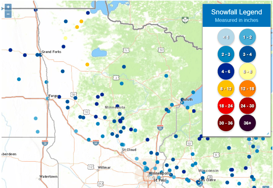
You can go to the linked NWS site and hover over any data point to see the snow total, and the location and time of the snow measurement. You can also grab the image on the site and shift it to include more of northern Minnesota or Wisconsin.
Turn Up Your Support
MPR News helps you turn down the noise and build shared understanding. Turn up your support for this public resource and keep trusted journalism accessible to all.
We’re not expecting additional snow accumulations in Minnesota today, but a few spots could see a stray flurry.
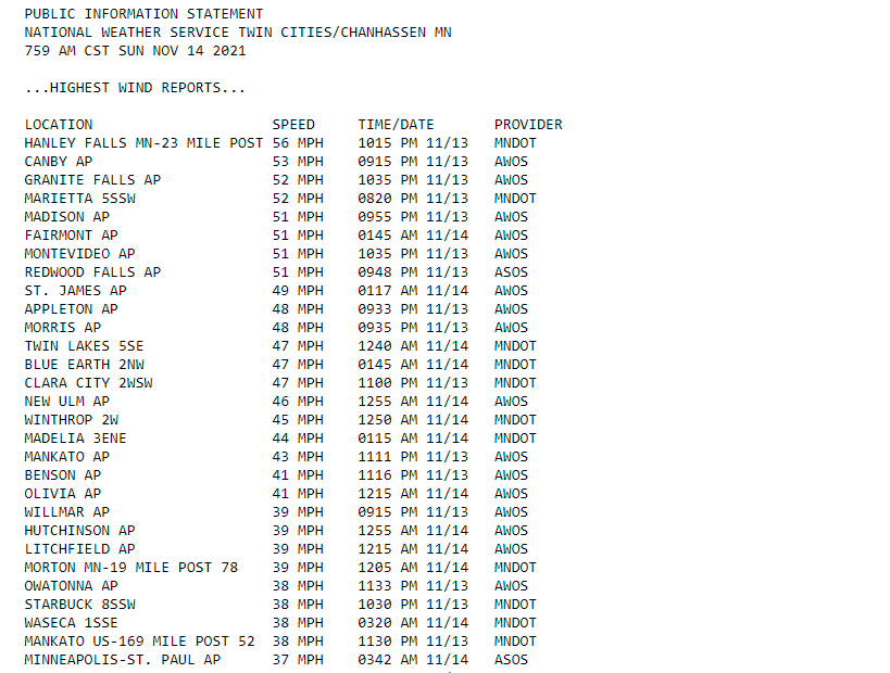
Strong winds Saturday evening and overnight
The NWS has posted a list of peak wind gusts from Saturday evening and overnight Saturday night. Hanley Falls, in Yellow Medicine County of southwestern Minnesota, had a gust of 56 mph. A gust of 53 mph was reported in Canby, which is several miles to the west of Hanley Falls. MSP airport had a gust of 37 mph:
Temperature trends
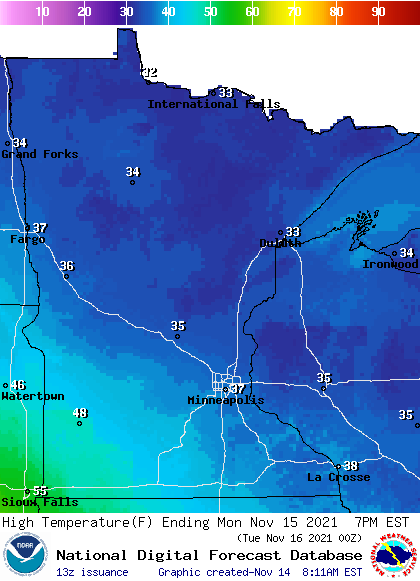
Our average Twin Cities high temp is 43 degrees this time of year. Highs in the metro area and most of Minnesota and western Wisconsin will be in the 30s Sunday afternoon. Some spots in far northwestern will top out in the 20s. Gusty winds will give many areas wind chills in the teens.
Monday highs will be mainly in the 30s, with some 40s in southwestern and south-central Minnesota:
Monday wind gusts will be in the 14-18 mph range in many areas, with gusts over 20 mph in far northwestern Minnesota:
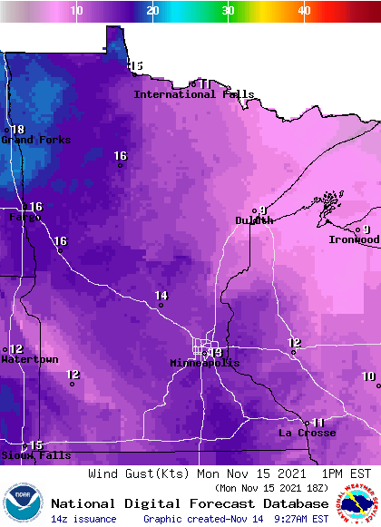
Forecast wind gusts are in knots, with 18 knots equal to 20.7 mph.
Back to forecast highs, Tuesday will be the warmest day of the week, with 50s in southern Minnesota and 40s elsewhere:
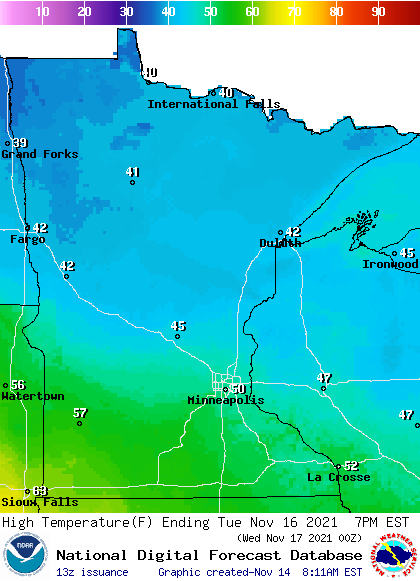
Some spots in the Twin Cities metro area are expected to reach the lower 50s Tuesday afternoon. Metro area highs retreat to the upper 30s for Wednesday, followed by mid 30s Thursday, then 40 on Friday.
Monday snow chances
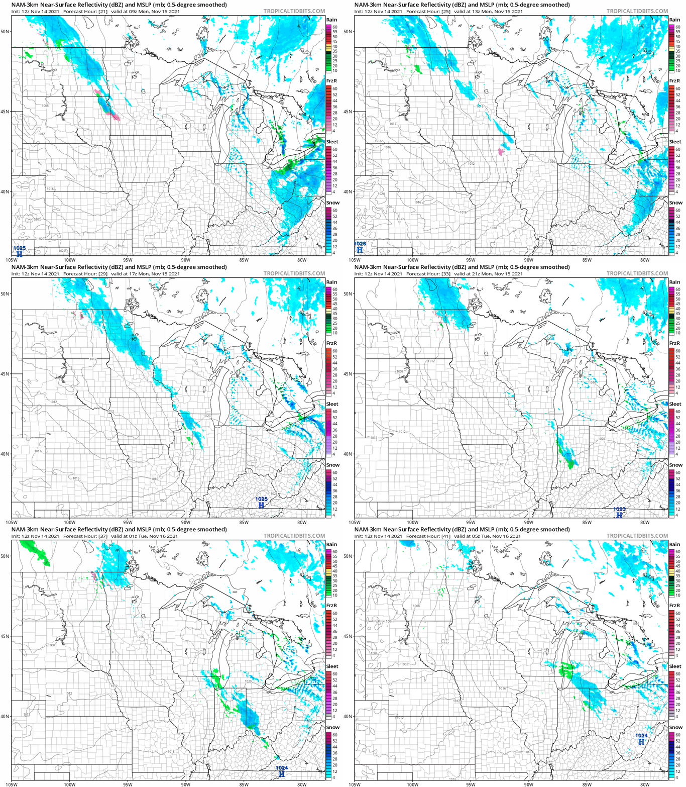
Parts of Minnesota and western Wisconsin will see light snow showers at times on Monday. The National Oceanic and Atmospheric Administration’s North American Mesoscale (NAM) forecast model shows the potential precipitation pattern for Monday and Monday evening:
NOAA’s High-Resolution Rapid-Refresh (HRRR) forecast model shows a similar precipitation pattern, with a bit more coverage:
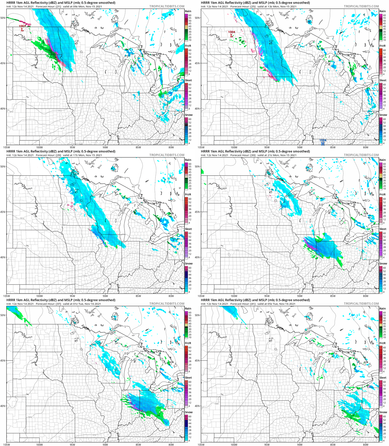
Some spots in southern Minnesota could see a bit of rain mixed with the flakes at times.
You can hear updated weather information for Minnesota and western Wisconsin on the Minnesota Public Radio News network, and you can see updated weather info on the MPR News live weather blog.
Weather nugget
The Twin Cities record high for today is 71 degrees, set in 1990. Our coldest high temp for this date is 12 degrees, on Nov. 14, 1940. I checked, we had 9 inches of snow cover that day in the Twin Cities.
Programming note
You can hear my live weather updates on MPR News at 7:35 a.m., 9:35 a.m. and 4:39 p.m. each Saturday and Sunday.

