
More light snow Monday
Temperatures remain below average
Go Deeper.
Create an account or log in to save stories.
Like this?
Thanks for liking this story! We have added it to a list of your favorite stories.


A disturbance moving across Minnesota brings little accumulating snow, but enough cloud cover to keep the state from warming much on Monday.
Monday’s forecast
Minnesota has been in a much more active pattern since the second half of last week, and that trend continues Monday, with more snow.
A disturbance is bringing light snow and flurries in a line slicing northwest to southeast Monday morning, including a dusting possible in the Twin Cities.
That line of snow diminishes by afternoon, although northern Minnesota may still see a few flakes.
Turn Up Your Support
MPR News helps you turn down the noise and build shared understanding. Turn up your support for this public resource and keep trusted journalism accessible to all.
The big difference between this snow and the rounds the state saw Thursday into Friday and again Saturday, is that no significant areas of accumulation are expected.
Most places that see snow will get no more than a dusting.

That disturbance also keeps the state mostly cloudy Monday, with a bit more sun in the Arrowhead.
Most of Minnesota is starting Monday in the 20s, with a few teens in central Minnesota, and a few single digits northeast.
The lack of much sunshine keeps the state from warming significantly Monday, and highs will be in the 30s for most areas.
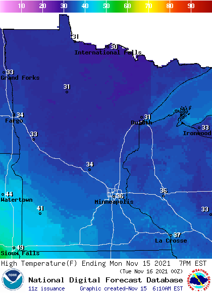
This is slightly below average for mid-November.
Most of the week ahead stays cool, with a brief warm up Tuesday. That extended forecast will be updated around 9 a.m.
Programming note
You can hear my live weather updates on Minnesota Public Radio at 7:49 a.m. Monday through Friday morning.

