
Snow chances stay light in the coming week
Tuesday turns warmer, but overall, cooler weather prevails
Go Deeper.
Create an account or log in to save stories.
Like this?
Thanks for liking this story! We have added it to a list of your favorite stories.


Following a light snow chance Monday, most of Minnesota sees limited snow chances the remainder of the week, but a midweek storm does bring back gusty winds.
Monday’s forecast
Minnesota has been in a much more active pattern since the second half of last week, and that trend continues Monday, with more snow.
A disturbance is bringing light snow and flurries in a line slicing northwest to southeast Monday morning, including a dusting possible in the Twin Cities.
That line of snow diminishes by afternoon, although northern Minnesota may still see a few flakes.
Turn Up Your Support
MPR News helps you turn down the noise and build shared understanding. Turn up your support for this public resource and keep trusted journalism accessible to all.
The big difference between this snow and the rounds the state saw Thursday into Friday and again Saturday, is that no significant areas of accumulation are expected.
Most places that see snow will get no more than a dusting.

That disturbance also keeps the state mostly cloudy Monday, with a bit more sun in the Arrowhead.
Most of Minnesota started Monday in the 20s, with a few teens in central Minnesota, and a few single digits northeast.
The lack of much sunshine keeps the state from warming significantly Monday, and highs will be in the 30s for most areas.
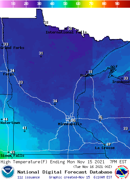
This is slightly below average for mid-November.
Extended forecast
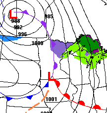
Another weather system already begins impacting Minnesota Tuesday, with breezy southeast winds that will gust over 20 mph at times.
That wind pattern does funnel in milder air, especially in southern Minnesota where a few spots could make it into the 50s, with low 60s possible southwest.
But, the cold side comes on Wednesday, dropping highs into the 30s north and 40s south, then all of the state is back to colder highs in the 30s Thursday (a few spots north may not make it out of the 20s.
Winds also stay gusty through Thursday, and especially on Wednesday, some of the gusts could top 40 mph in western Minnesota.
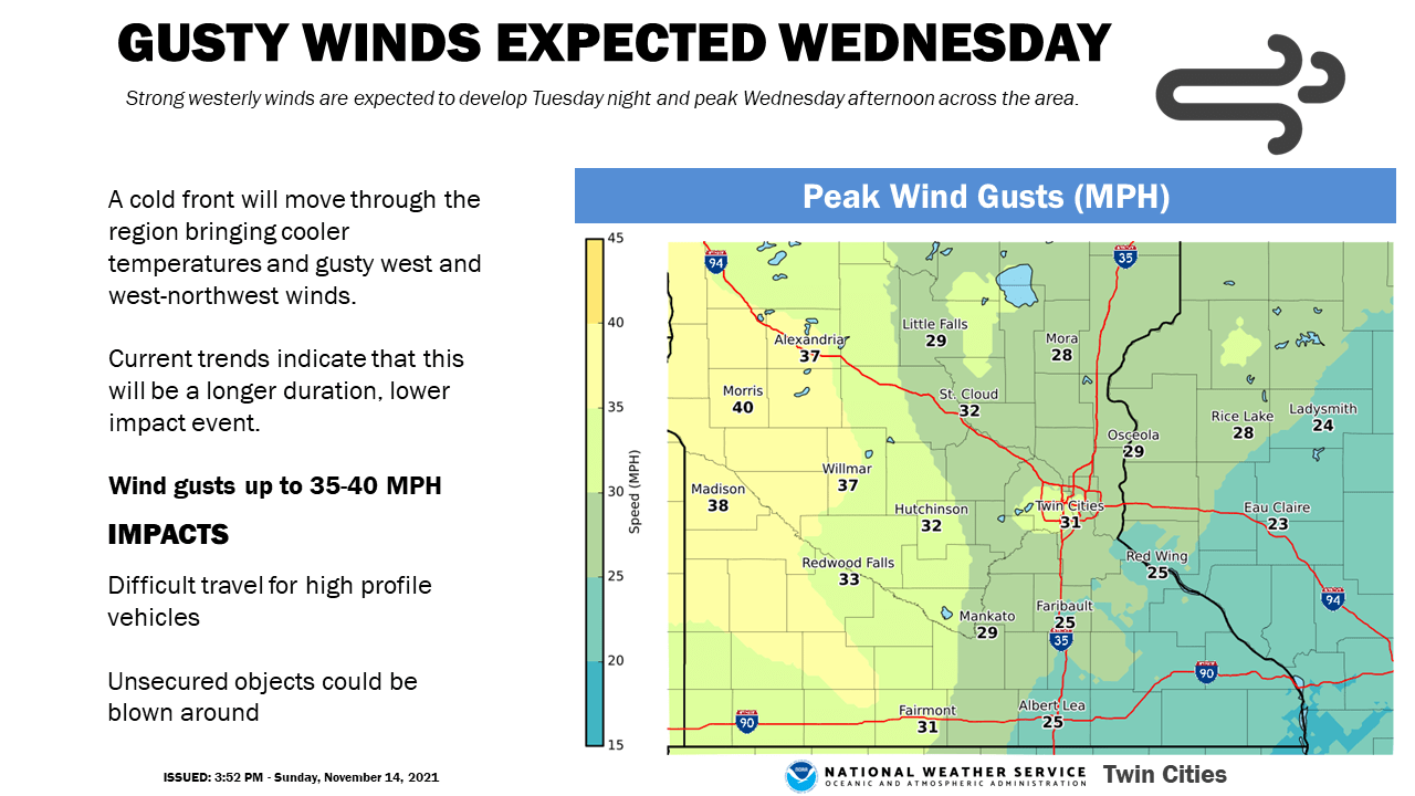
That system is predominantly dry, with only light snow possible in northern Minnesota Wednesday.
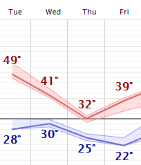
Overall most of the week will be spent below average.
For comparison, the average high in the Twin Cities on Nov. 15 is 42. For International Falls it is 35.
Programming note
You can hear my live weather updates on Minnesota Public Radio at 7:49 a.m. Monday through Friday morning.

