
Snow chances return Sunday; Thanksgiving looks chilly, quiet
A seasonable end to the week, then colder again
Go Deeper.
Create an account or log in to save stories.
Like this?
Thanks for liking this story! We have added it to a list of your favorite stories.


Following quiet weather Friday, two cold fronts impact Minnesota over the weekend, returning snow, gusty winds and colder temperatures to the state.
Friday’s forecast
After Thursday’s chill, Friday had a seasonably cold start, with morning lows ranging from the teens north to the 20s south.
Despite mostly clear skies overnight, temperatures did not drop any more because Minnesota is now back under a southerly wind flow versus the cold, blustery northwest wind of Thursday.
The milder wind flow helps warm temperatures back to average for mid-November, with highs in the 30s north and 40s south.
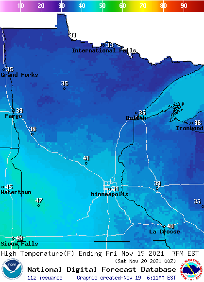
Conditions remain dry under partly sunny skies.
Turn Up Your Support
MPR News helps you turn down the noise and build shared understanding. Turn up your support for this public resource and keep trusted journalism accessible to all.
Weekend fronts
Two cold fronts are forecast to move through Minnesota over the weekend.
The first is weaker and should be through the state by early Saturday afternoon. It will shift winds back to being out of the northwest, but the winds will be relatively light, and highs will still make it into the 30s north and 40s south.
There is a very slight chance for a few snowflakes or sprinkles in southern Minnesota Saturday morning or afternoon behind that front.
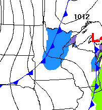
The second front is much stronger, moving across the state during the day Sunday. It is expected to be accompanied by gusty winds, cooler temperatures, and light snow.
Winds with that storm are likely to gust over 30 mph during the day Sunday.
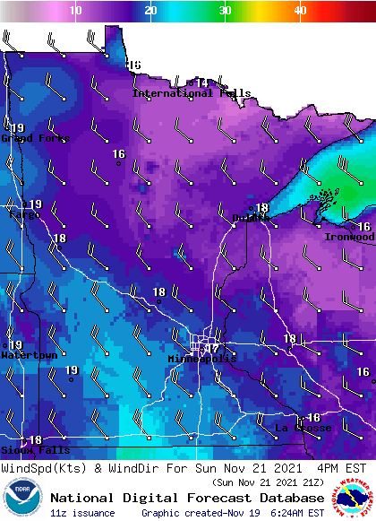
Combined with already cooler highs in the 20s north and 30s south, wind chills will dive into the single digits north and teens south by Sunday afternoon.
Precipitation is expected to be limited with that cold front, but northern Minnesota could see 1 to 2 inches. Areas as far south as the Twin Cities may see a dusting.
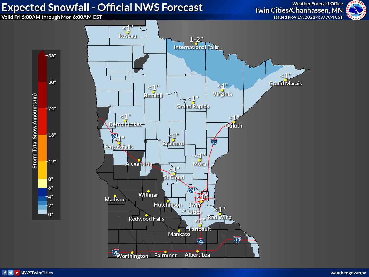
By Monday, the snow is gone but the coldest air behind Sunday’s storm filters across Minnesota, with highs in only the 20s for most of the state.
Here is that forecast for the Twin Cities:
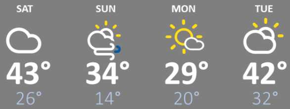
Temperatures should rebound closer to average again Tuesday and Wednesday. Right now, Thanksgiving is forecast to bring highs in the 20s north and 30s south, but holiday travel currently looks cooperative around the Midwest.
That travel forecast will be updated as we get closer to Thanksgiving!
Programming note
You can hear my live weather updates on Minnesota Public Radio at 7:49 a.m. Monday through Friday morning.

