
Rain, snow and high winds by midweek
Minnesota sees a chance for record warmth Wednesday
Go Deeper.
Create an account or log in to save stories.
Like this?
Thanks for liking this story! We have added it to a list of your favorite stories.


Quiet and milder weather prevails until Tuesday, then a strong storm causes a huge temperature swing accompanied by high winds and a rain-snow mix.
Monday night and Tuesday
Following a mild and mostly sunny day Monday, overnight temperatures also stay mild for December, with most of Minnesota dropping only in the 20s for lows.
A few more clouds move in overnight, and Tuesday will be partly sunny.
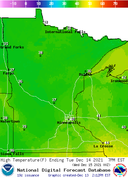
Despite a few more clouds, Tuesday still be a couple degrees warmer than Monday thanks to winds form the southeast. Highs will range from the mid-30s north to lower 40s south.
Turn Up Your Support
MPR News helps you turn down the noise and build shared understanding. Turn up your support for this public resource and keep trusted journalism accessible to all.
Midweek storm
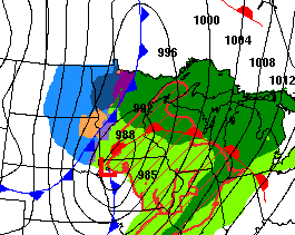
Ahead of the warm front side of a strong storm, those southeast winds increase during the day Wednesday, putting much of the state into the 40s, with some 50s possible in southern Minnesota.
Temperatures would be even higher if not for the snowpack in southern Minnesota capping the warm potential. Despite the snow balancing the warmth somewhat, it is not out of the question a couple of records may be set. For example, the current record in the Twin Cities for Dec. 15 is 51, which we may be able to pass despite the snow.
Because of the warmth, much of the precipitation that initially moves in with the storm will be drizzle or light rain Wednesday morning.
The rain becomes more persistent in the afternoon and evening hours, and there could even be a couple thunderstorms southeast Wednesday evening.
Meanwhile, the cold front side of the storm starts pushing into northwestern Minnesota by Wednesday afternoon, dropping temperatures quickly and making more of the precipitation snow.
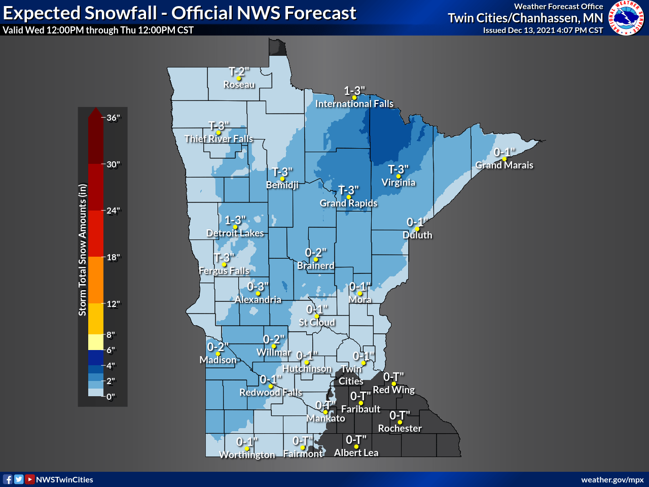
Northern Minnesota could see up to 3 inches of snow Wednesday into early Thursday.
As the front sweeps northwest to southeast, clearing through the state by late Wednesday, it not only drops temperatures, but it also increases the winds even more. Most of Minnesota can expect gusts of at least 30 to 40 mph or higher by Wednesday afternoon and evening.
Wind gusts may top 60 mph in portions of southeastern Minnesota, including Rochester, prompting a high wind watch in that corner of the state.

The precipitation should clear by early Thursday, and winds diminish, but the cold air keeps funneling in.
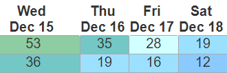
Most of the state will see falling temperatures during the day, with temperatures only in the single digits north and low 20s south by Thursday afternoon. Even cooler air moves in Friday and especially Saturday. By Saturday mostly of the state will be 10 to 15 degrees below average with single digits north and teens south.
Here is the Twin Cities forecast through Friday (the 35 degrees Thursday is the forecast high set at midnight):
Programming note
You can hear my live weather updates on Minnesota Public Radio at 7:49 a.m. Monday through Friday morning.

