
Light snow moves across Minnesota Friday
Temperatures remain on the chilly side
Go Deeper.
Create an account or log in to save stories.
Like this?
Thanks for liking this story! We have added it to a list of your favorite stories.


A weather disturbance brings a dusting of snow to most of Minnesota Friday, but a few spots could see up to 4 inches, causing travel impacts.
Friday’s forecast
The state is off to a seasonably cold start Friday morning, with single digits north and teens south. However, northern Minnesota would have been colder except for cloud cover. In central Minnesota, where skies were clear and winds were calm, a few spots dipped below zero.
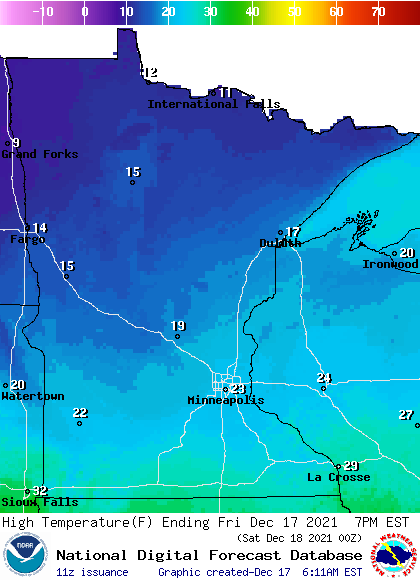
Under mostly cloudy skies, high make it into the teens north and low 20s south, which is 5 to 10 degrees below average, but very typical for mid-December.
The skies turn cloudier thanks to a disturbance which also brings snow back to the state. In fact, there are already a couple snow showers on the west-central edge of Minnesota as of 7 a.m.
Turn Up Your Support
MPR News helps you turn down the noise and build shared understanding. Turn up your support for this public resource and keep trusted journalism accessible to all.
Snow slowly expands across Minnesota during the day and into the overnight, but it is very light, with most places forecast to see less than an inch.
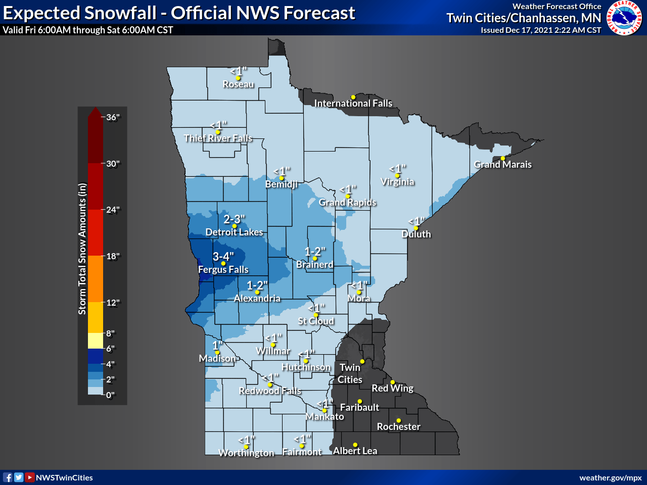
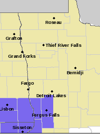
West-central Minnesota is the one area snow could be more persistent, with up to 4 inches of snow. Because the snow may cause travel impacts, that portion of the state is under a winter weather advisory beginning at noon.
Other than Friday’s snow, precipitation chances stay limited in the week ahead and temperatures stick closer to average.
That extended forecast will be updated around 9 a.m.
Programming note
You can hear my live weather updates on Minnesota Public Radio at 7:49 a.m. Monday through Friday morning.

