
A bit warmer on Sunday, but breezy
Far northern Minnesota could see some light snow
Go Deeper.
Create an account or log in to save stories.
Like this?
Thanks for liking this story! We have added it to a list of your favorite stories.


The Saturday afternoon high at Minneapolis-St. Paul International Airport was 23 degrees. That’s 5 degrees cooler than our average Dec. 18 Twin Cities high of 28 degrees. Winds were fairly light, so it was an enjoyable day for outdoor activities.
Sunday flake chance north
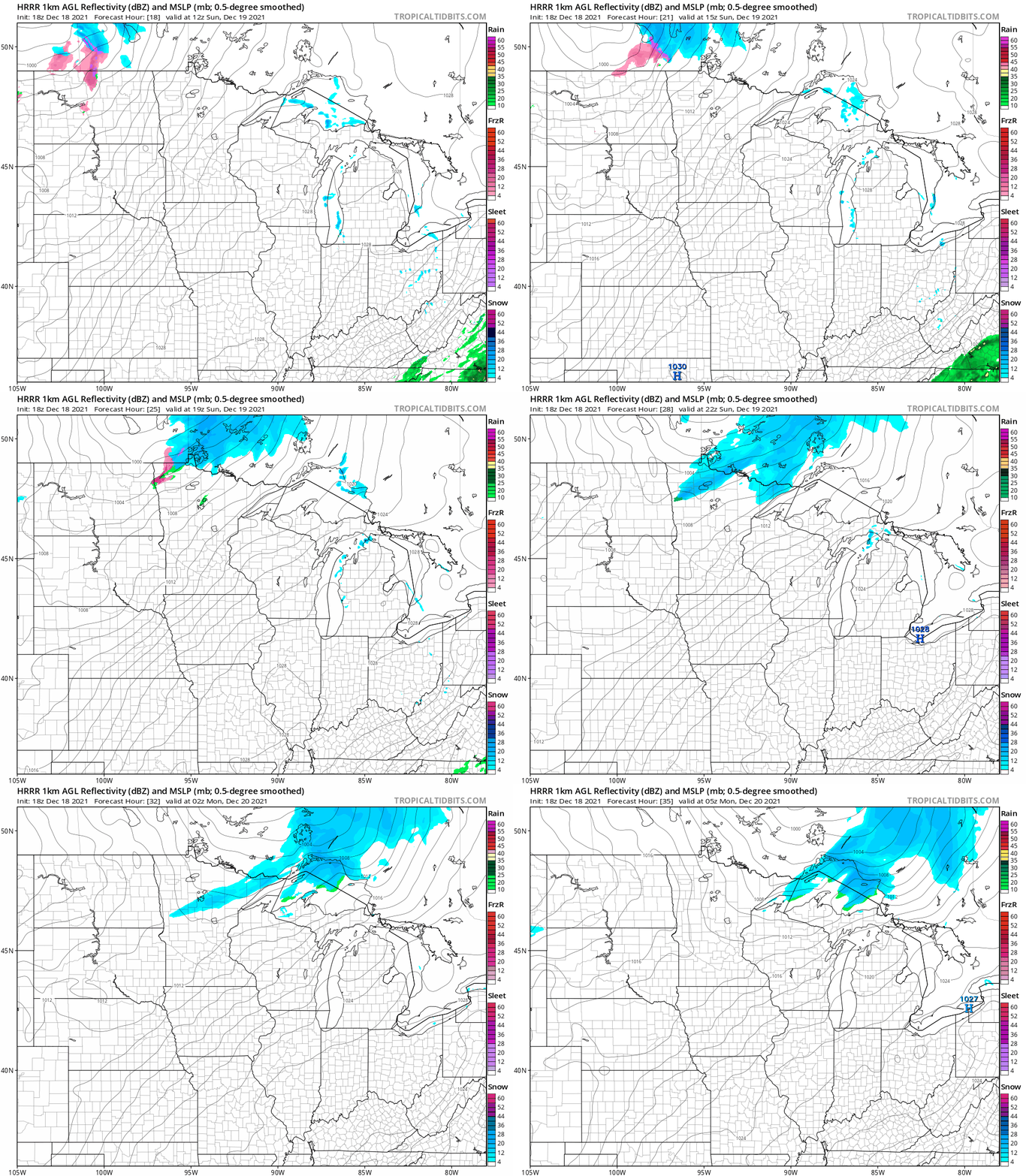
A low pressure system moves across southern Canada on Sunday, and it could spin some light snow showers over parts of far northern Minnesota.
The National Oceanic and Atmospheric Administration’s High-Resolution Rapid-Refresh (HRRR) model shows the potential precipitation pattern for Sunday and Sunday evening:
Turn Up Your Support
MPR News helps you turn down the noise and build shared understanding. Turn up your support for this public resource and keep trusted journalism accessible to all.
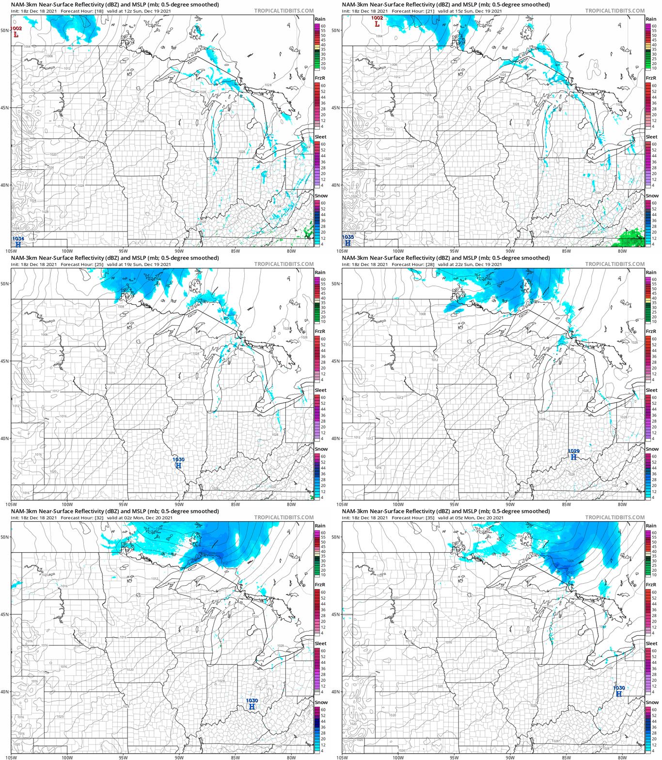
NOAA’s North American Mesoscale (NAM) model shows a similar precipitation pattern, but shifted a bit to the north:
Forecast models also show a chance of light snow in the northern half of Minnesota plus parts of northern Wisconsin on Tuesday. Minnesota and western Wisconsin could see a bit of light snow late Friday.
You can hear updated weather information for Minnesota and western Wisconsin on the Minnesota Public Radio News network, and you can see updated weather info on the MPR News live weather blog.
Temperature trends
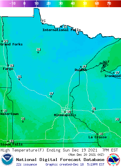
Sunday highs reach the lower 30s in portions of southern Minnesota, with 20s in central and northern Minnesota:
Winds increase as we go through Sunday, with gusts of 20 to 30 mph in many areas Sunday afternoon:
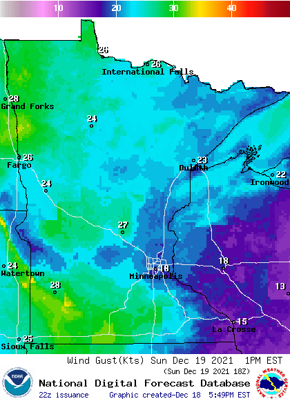
Forecast gusts are in knots, with 20 knots equal to 23 mph.
Back to temperatures, Twin Cities metro area highs are projected to reach the mid 20s early Monday morning, with temps dropping into the teens by Monday afternoon. Metro highs reach the mid 20s Tuesday and Wednesday, followed by 30 Thursday and lower 30s on Friday.
Weather nugget
On this date in 1983, our Twin Cities high temp was 11 degrees below zero! The Twin Cities high temp was also 11 below zero the next day, Dec. 19, 1983. Low temps were -24 on Dec. 18 and -29 on Dec. 19 of 1983. There was about a foot and a half of snow cover at the time.
Programming note
You can hear my live weather updates on MPR News at 7:35 a.m., 9:35 a.m. and 4:39 p.m. each Saturday and Sunday.

