
Snow totals; cool Saturday, a bit warmer but breezy on Sunday
Above normal snowfall this month
Go Deeper.
Create an account or log in to save stories.
Like this?
Thanks for liking this story! We have added it to a list of your favorite stories.


Minneapolis-St. Paul International Airport tallied 1.3 inches of snow overnight. There were a lot of 1 to 2 inch reports in the Twin Cities metro area, with a few higher snow totals in the west metro, including 2.5 inches in Mound and 5 inches a couple of miles west of Excelsior. Some reports of around 2 inches have been noted in the St. Cloud area. Friday/overnight Friday night snow totals from west-central Minnesota include 3 inches in Wheaton and 6 inches in Browns Valley.
This is how the NWS 24-hour snow map looked at 10 a.m. Saturday:

You can hover over any data point on the linked NWS snowfall map to see the location and time of the snow measurement. You can also zoom into the linked map and slide the map to see snow reports in other parts of Minnesota and Wisconsin.
The snow created slippery spots on some roads Saturday morning. Updated Minnesota road conditions can be found here. Wisconsin road conditions can be found here.
Turn Up Your Support
MPR News helps you turn down the noise and build shared understanding. Turn up your support for this public resource and keep trusted journalism accessible to all.
Southeastern Minnesota and northeastern Minnesota, plus parts of western Wisconsin, could see some additional light snow showers into Saturday afternoon. A few flurries are possible elsewhere.
You can hear updated weather information for Minnesota and western Wisconsin on the Minnesota Public Radio News network, and you can see updated weather info on the MPR News live weather blog.
Sunday snow chance north
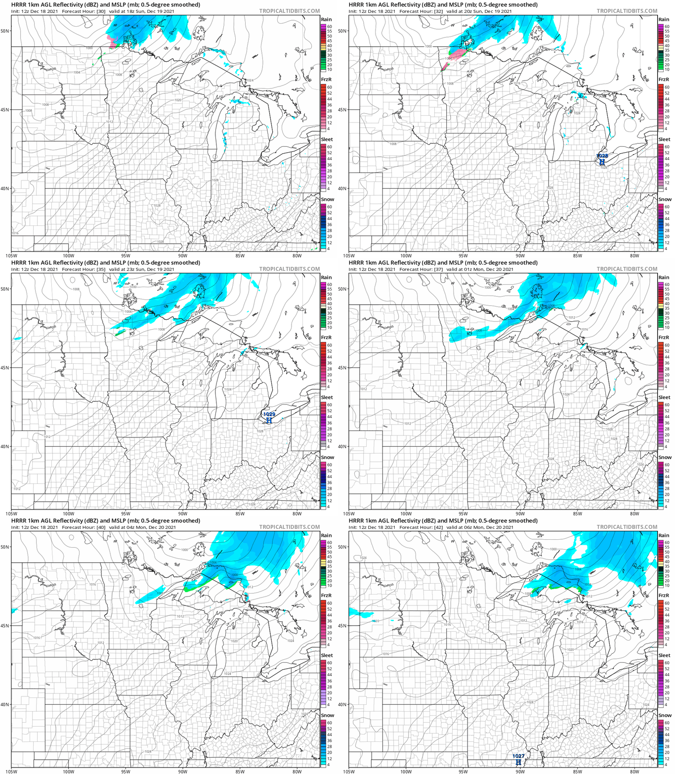
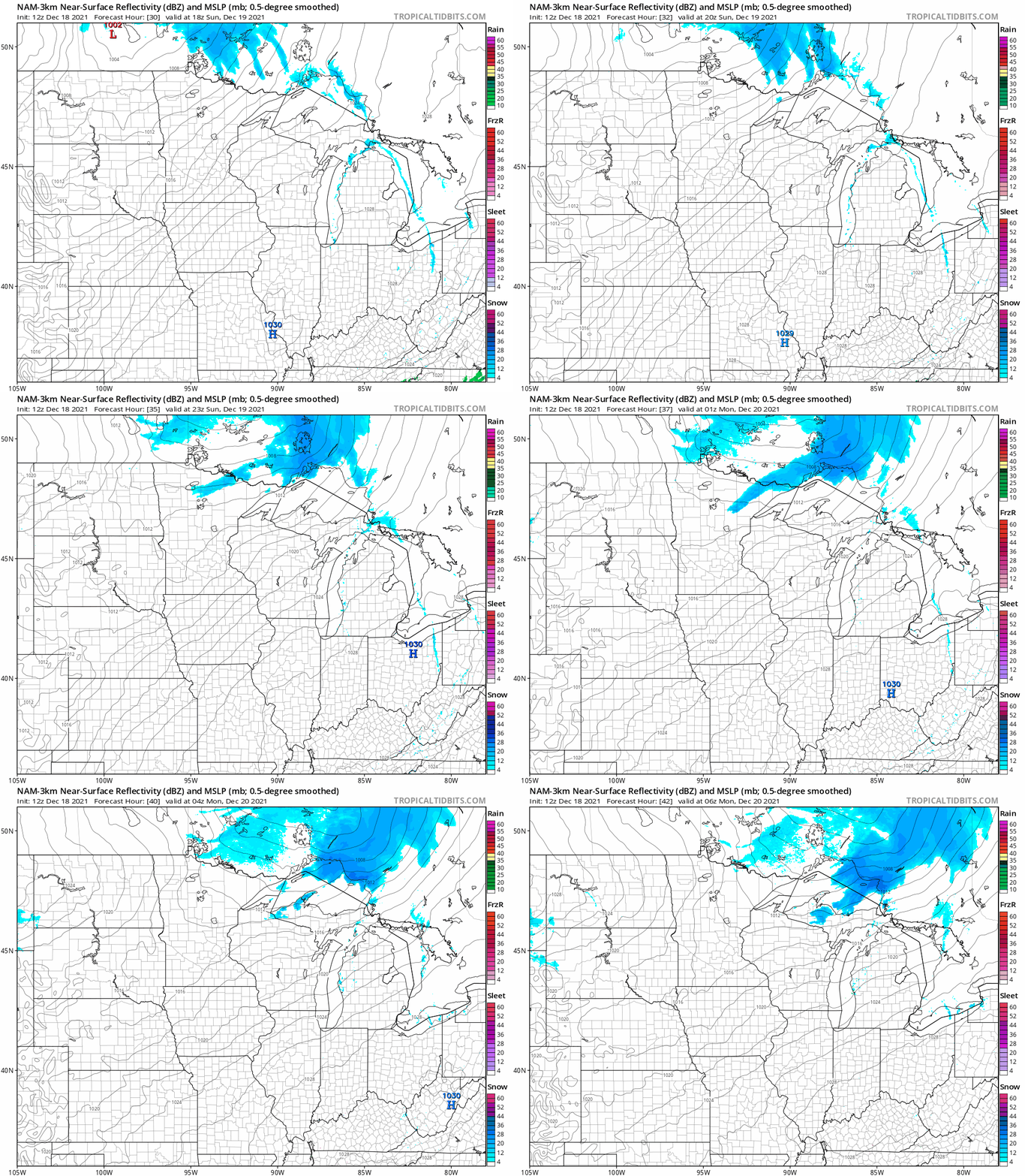
Far northern Minnesota could see a bit of light snow Sunday afternoon and Sunday evening.
The National Oceanic and Atmospheric Administration’s High-Resolution Rapid-Refresh (HRRR) model shows the potential precipitation pattern for Sunday afternoon and evening:
NOAA’s NAM model shows a similar snow pattern:
Temperature trends
Our average Twin Cities high temp is 28 degrees on Dec. 18. Much of the metro area will reach the lower 20s Saturday afternoon. We’ll share highs in the 20s with roughly the southeastern half of Minnesota plus western Wisconsin, with teens elsewhere.
Sunday highs will be in the 20s in northern and central Minnesota, with some lower 30s south:
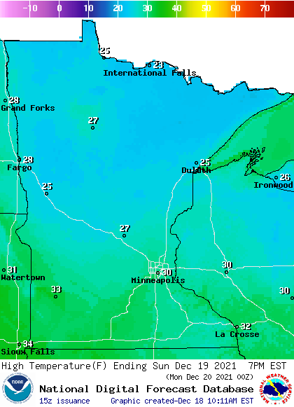
The metro area will top out around 30 or slightly above 30.
Southerly wind gusts of 20-30 mph are expected:
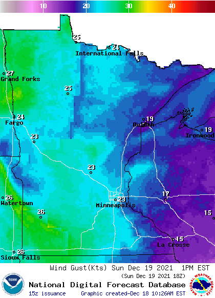
Forecast gusts are in knots, with 23 knots equal to 26.5 mph.
Back to temperatures, Twin Cities metro area highs are projected to be in the mid 20s early Monday, with temps falling into the teens Monday afternoon. Highs in the mid 20s are on tap for Tuesday and Wednesday, followed by 30 Thursday and lower 30s on Friday. We could see some light snow on Tuesday and Friday.
Weather nugget
The 1.3 inches of snow at MSP airport overnight raises our December snowfall total to 15.8 inches. Our average snow total for the entire month of December is 11.4 inches in the Twin Cities.

