
Much colder Monday; chances of snow mainly north this week
Go Deeper.
Create an account or log in to save stories.
Like this?
Thanks for liking this story! We have added it to a list of your favorite stories.


Sunday’s weather was rather benign. Afternoon temperatures were about average for mid December with the Twin Cities reaching the upper 20s under gray skies while parts of southern Minnesota from Mankato and Waseca west to Marshall, Granite Falls and Worthington reached the low 30s.
Scattered light snow has been falling in northern Minnesota, including around International Falls, Orr and Cook.
Much colder Monday
A cold front from the northwest will be the leading edge of colder Canadian air that will slide southeast across Minnesota Sunday night and Monday and bring falling temperatures. Temperatures in the Twin Cities are likely to dip to the low teens Monday afternoon.
Tuesday morning will definitely be on the chilly side. Low temperatures are likely to be in the single digits below zero in northern Minnesota, while southern parts of the state wake up to single digits above zero. The Twin Cities should have a low near 5 above.
Turn Up Your Support
MPR News helps you turn down the noise and build shared understanding. Turn up your support for this public resource and keep trusted journalism accessible to all.
A couple snow events during the week
No major winter storms are likely this coming week, but some snow is likely.
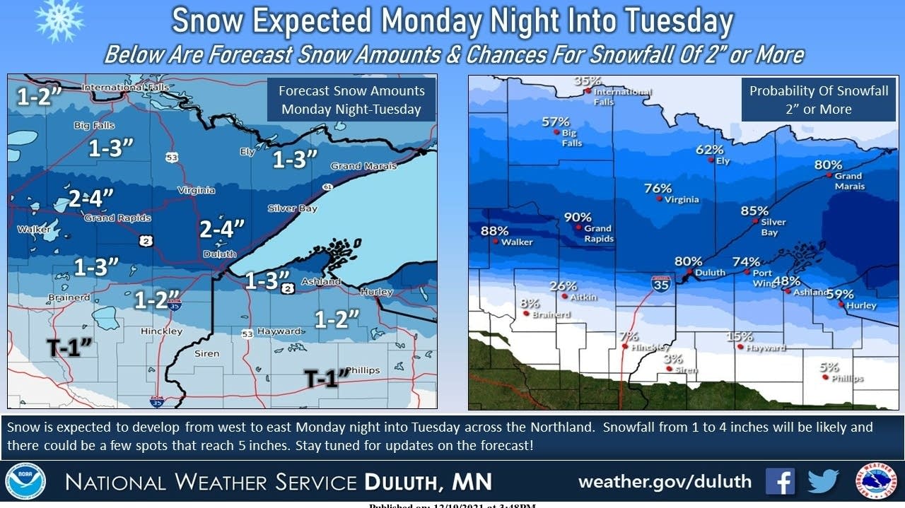
The first weather system will spread a broad band of snow across about the northern half of Minnesota from Monday night into Tuesday. A dusting of light snow is possible as far south as the Twin Cities area.
A more uncertain weather system might get organized and drop a bit of snow and maybe even some mixed precipitation on our state from Friday into Christmas Day on Saturday. Forecast models are in fuzzy disagreement about this one, so far in the future, but the best chance for some Christmas snow might be across northern Minnesota.
Christmas temperatures near normal?

Generally speaking, winter temperatures are easier to forecast to a reasonable approximation than snowfalls in the extended forecast because they are a function of mainly the air mass present. Snowfall amounts depend on more variables including air masses, moisture flows, fronts and upper air dynamics.
With that in mind, the current outlook for high temperatures for Christmas Day next Saturday is for a near-normal day.

