
Clipper targets northern Minnesota with heavy snow
Temperatures in southern Minnesota fall by Monday afternoon
Go Deeper.
Create an account or log in to save stories.
Like this?
Thanks for liking this story! We have added it to a list of your favorite stories.


A fast-moving storm early Tuesday brings snow and reinforces cooler temperatures across Minnesota. Then milder weather returns, which could limit prospects for a white Christmas in southern Minnesota.
Monday’s forecast
Minnesota is feeling the effects Monday morning of a cold front that went through the state from late Sunday through the overnight.
Morning temperatures are ranging from the single digits north to a few 20s south, but with colder air funneling across the state, temperatures barely warm Monday.
Highs will still only be in the single digits north, and southern Minnesota — where the front went through later — will see temps fall slightly during the day, into the teens by late afternoon.
Turn Up Your Support
MPR News helps you turn down the noise and build shared understanding. Turn up your support for this public resource and keep trusted journalism accessible to all.
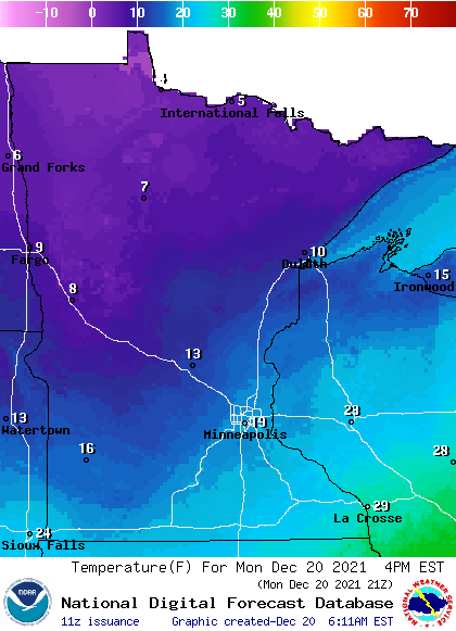
For example, the Twin Cities already set the high for the day being at 29 just after midnight, was at 25 at 9 a.m., and will likely only be in the upper teens by late afternoon Monday.
Behind the front, winds also stay breezy, with guests of 15 to 20 mph. There is still a little lingering light snow in central and northern Minnesota, and much of the state is starting the day mostly cloudy. However, the snow ends, and skies clear through Monday morning, with more sunshine in the afternoon.
Extended forecast
A clipper zips across Minnesota beginning in the wee hours Tuesday and already out of most of Minnesota (some lingering snow in the Arrowhead) but early Tuesday afternoon.
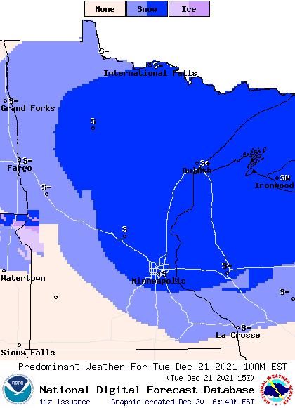
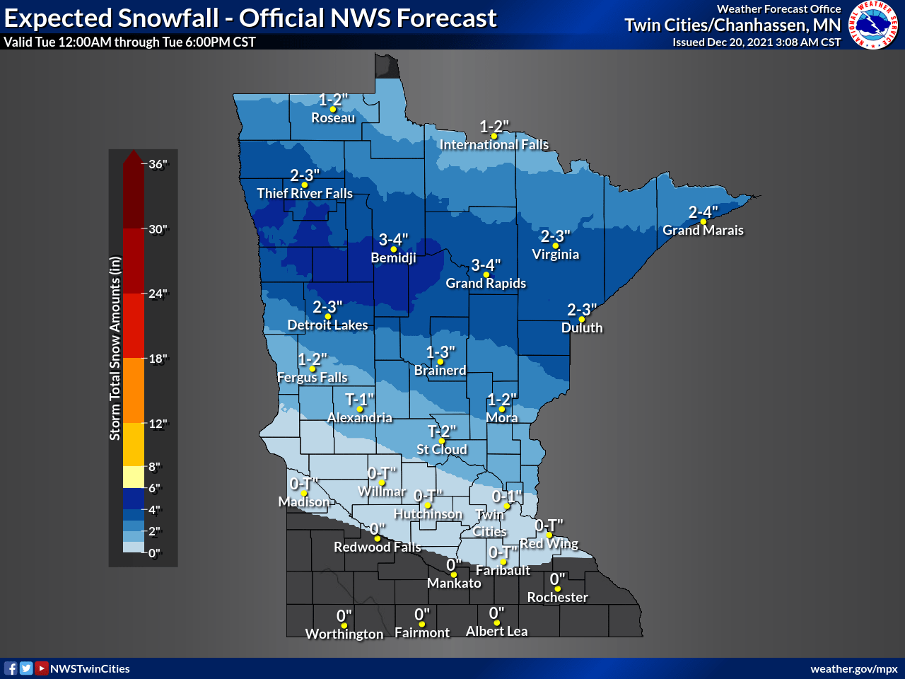
Despite moving through quickly, it does have enough moisture to dump some heavier snow in north central Minnesota, where there could be some isolated reports up to 6 inches of snow.
Here is that snow forecast for Minnesota produced by the National Weather Service at 3 a.m. Newer models indicate an additional 1 or 2 inches of snow possible, thus the potential for Bemidji could be as high as 6 inches, up to 4 inches for Duluth, etc.
That weather system reinforces the seasonably chilly temperatures, keeping Tuesday’s highs in the teens north and 20s south.
On Wednesday a southerly flow returns to Minnesota, quickly putting the state back above average with 20s north and 30s south. By Friday, almost all of Minnesota is back in the 30s.
Here is that Twin Cities temperature trend through Saturday:
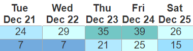
Despite another dusting of snow possible Wednesday night into Thursday, those temperatures along with more sunshine Wednesday and Thursday is likely to erode much of the snow in southern Minnesota.
Because of the heavier snow from the clipper and slightly cooler temperatures, northern Minnesota has a much better chance of retaining snow on the ground for a white Christmas on Saturday.
There is another disturbance that could bring a wintry mix to Minnesota Friday into early Saturday. We will watch that closely and keep you updated if it could help bring enough of a dusting south for a white Christmas to that part of the state too!
Programming note
You can hear my live weather updates on Minnesota Public Radio at 7:49 a.m. Monday through Friday morning.

