
A quick round of snow impacts the Tuesday morning commute
Cold, gusty winds keep temperatures below average
Go Deeper.
Create an account or log in to save stories.
Like this?
Thanks for liking this story! We have added it to a list of your favorite stories.


Minnesota is starting Tuesday off with snow thanks to a fast-moving system that also brings wind gusts over 30 mph by the afternoon.
Tuesday’s forecast
A clipper is bringing a quick moving area of snow across Minnesota Tuesday morning. For the majority of the state, the snow will clear by early afternoon, but in the meantime, there is snow in central and southern Minnesota as of 7 a.m.
Most places will see less than an inch of additional snow Tuesday, but the North Shore is forecast to see some higher totals of 3 to 5 inches in some areas.
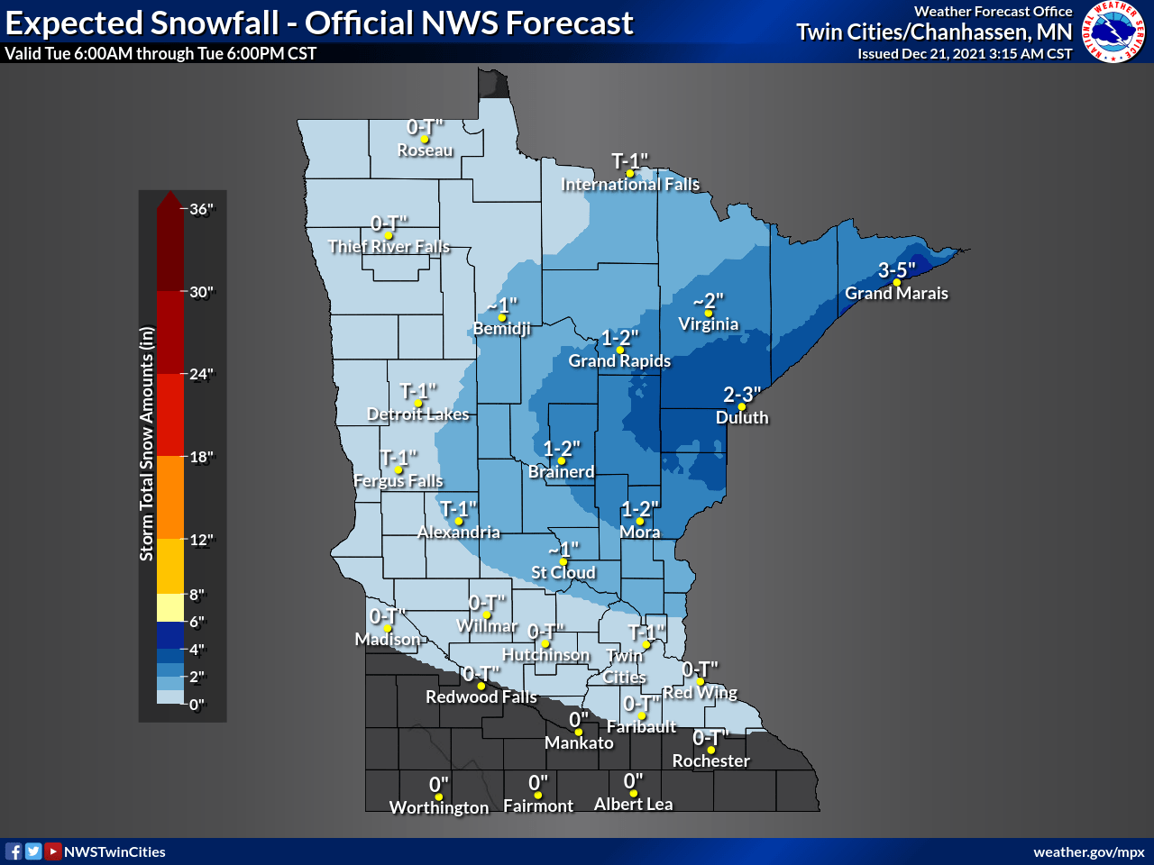
Some of that heaviest snow is expected to fall during the morning commute, impacting travel conditions.
Turn Up Your Support
MPR News helps you turn down the noise and build shared understanding. Turn up your support for this public resource and keep trusted journalism accessible to all.

Because of this, much of north-central Minnesota is under a winter weather advisory until noon, including the cities of Brainerd and Duluth.
Even as far south as the Twin Cities, some of the light snow forecast of less than an inch will fall during the morning commute, which could cause slow-downs.
Behind the system, winds gust from the northwest, and southern Minnesota may see gusts over 30 mph in the afternoon.
That colder wind pattern means temperatures only go into the teens north and low 20s south for highs, following morning temperatures in the single-digits and low teens.
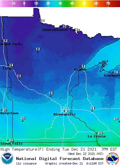
Some sunshine does return in the afternoon as the snow clears out.
The cooler than average temperatures of Tuesday do not last long, as almost all of Minnesota rebounds into the 30s by Friday.
That extended forecast will be updated by 9 a.m.
Programming note
You can hear my live weather updates on Minnesota Public Radio at 7:49 a.m. Monday through Friday morning.

