
Minnesota's weather stays active, but no major storms expected
The winter solstice on Tuesday appropriately begins with some snow
Go Deeper.
Create an account or log in to save stories.
Like this?
Thanks for liking this story! We have added it to a list of your favorite stories.


Following snow Tuesday morning, Minnesota sees a couple more chances for precipitation through the weekend, but those systems are expected to move through quickly without significant snowfall.
Tuesday is also the winter solstice at 9:59 a.m., meaning for those of us in the Northern Hemisphere, we are at our tilt on the Earth’s axis the farthest form the sun. Because our rotation will now start taking us closer to the sun, daylight begins to slowly increase starting Wednesday.
Tuesday’s forecast
A clipper is bringing a quick moving area of snow across Minnesota Tuesday morning. For the majority of the state, the snow will clear by early afternoon, but in the meantime, there is light snow across much of Minnesota as of 9 a.m.
Most places will see less than an inch of additional snow Tuesday, but the North Shore is forecast to see some higher totals, 3 to 5 inches in some areas.
Turn Up Your Support
MPR News helps you turn down the noise and build shared understanding. Turn up your support for this public resource and keep trusted journalism accessible to all.
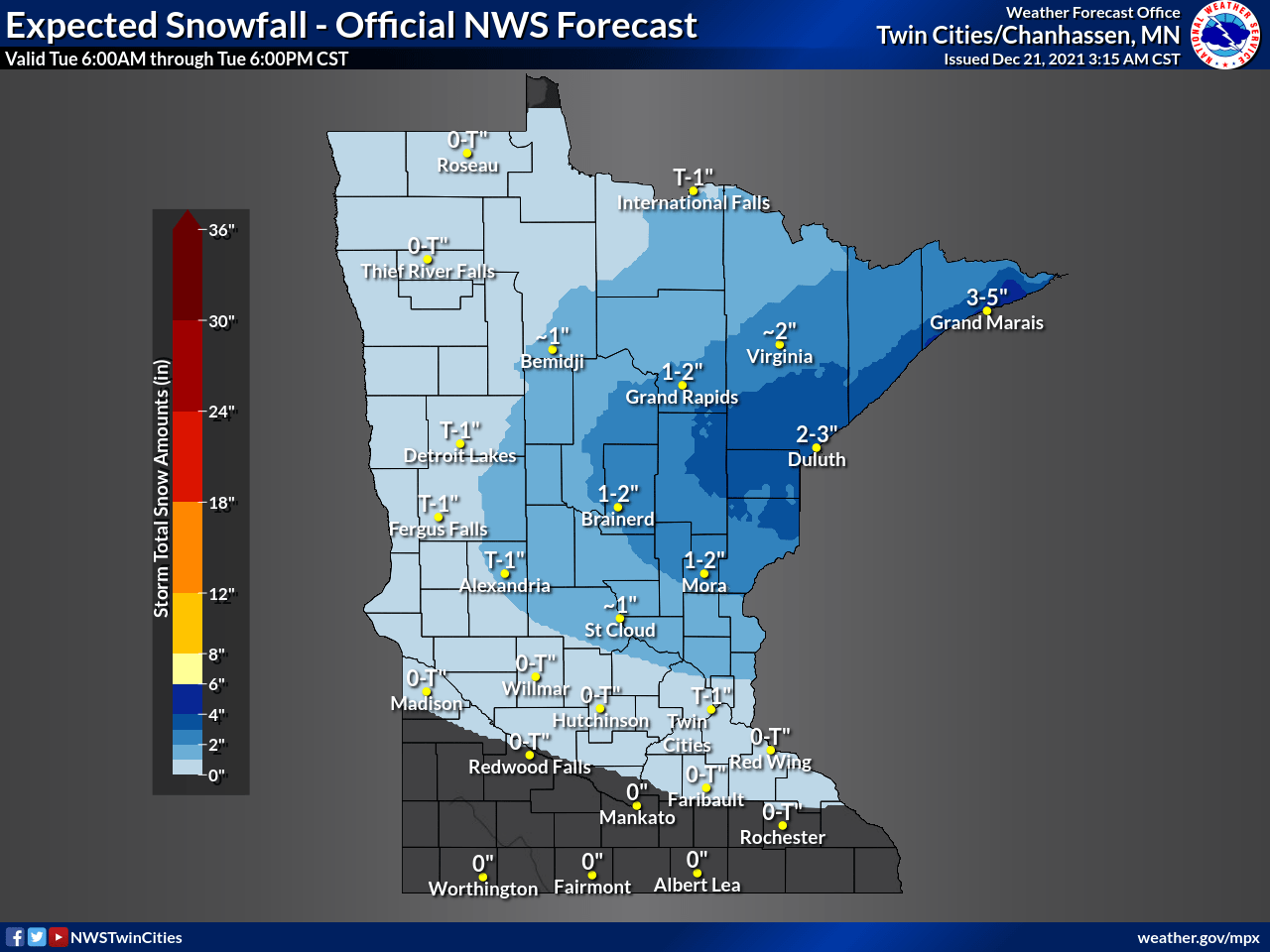
Some of that heaviest snow is falling during the morning commute, affecting travel conditions.

Because of this, much of north-central Minnesota is under a winter weather advisory until noon, including the cities of Brainerd and Duluth.
Even as far south as the Twin Cities, some of the light snow (forecast to stay under one inch) is slowing the morning drive.
Behind the system, winds gust from the northwest, and southern Minnesota may see gusts over 30 mph in the afternoon.
That colder wind pattern means temperatures only go into the teens north and low 20s south for highs, following morning temperatures in the single-digits and low teens.
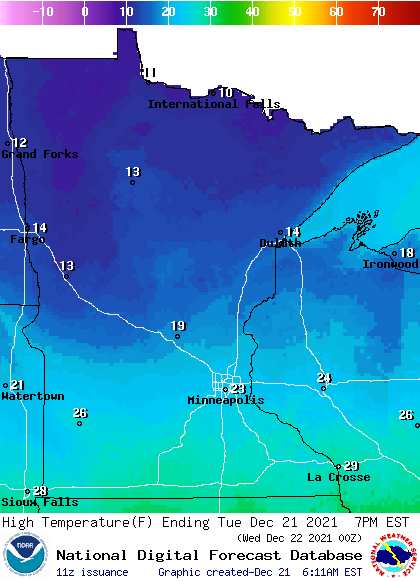
Some sunshine does return in the afternoon as the snow clears out.
Extended forecast
The chilly northwest wind pattern of Tuesday is replaced by a warmer, southerly flow by Wednesday morning, beginning a warming trend that lasts through Friday.
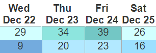
Temperatures return slightly above average Wednesday, with highs ranging from the teens north to a few 30s south. Those temperatures continue to nudge warmer Thursday and Friday, with most of Minnesota in the 30s by Friday.
A cold front currently forecast to move through Minnesota by late Friday will cool temperatures back to more seasonable cold for late December. Highs Saturday (Christmas) are currently forecast to range from a few single-digits northwest to low 20s south.
Here is that temperature trend for the Twin Cities:
Meanwhile, Minnesota stays under an active pattern with a few quick-moving disturbances moving across the state, but no major storms are currently expected through early next week.
Another quick round of light snow is possible Wednesday night into early Thursday.
The same system that brings the cold front Friday also brings what is likely to be a light mix of rain and snow Friday.
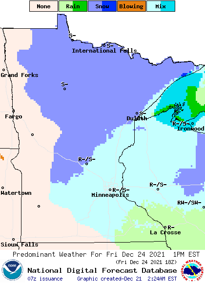
While not heavy precipitation, any moisture on the ground is expected to freeze by Saturday morning, so that will create some icy spots.
We will keep you posted here on MPR with any impacts to your holiday travel!
Programming note
You can hear my live weather updates on Minnesota Public Radio at 7:49 a.m. Monday through Friday morning.

