Increasingly milder Wednesday through Friday; periods of weekend snow likely
Go Deeper.
Create an account or log in to save stories.
Like this?
Thanks for liking this story! We have added it to a list of your favorite stories.


Happy first day after the winter solstice! I am excited to say that since it means that days are now getting longer, if slowly at first.
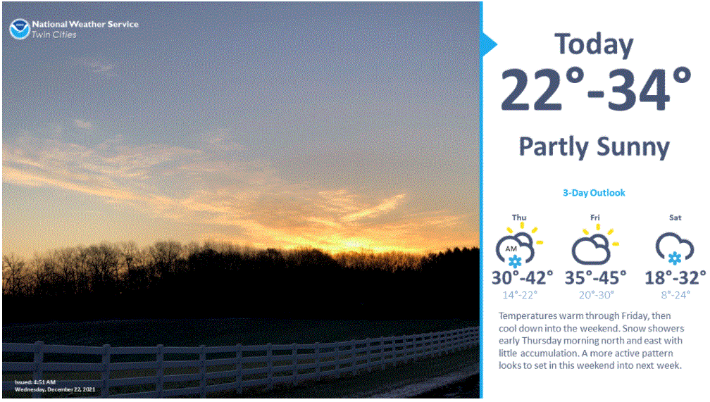
A weak southerly flow will bring in milder temperatures for Wednesday. High temperatures should be in the cool upper teens across the north, but 20s for most of the state and low 30s in the southwest. The Twin Cities should see about 30 degrees if the high clouds thin and clear sufficiently in the afternoon.
Light snow is likely across northern Minnesota Wednesday night. There will be just a chance of brief light freezing rain in the Twin Cities area late in the night.
The warmup will continue through Friday. High temperatures will be in the 20s in northern Minnesota, with widespread 30s and even low to maybe mid 40s in the southwest around Luverne, Worthington and Jackson. The Twin Cities could reach the low 40s on Friday.
Turn Up Your Support
MPR News helps you turn down the noise and build shared understanding. Turn up your support for this public resource and keep trusted journalism accessible to all.
There will be a chance of light snow and mixed precipitation in northern Minnesota on Friday.
Unsettled weather for Christmas weekend
The mild weather pattern will begin to break down on Saturday. Temperatures will begin to turn cooler, closer to seasonal normal, on Christmas Day, Saturday.

Weather systems from the west will bring periods of snow to Minnesota on Saturday and Sunday. The greatest likelihood of plowable snow might be across central Minnesota. But that could shift to the south or north with time.
Widespread snow next week?
Forecast models indicate the decent chance of a bigger weather system arriving on Tuesday or Tuesday night.
Next week will be cooler again as colder air slides in from the northwest.