
Very mild Christmas Eve Day; snow chances increasing for Christmas Day and Sunday
Go Deeper.
Create an account or log in to save stories.
Like this?
Thanks for liking this story! We have added it to a list of your favorite stories.


Lots of snow melted on Friday. Temperatures warmed into the low 40s from Winona and Worthington north to Mankato, the Twin Cities, St. Cloud, Brainerd, Duluth and even up to Grand Rapids.
A cold front from the northwest will sweep much colder temperatures across Minnesota overnight in time for Christmas on Saturday.
And when a meteorologist thinks about Christmas, he or she thinks about…. Yes! Christmas weather stats from the past come to mind.
Twin Cities Christmas temperatures of the past
Turn Up Your Support
MPR News helps you turn down the noise and build shared understanding. Turn up your support for this public resource and keep trusted journalism accessible to all.
Last year the Twin Cities enjoyed a storm-free, sunny but chilly Christmas Day. The morning low of 5 below and daily high of 17 made it a colder-than-normal but unremarkable day as far as the record books are concerned. The snow depth that morning was a Christmassy eight inches.
The warmest Twin Cities Christmas was 57 degrees in 1922. The coldest temperature of record was 39 below set back in 1879. That’s also by far the coldest official temperature for any day in December. And for a day that just couldn’t stop being bitterly cold, the record for coldest high temperature for a Christmas Day was 11 below set in 1884.
Christmas 2021
Christmas this year will be on the slightly cool side. High temperatures will range from the upper single digits and teens in the north to 20s in the south. The Twin Cities should have a high around 23 with a light wind.
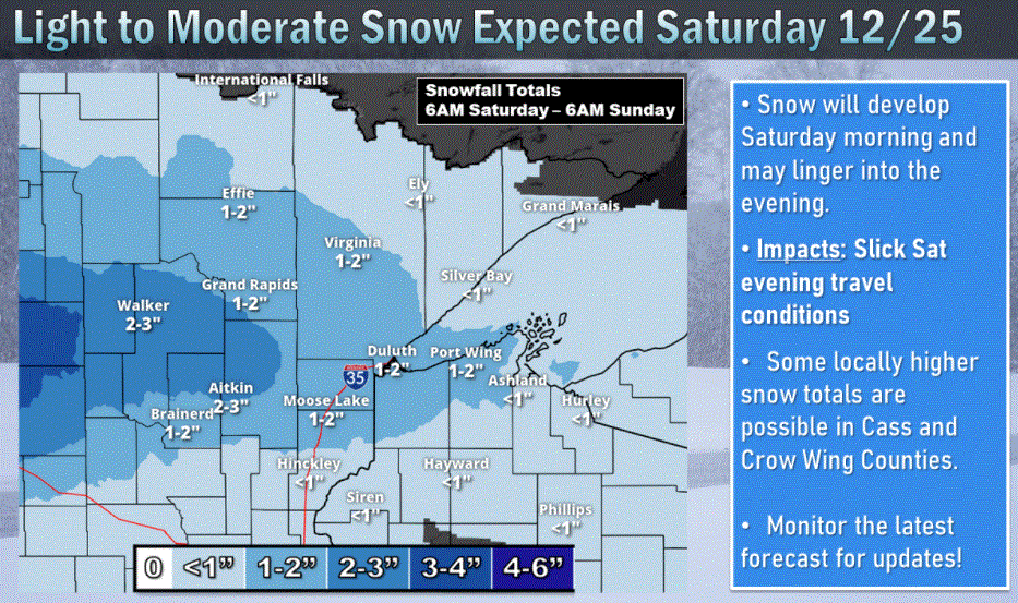
Fairly light snow will spread eastward across central and northern Minnesota for a snowy Christmas freshening. Amounts should be generally one to three inches with the area of about three inches generally around the Detroit Lakes and Walker area.
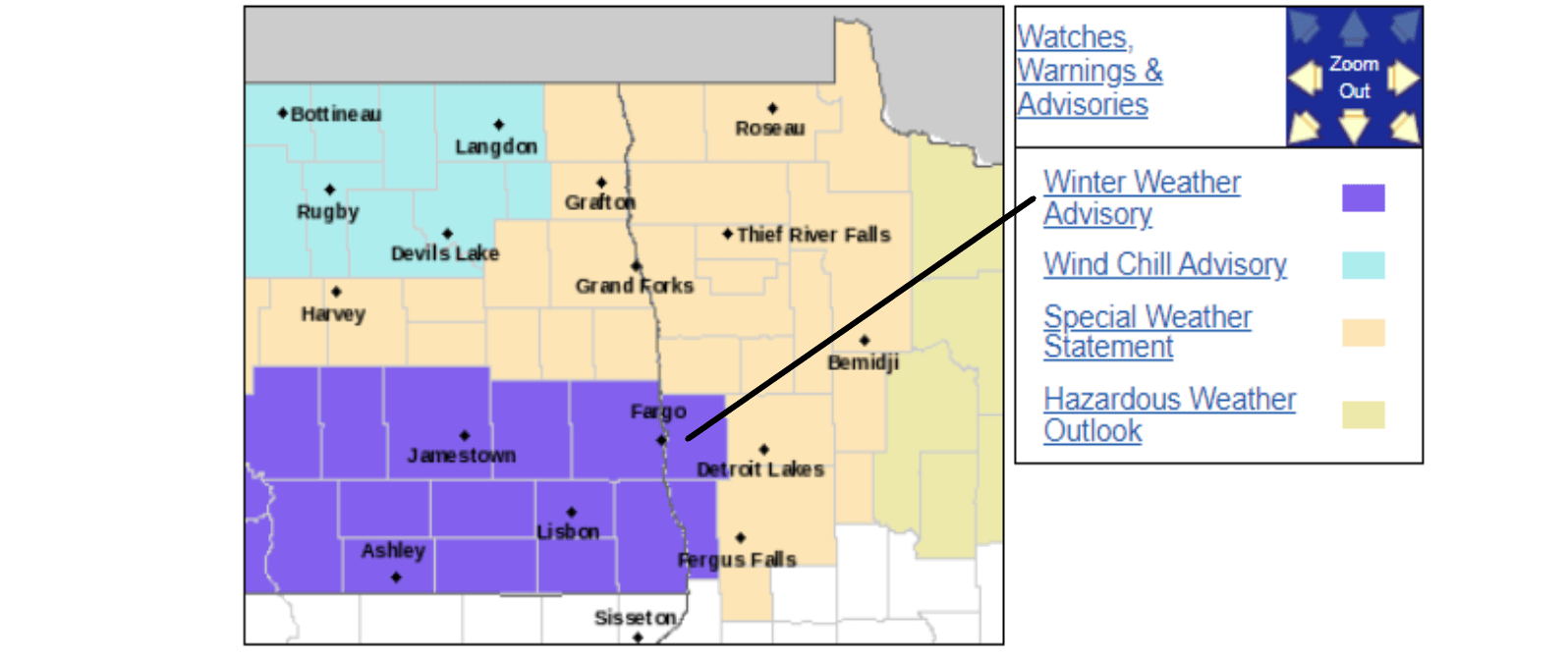
A winter weather advisory has been extended from North Dakota into Clay and Wilkin Counties of west central Minnesota, including Moorhead and Breckenridge, from 6 a.m. to 6 p.m. Saturday for likely heavier snowfalls of three to five inches.
The Twin Cities area should get little or no snow accumulation during Christmas Day.
Heavier snow arrives on Sunday
A more potent storm will reach western Minnesota Sunday afternoon, continue Sunday night and finally end on Monday in northern Minnesota. Most of Minnesota except the southern tiers will pick up at least some snow.
The heaviest snow will fall on central and northern Minnesota where this will likely become a plowable event. Snowfalls of six up to ten inches are likely.
The Twin Cities are forecast to be near the south edge of this storm. Snowfalls of two to five inches seem likely at this time, with two to three inches in the south metro and around three to five inches on the north side.
Forecasts can change, so check the Sunday weather if you will be going over the road to end the holiday weekend.
Another storm Tuesday
It does look as though the unsettled weather will continue next week. Another snow maker is likely to arrive about Tuesday.
Then turning even colder
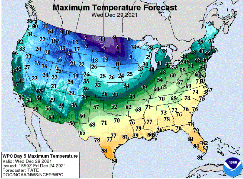
As often happens, cold air will sweep in from Canada on Wednesday after the snow ends.
Now, have some eggnog and enjoy the weekend.

