Milder Thursday into Friday before a very cold start of 2022
Go Deeper.
Create an account or log in to save stories.
Like this?
Thanks for liking this story! We have added it to a list of your favorite stories.


The Twin Cities recorded its first subzero temperature of this winter season Wednesday morning with a low of 7 below. Cold, dry Canadian high pressure allowed the sun to brighten the wintry landscape for much of the day but kept temperatures on the chilly side of normal.
Clouds overspreading the area from the southwest will provide a bit of a thermal blanket Wednesday night. Low temperatures Thursday morning will be in the 20s below zero in the northwest, negative teens in the rest of the north and plus and minus singles for central to southern Minnesota. The Twin Cities should have a low around 2 above.
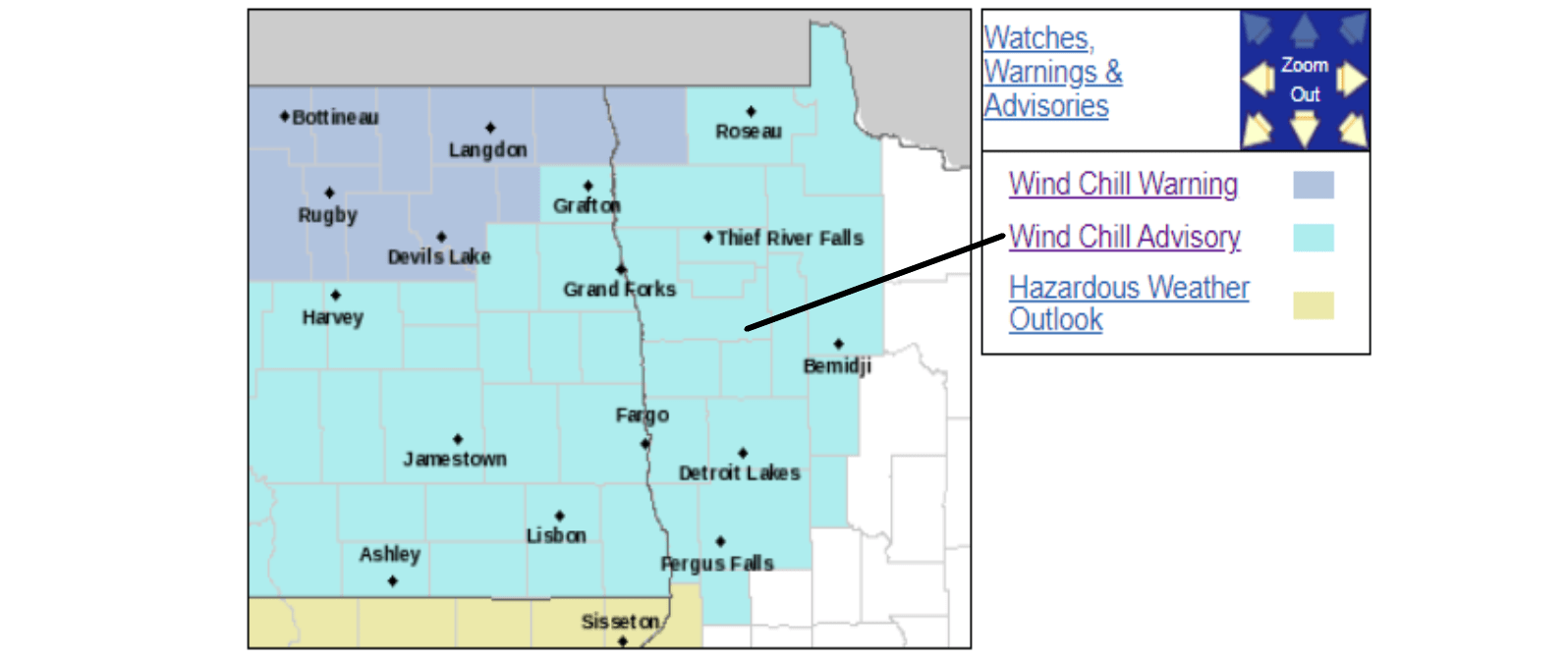
Even with those slightly milder temperatures, the air is still so cold that the National Weather Service has issued a wind chill advisory for northwest and west central Minnesota that continues until noon on Thursday. Very cold wind chills in that area are likely to be as low as minus 40 overnight and into Thursday.
Milder Thursday
Turn Up Your Support
MPR News helps you turn down the noise and build shared understanding. Turn up your support for this public resource and keep trusted journalism accessible to all.
Highs temperatures on Thursday will be in the single digits below zero in northwestern Minnesota, singles above zero in the northeast, teens central and 20s across the south with southwestern Minnesota probably warming into the upper 20s.
The Twin Cities should have a high around 22 with a southeast breeze around 10 mph beneath overcast skies.
Light snow is likely across much of northern Minnesota with accumulations of an inch or less.
Sharp cold snap from Friday night into Sunday
Another pesky Canadian cold front will make its push from the northwest on Friday. Low temperatures Friday night/Saturday morning will be a frigid 30 to 35 below in northwestern Minnesota. The rest of northern Minnesota should chill into the minus 20s. Look for negative teens from central to southwestern Minnesota while the southeast corner gets negative singles. The Twin Cities should wake up to a low around 10 below to greet the new year Saturday morning.
New Years Day will be a cold one with highs from around 12 below in the north to mainly negative singles in the south. The Twin Cities should have a high of just around 2 below.
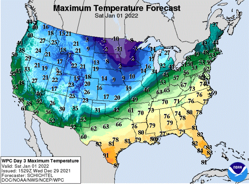
We will be deep into the arctic air Saturday night. Lows Sunday morning should range from around 25 below in the north to around 10 below in the south. The Twin Cities are likely to see an ear-biting low of about 18 below, nearly matching the 19 below that was our coldest temperature last winter (on Valentine’s Day, ironically).
Then a warmup
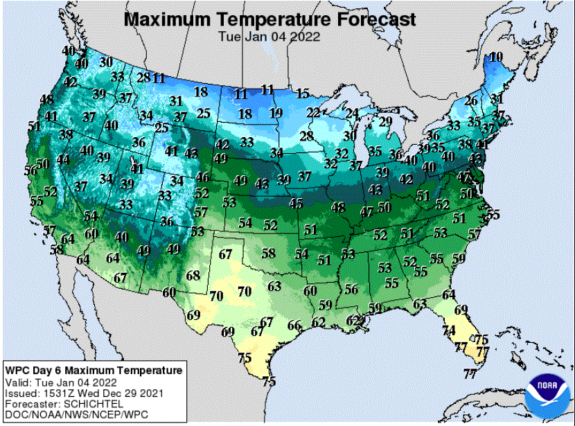
Milder temperatures will begin to arrive on Sunday and return to seasonal normals by early next week.
No storms in the immediate future
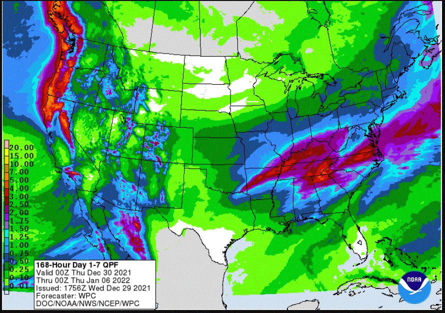
Notice that no storms have been mentioned above. These cold patterns generally block stormy weather to our south. The forecast for total precipitation for the next seven days, through next Wednesday, brings very little precipitation to Minnesota. Meanwhile, much more rain and snow will fall in the Pacific Northwest while areas well to our south from Arkansas to North Carolina and surrounding states seem to be in the path of thunderstorms.